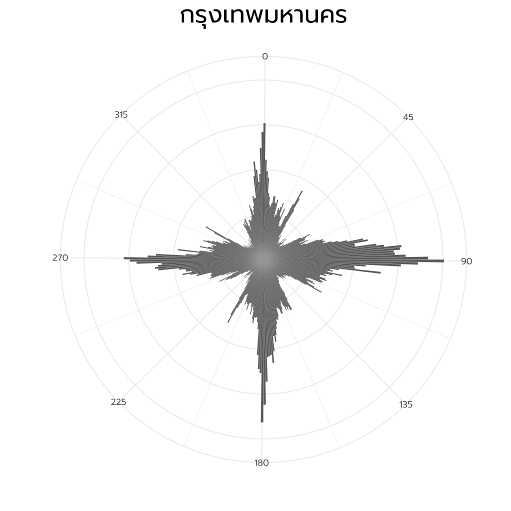
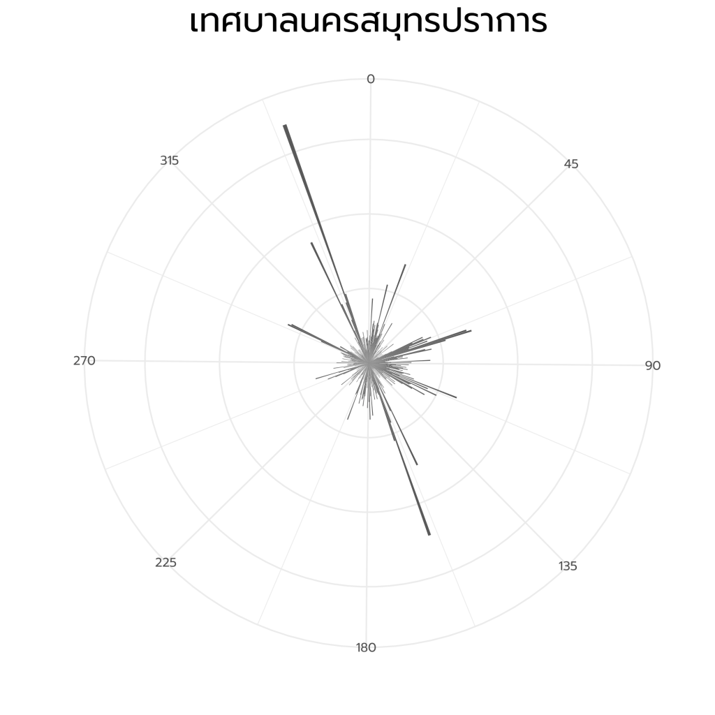
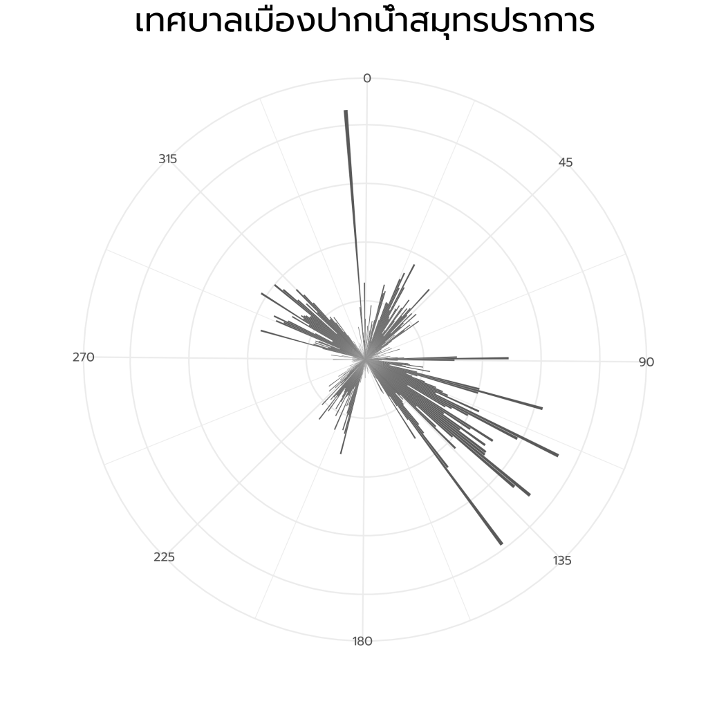
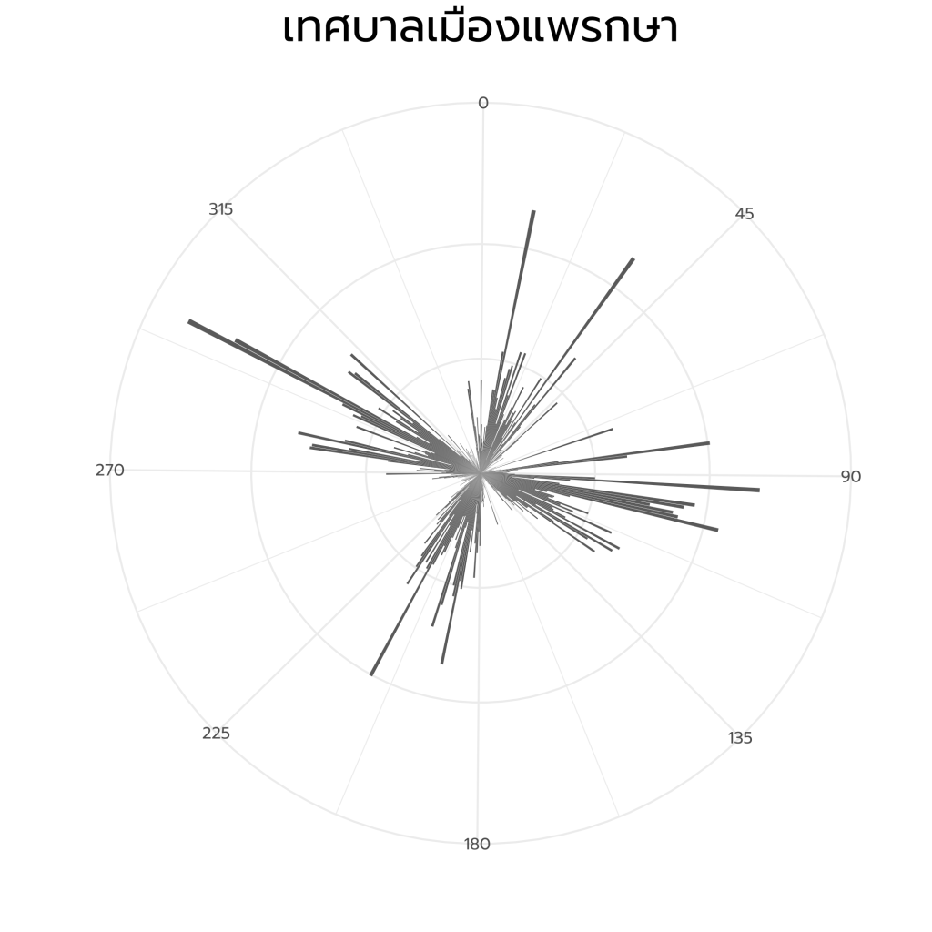
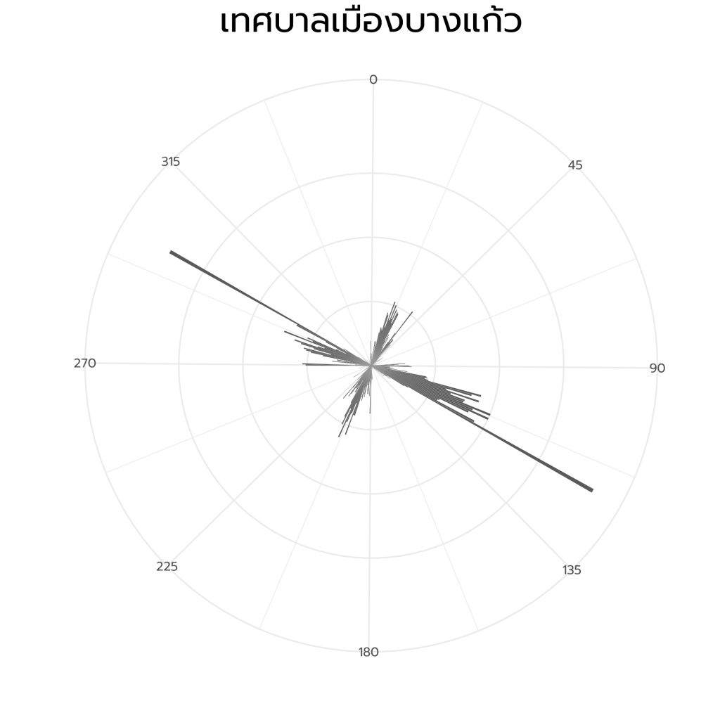
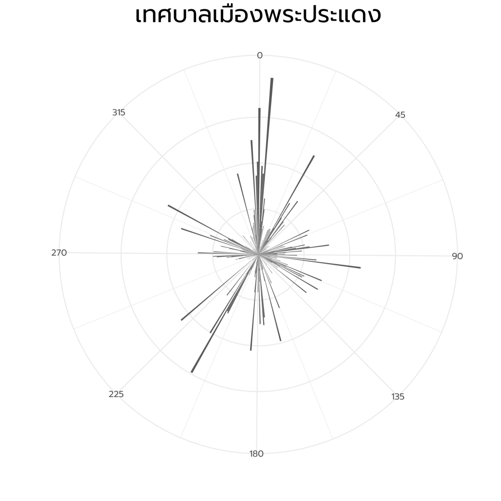
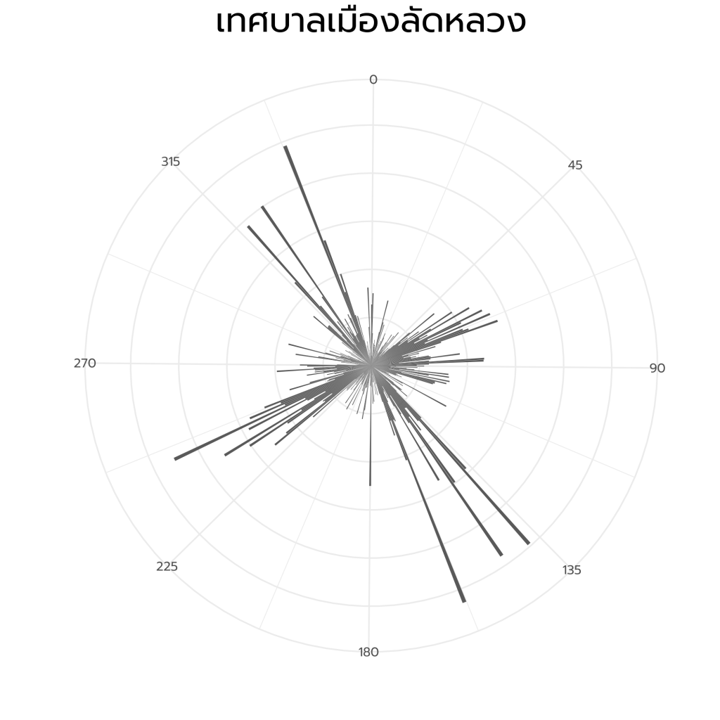
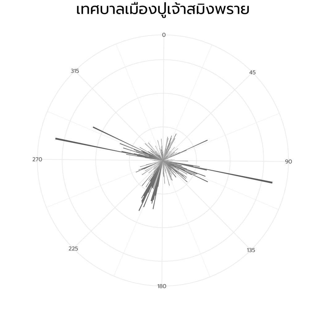
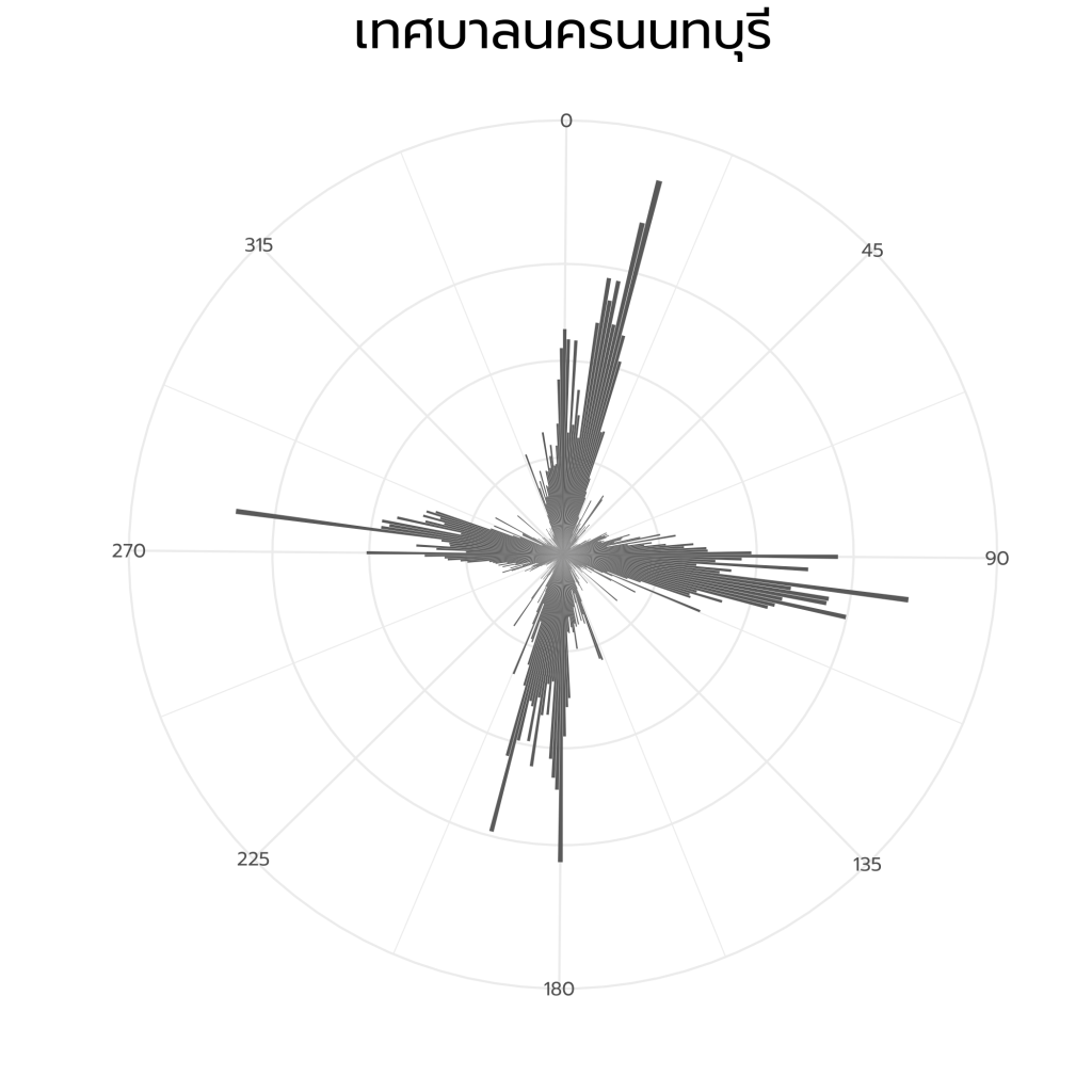
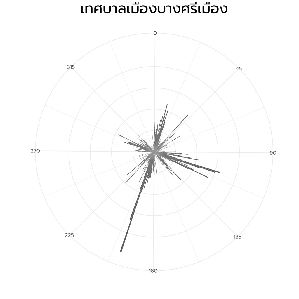
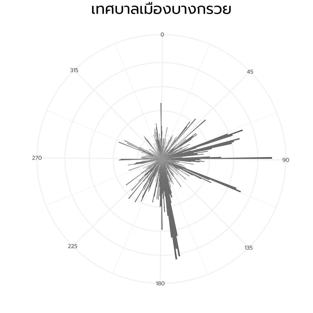
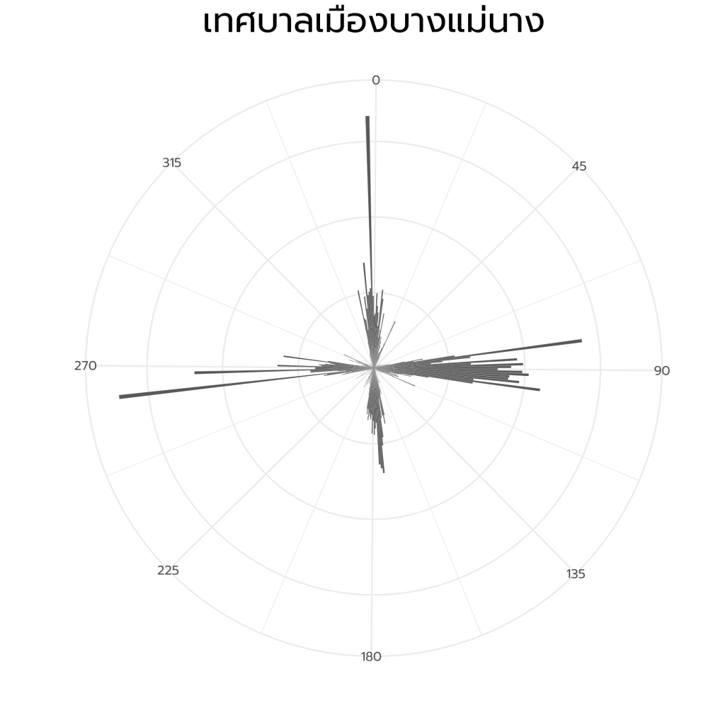
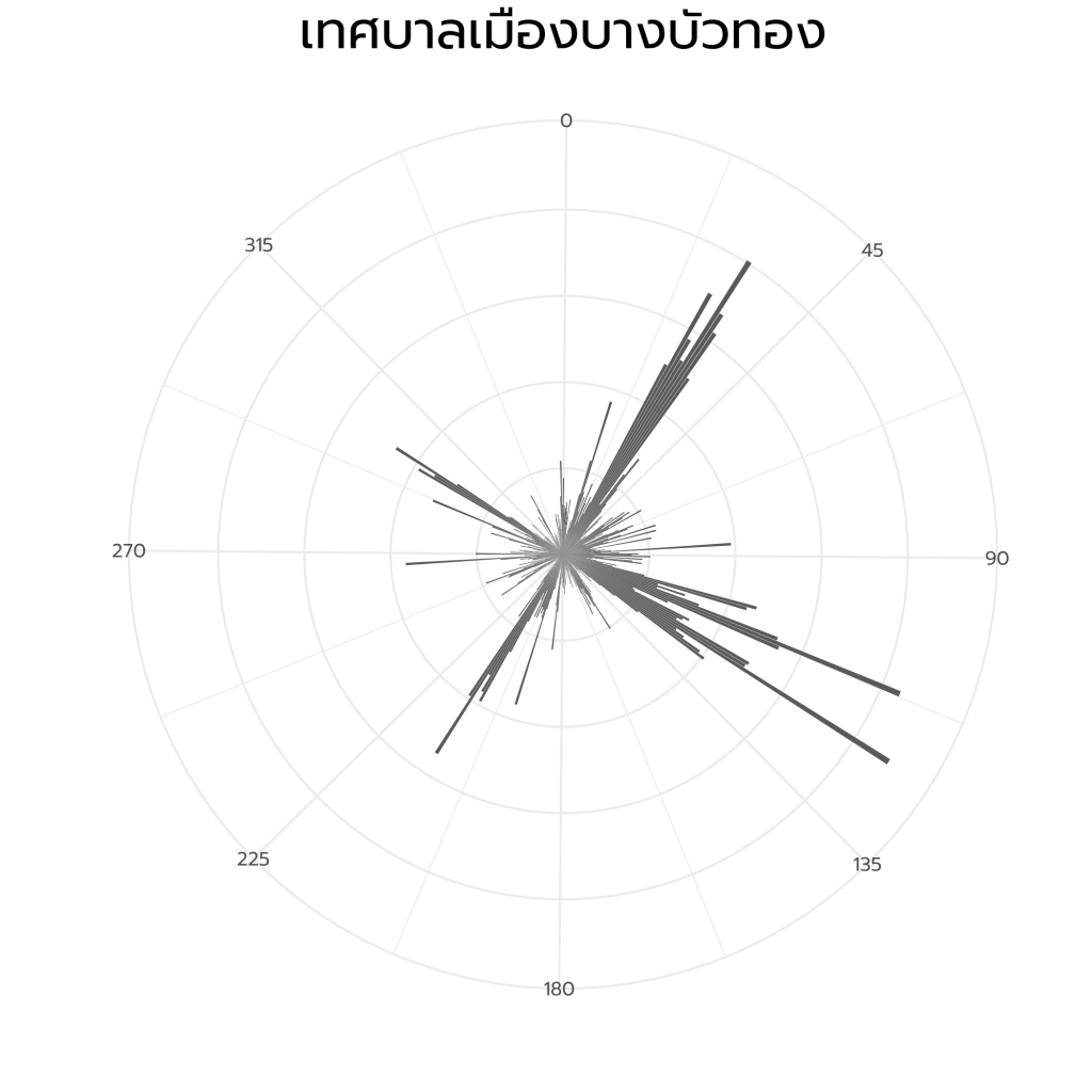
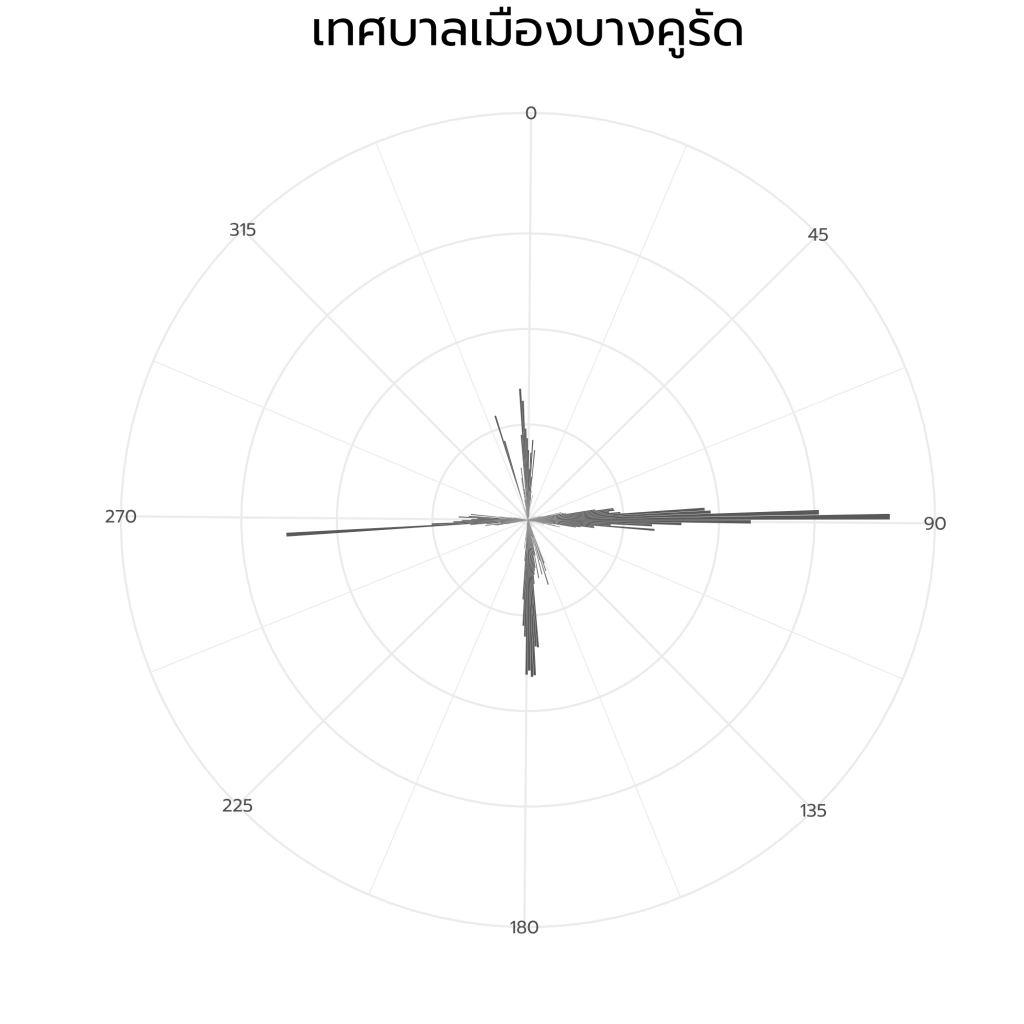
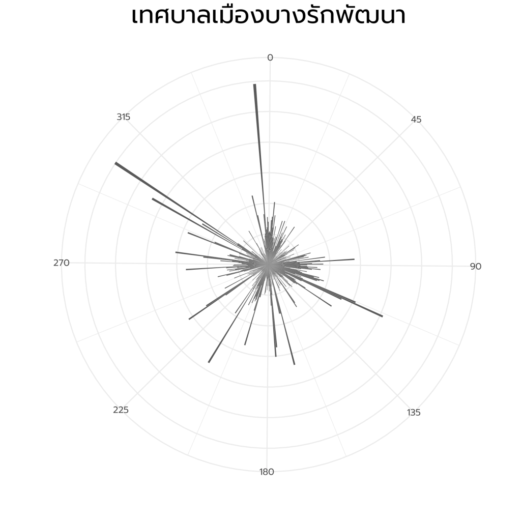
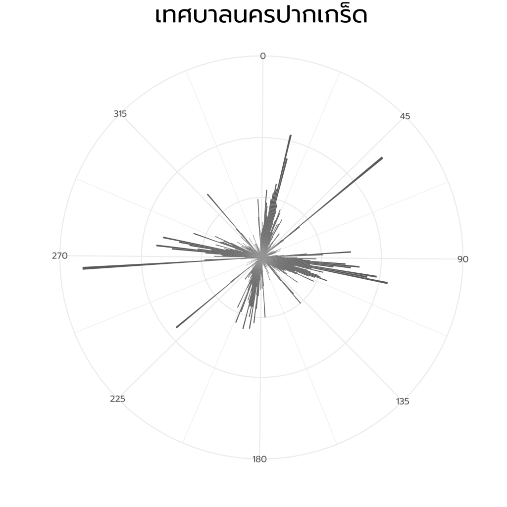
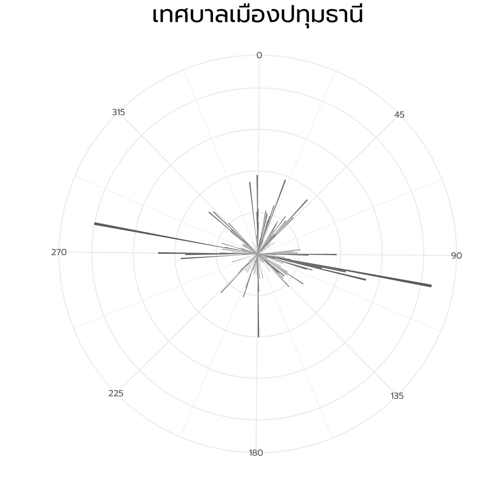
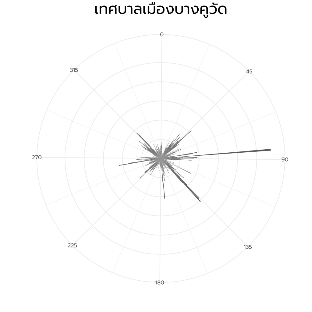
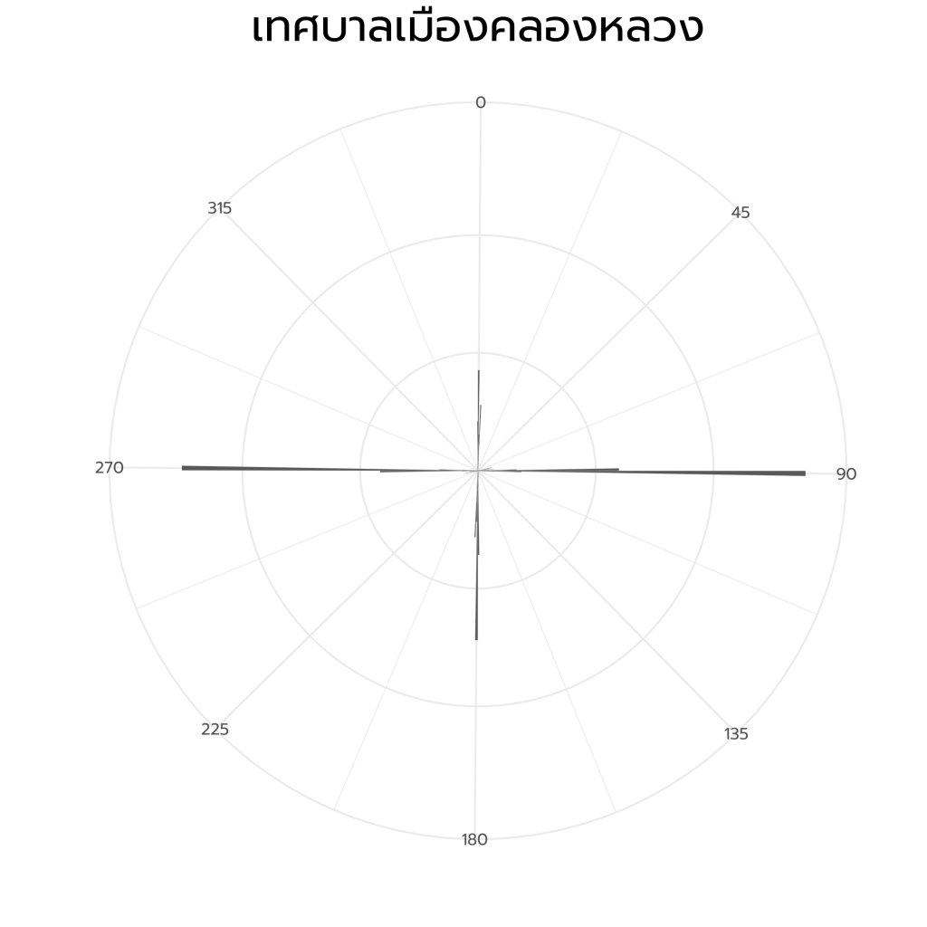
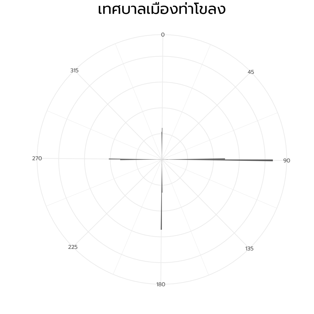
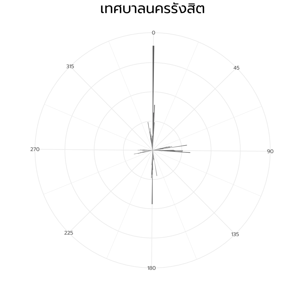
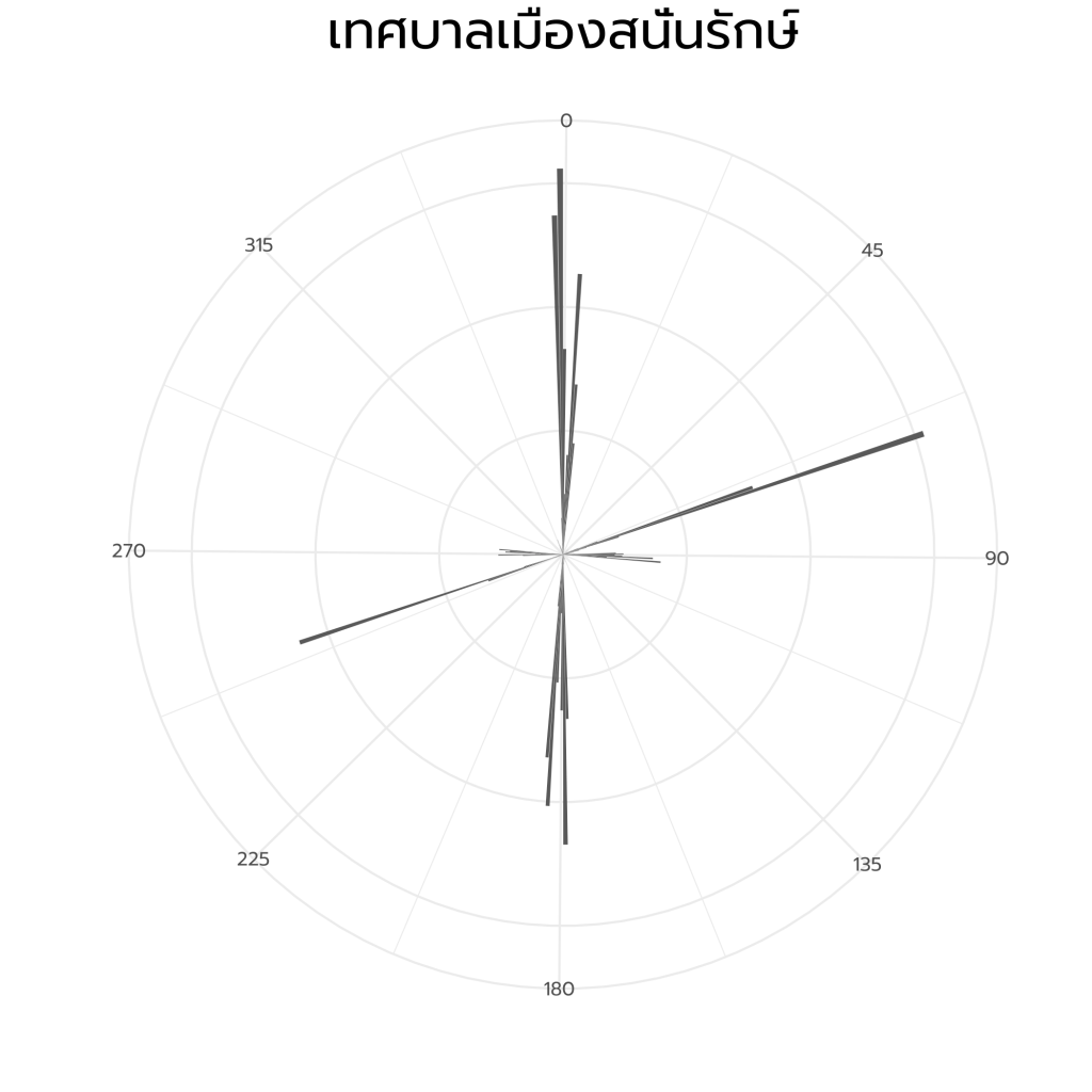
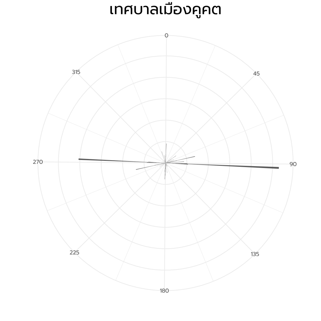
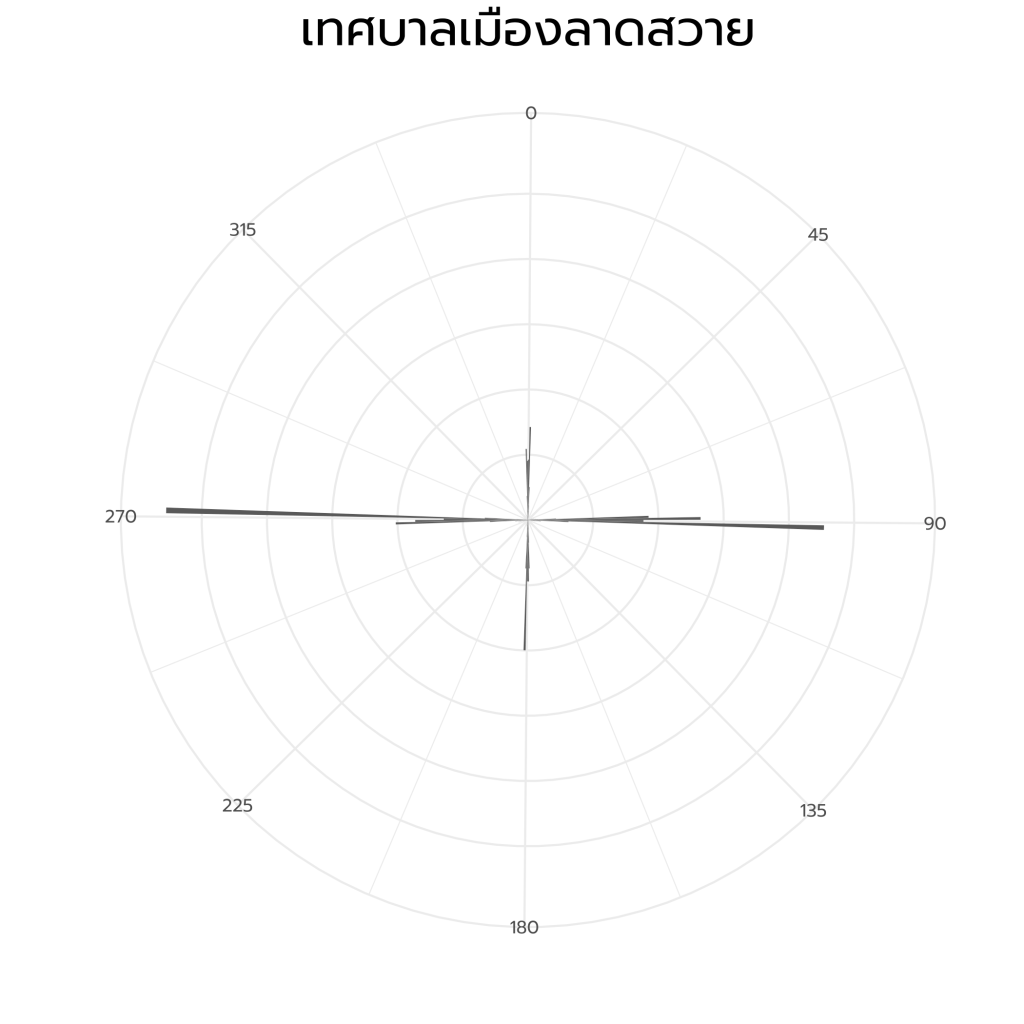
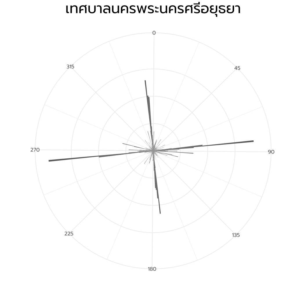
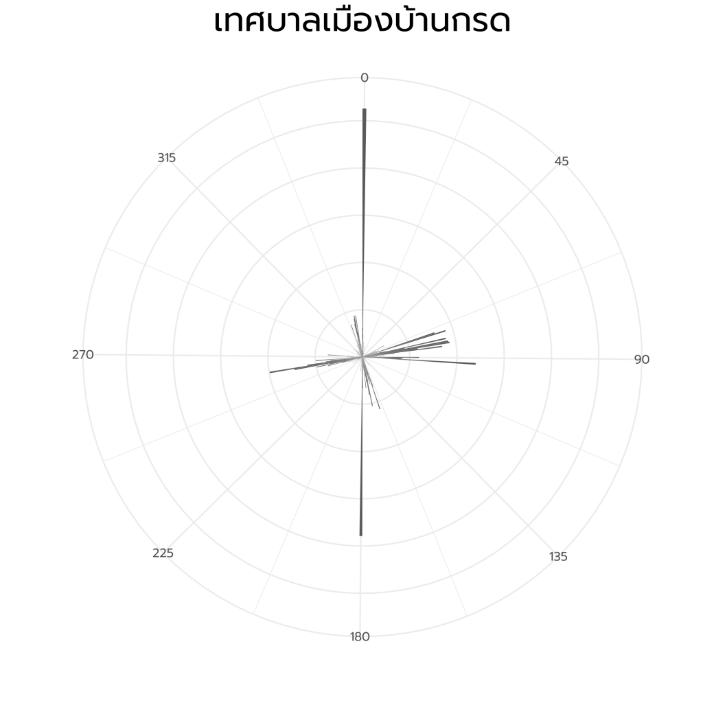
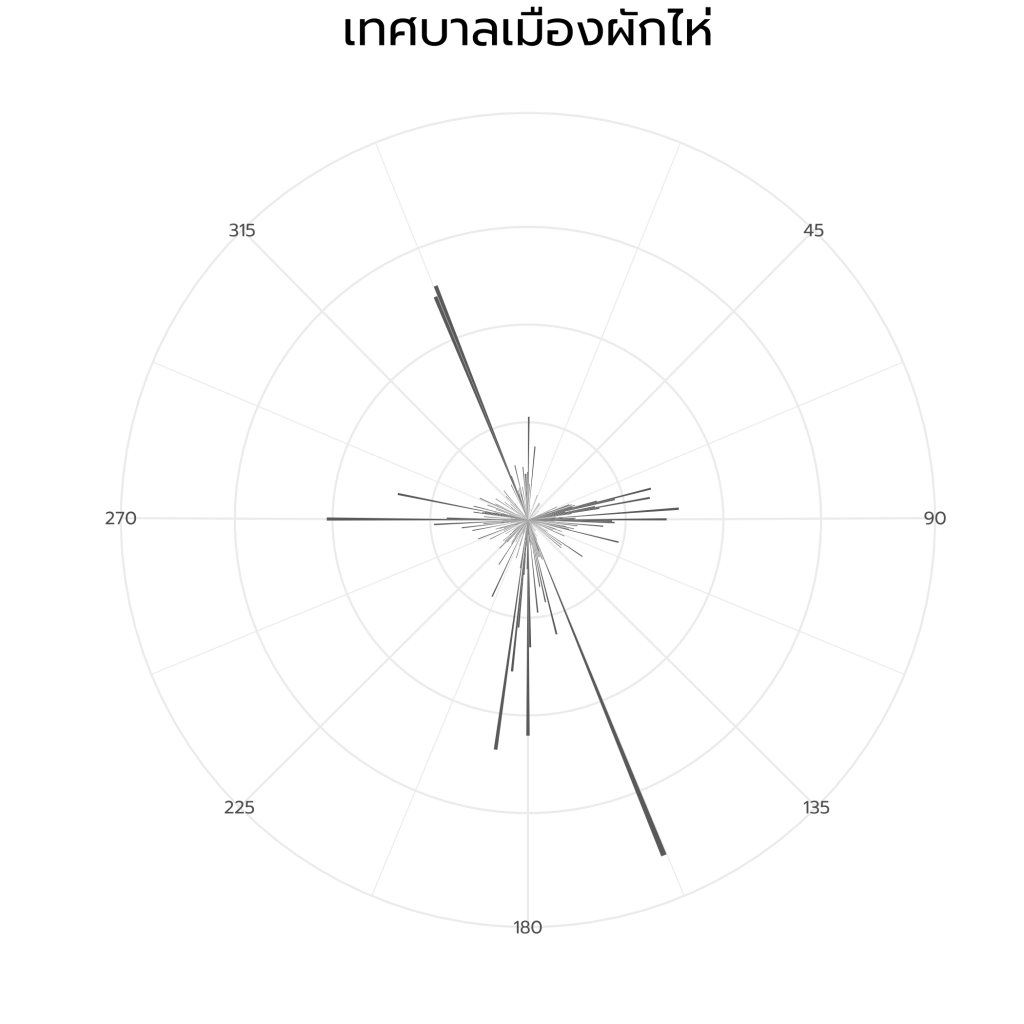
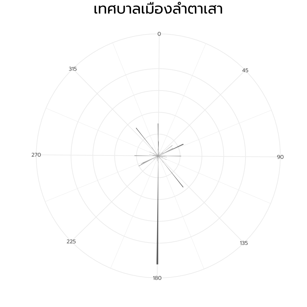
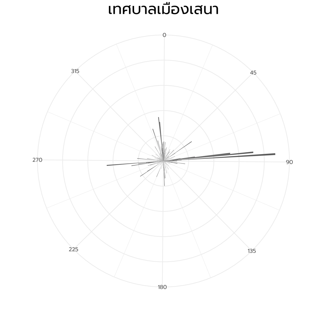
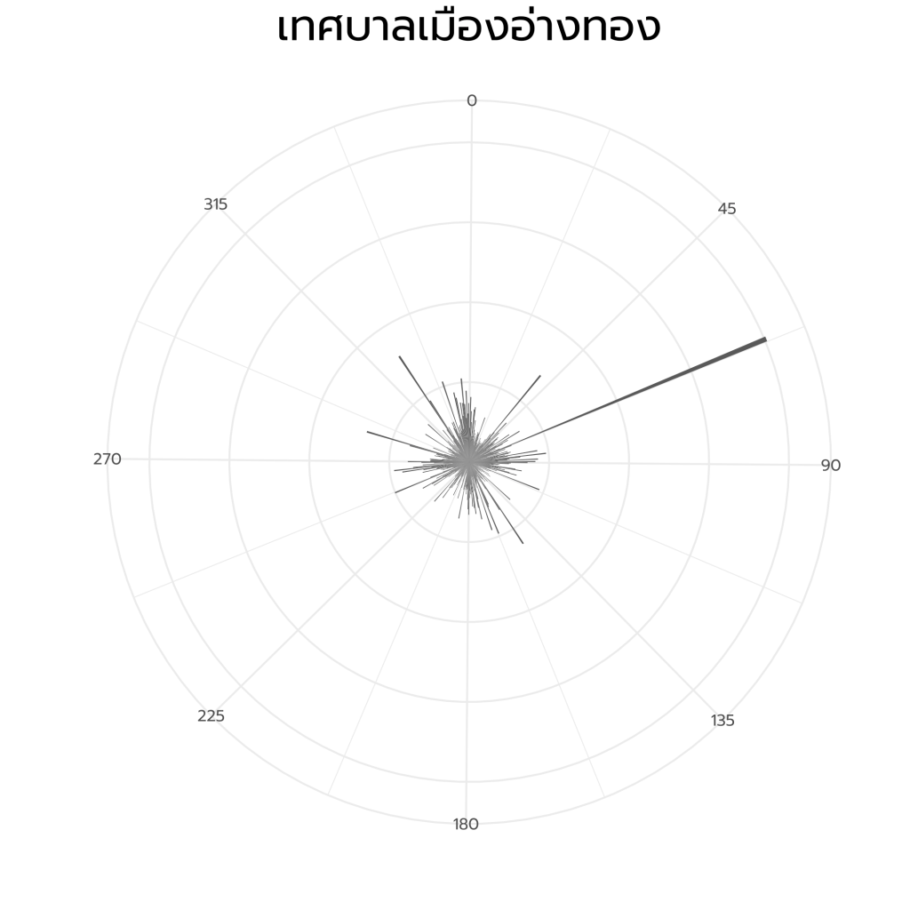
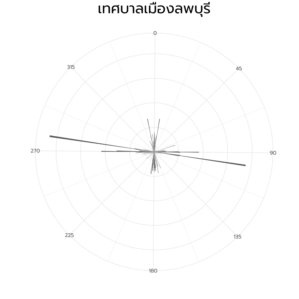
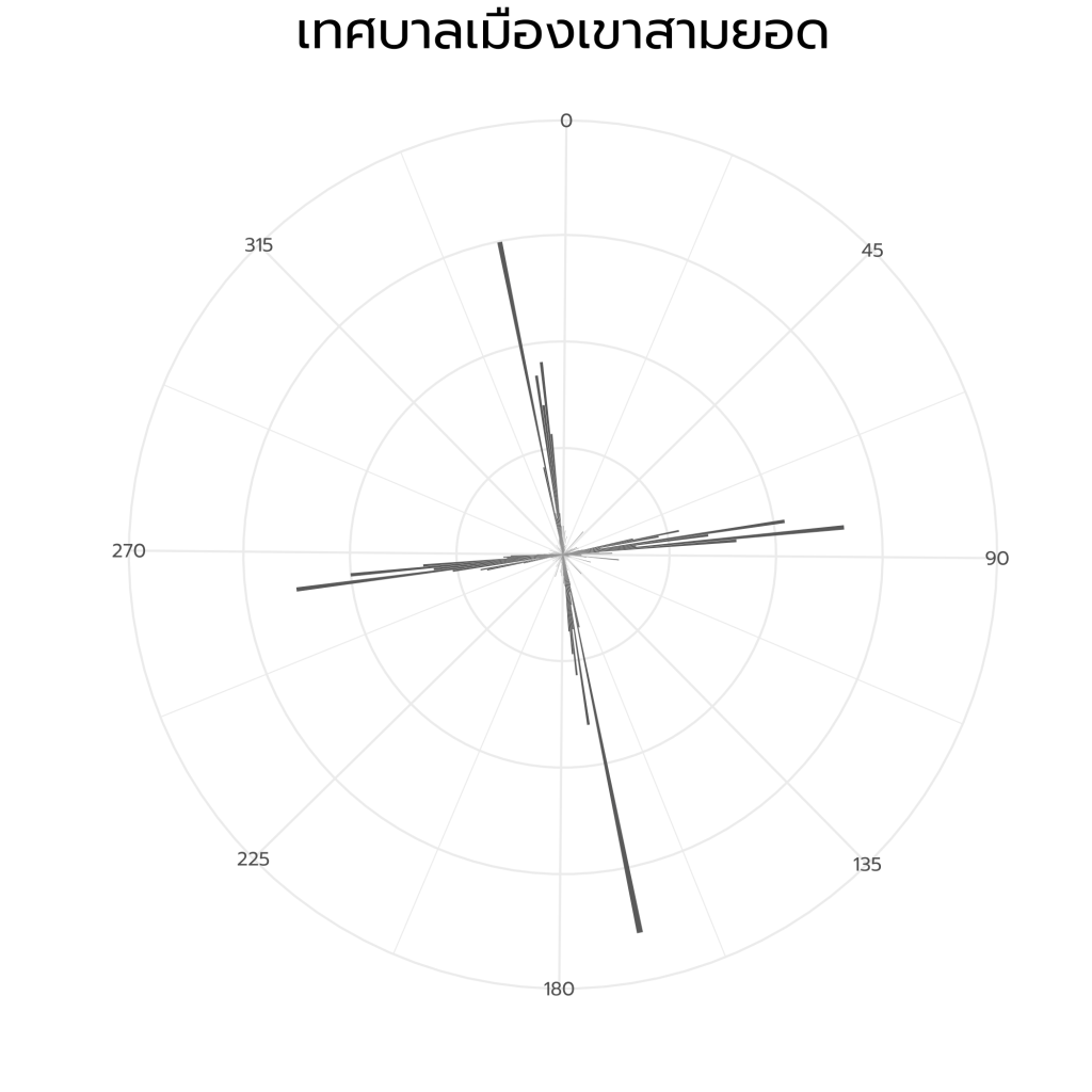
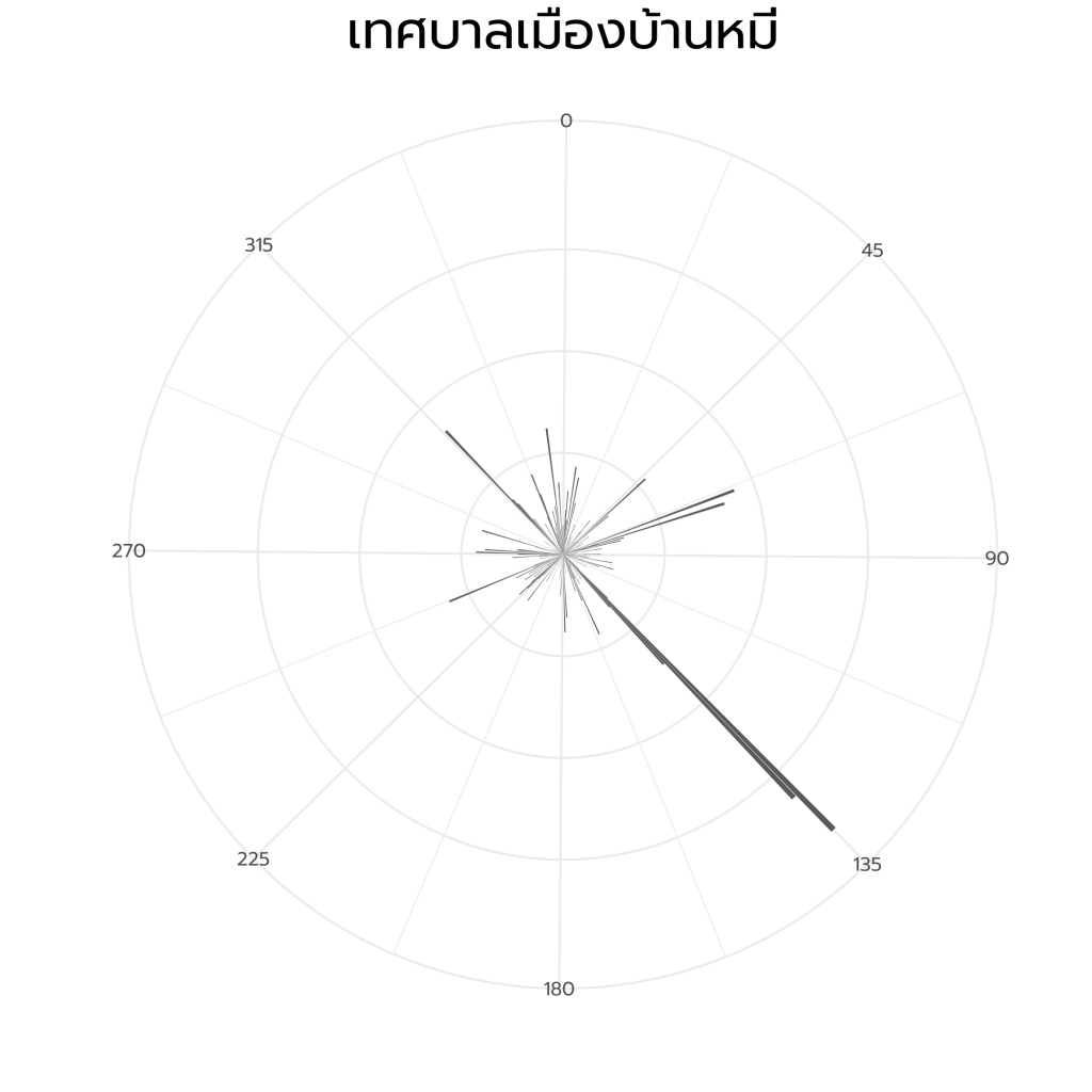
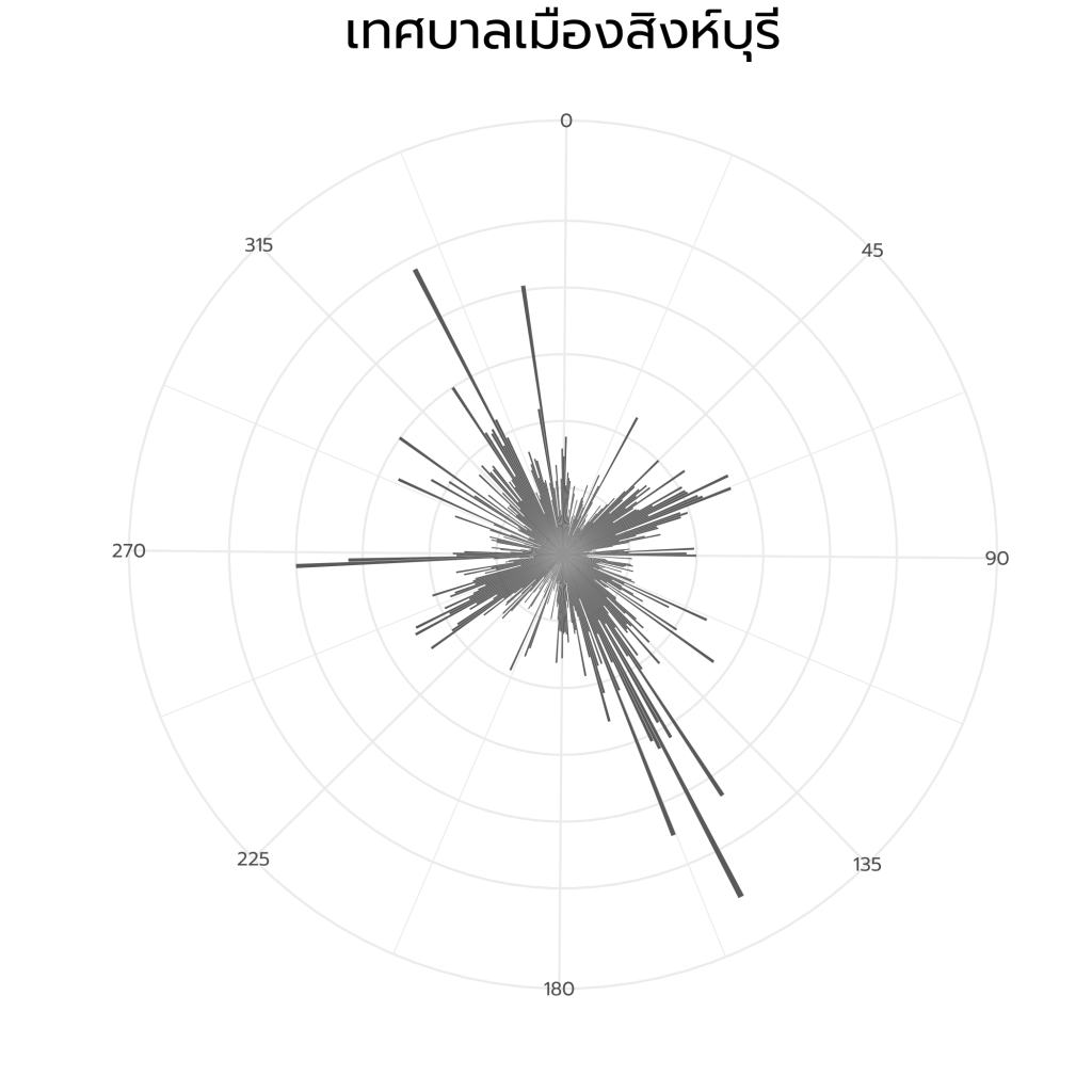
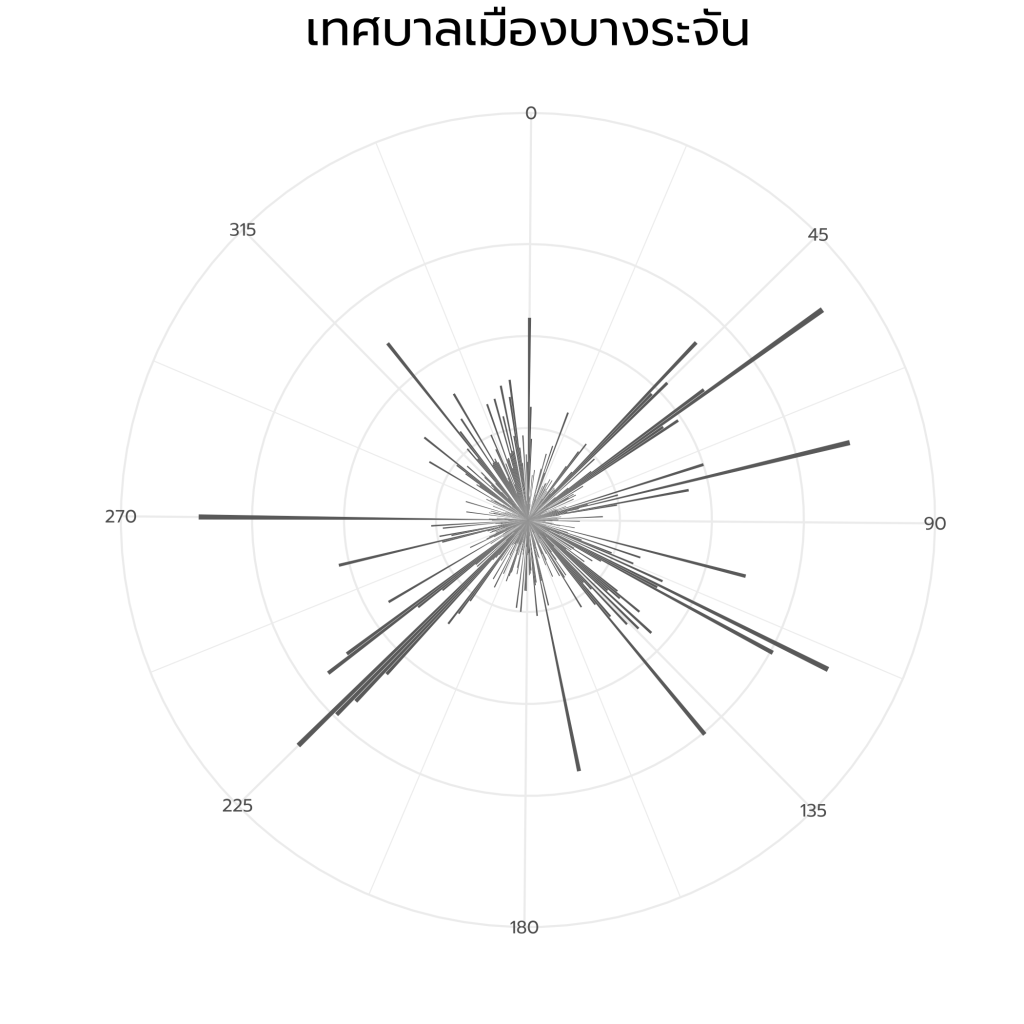
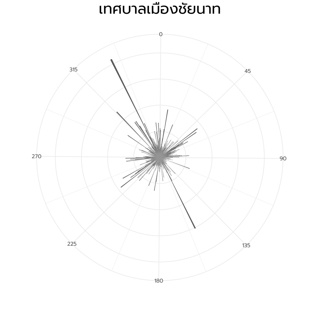
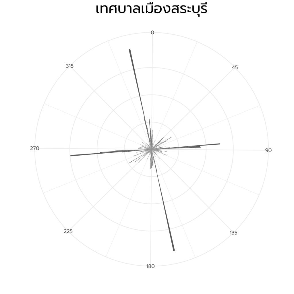
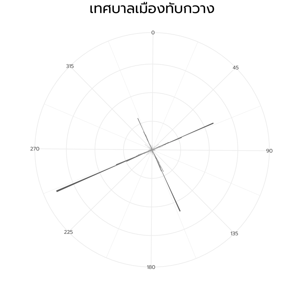
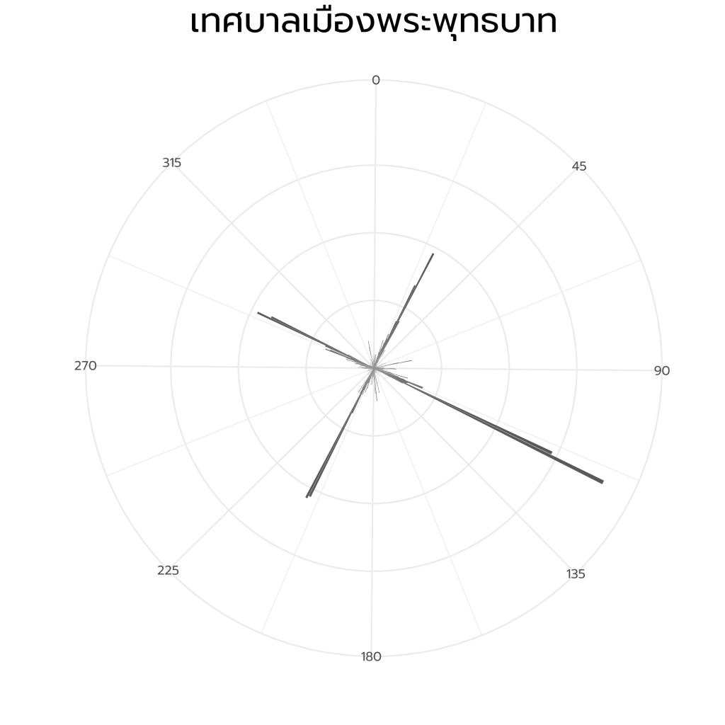
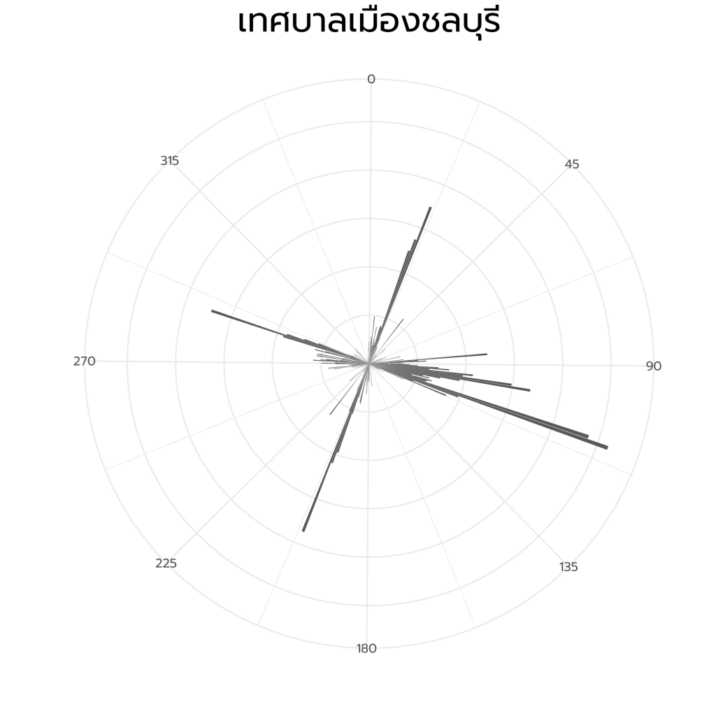
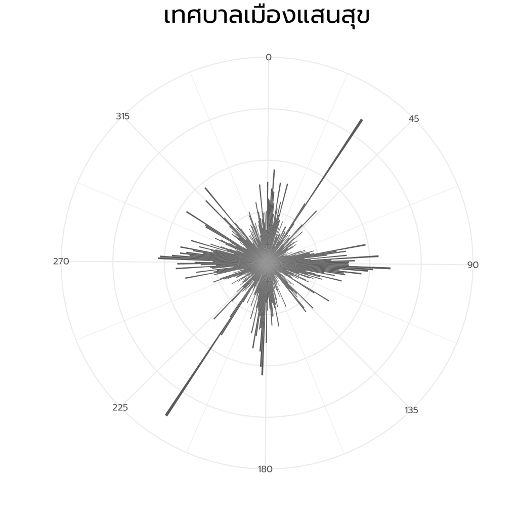
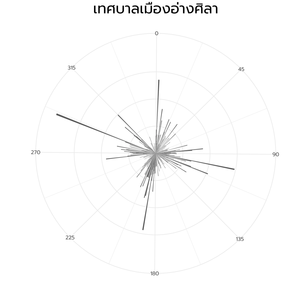
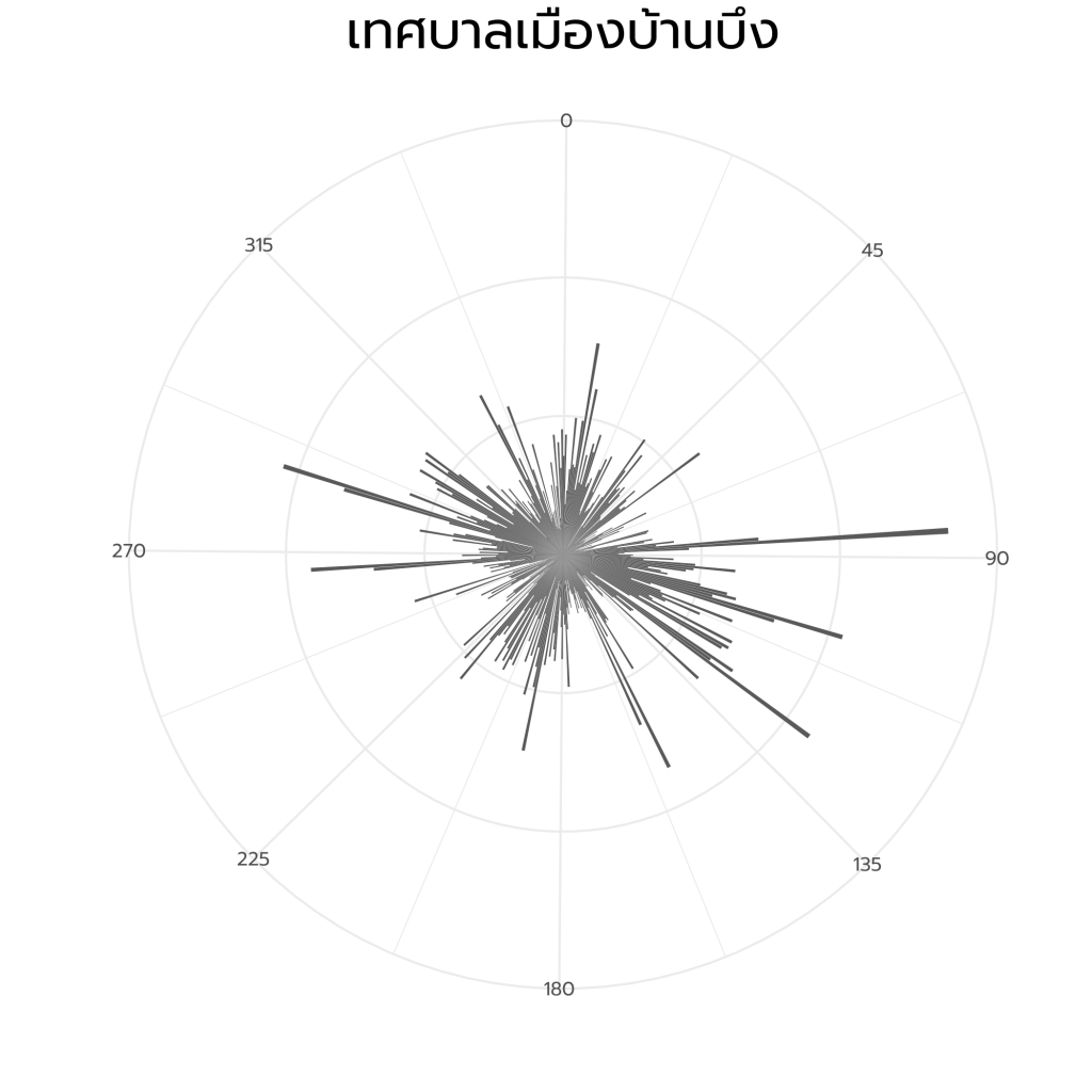
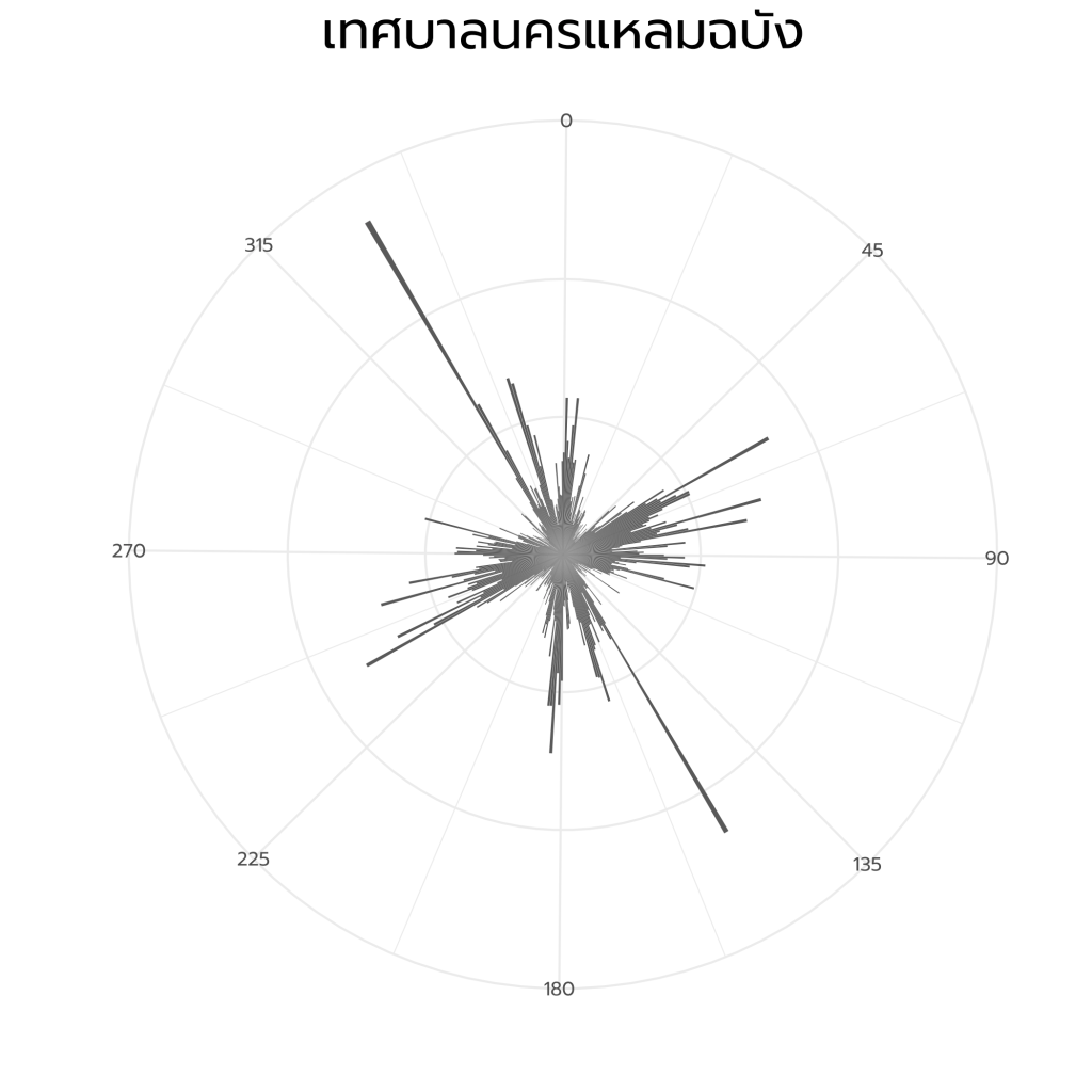
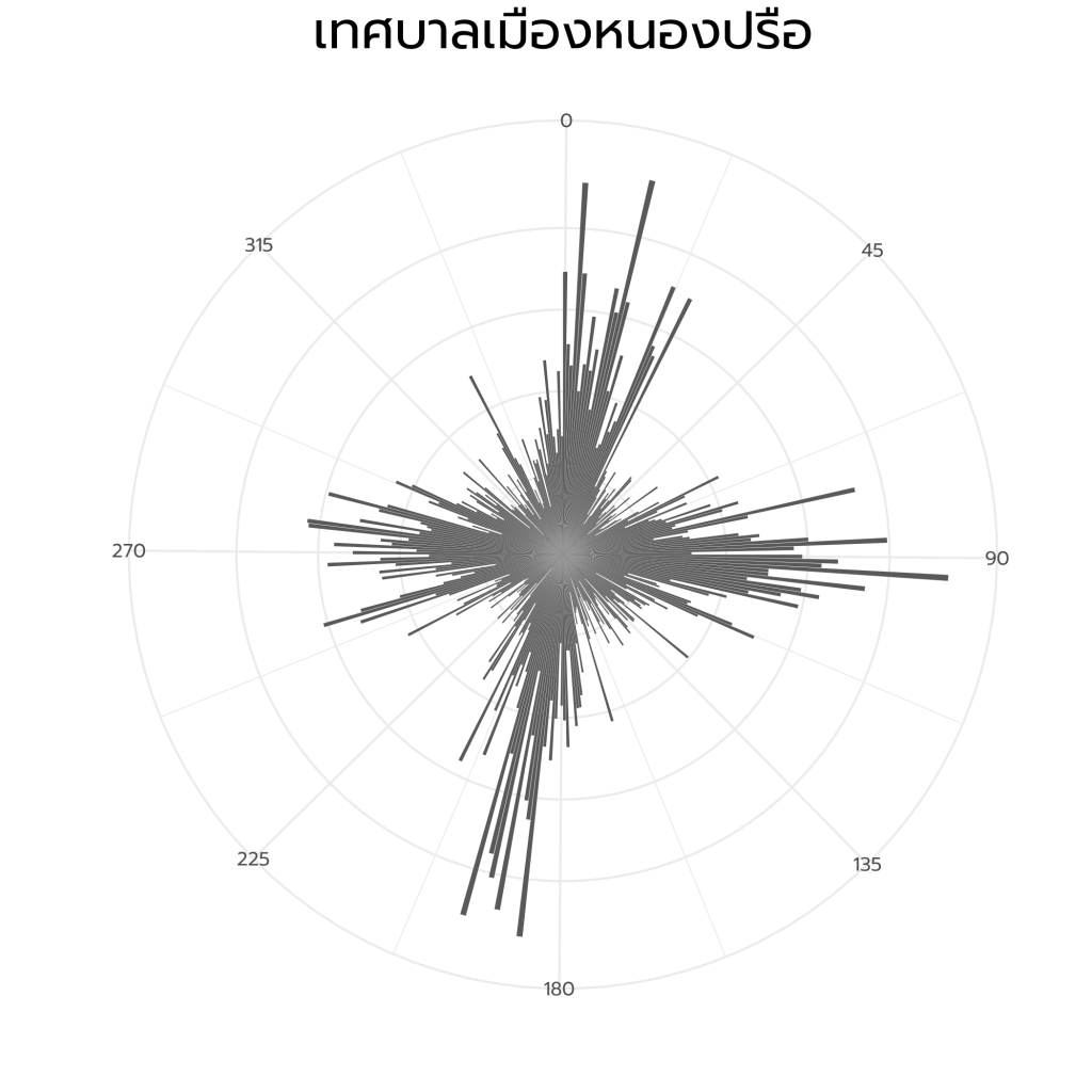
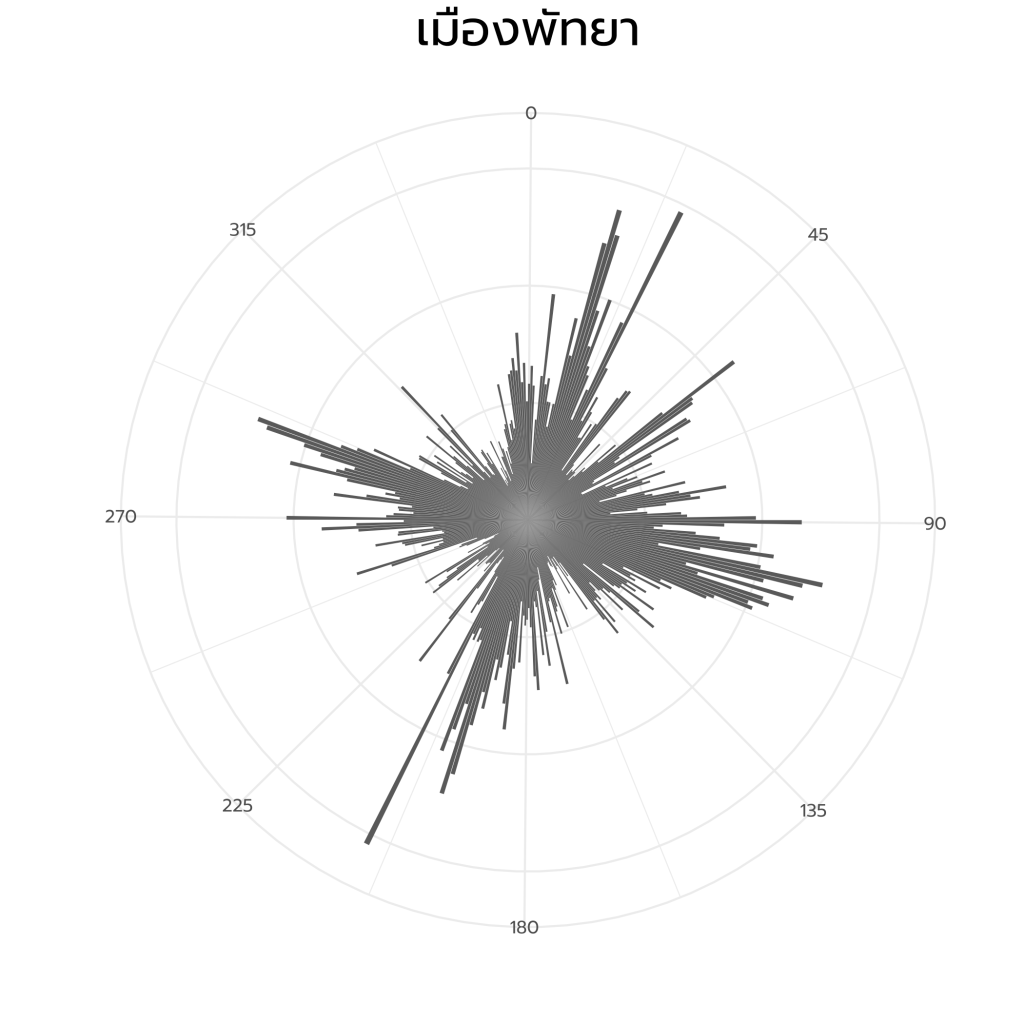
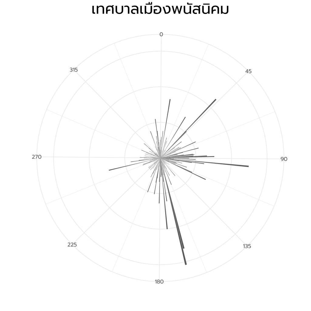
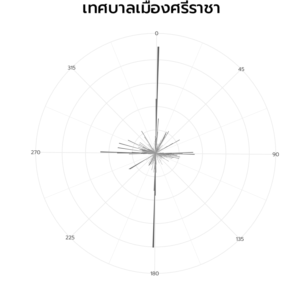
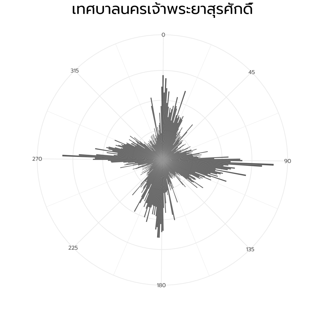
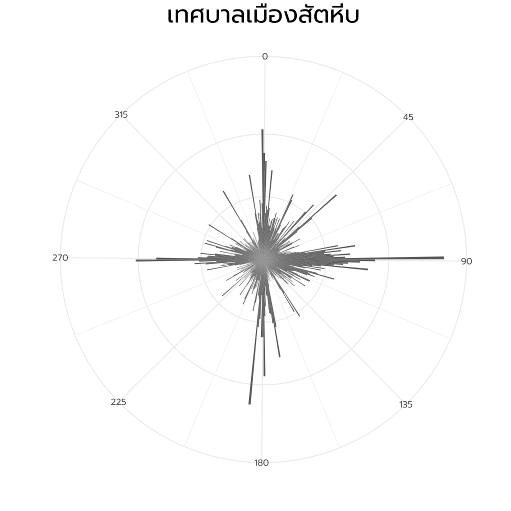
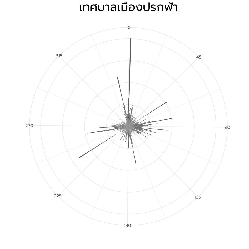
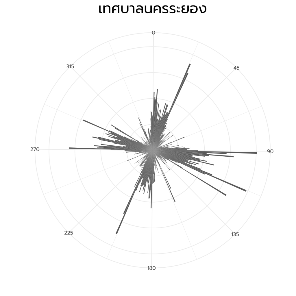
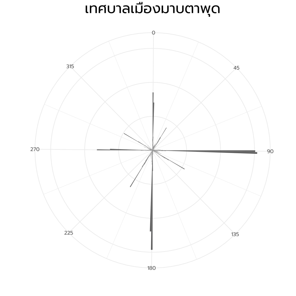
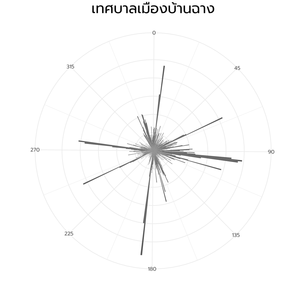
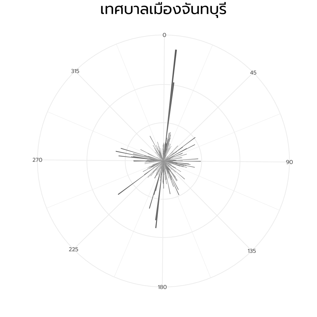
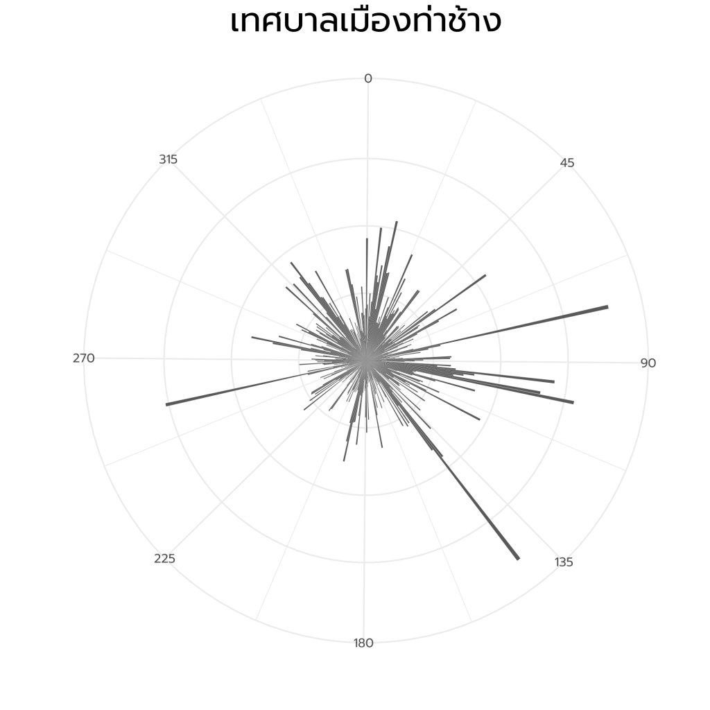
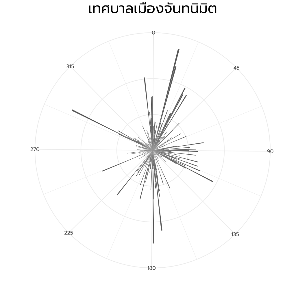
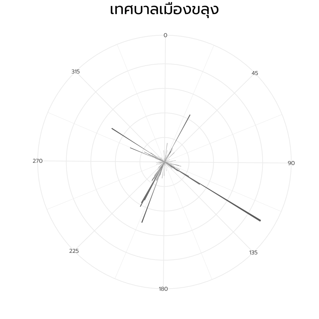
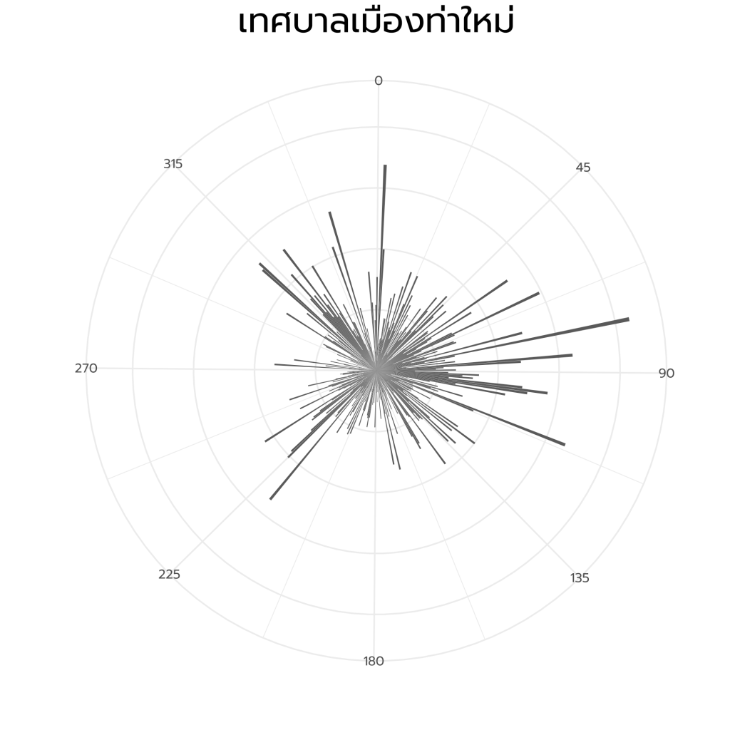
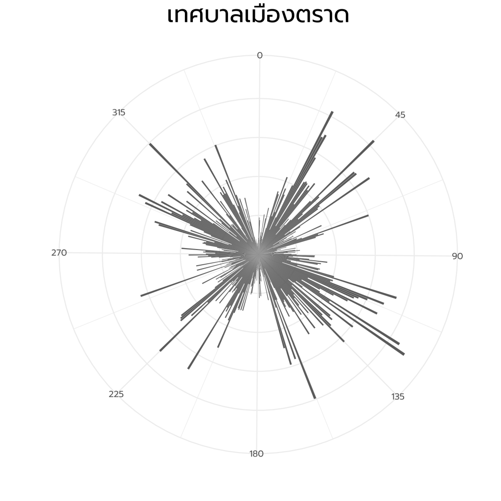
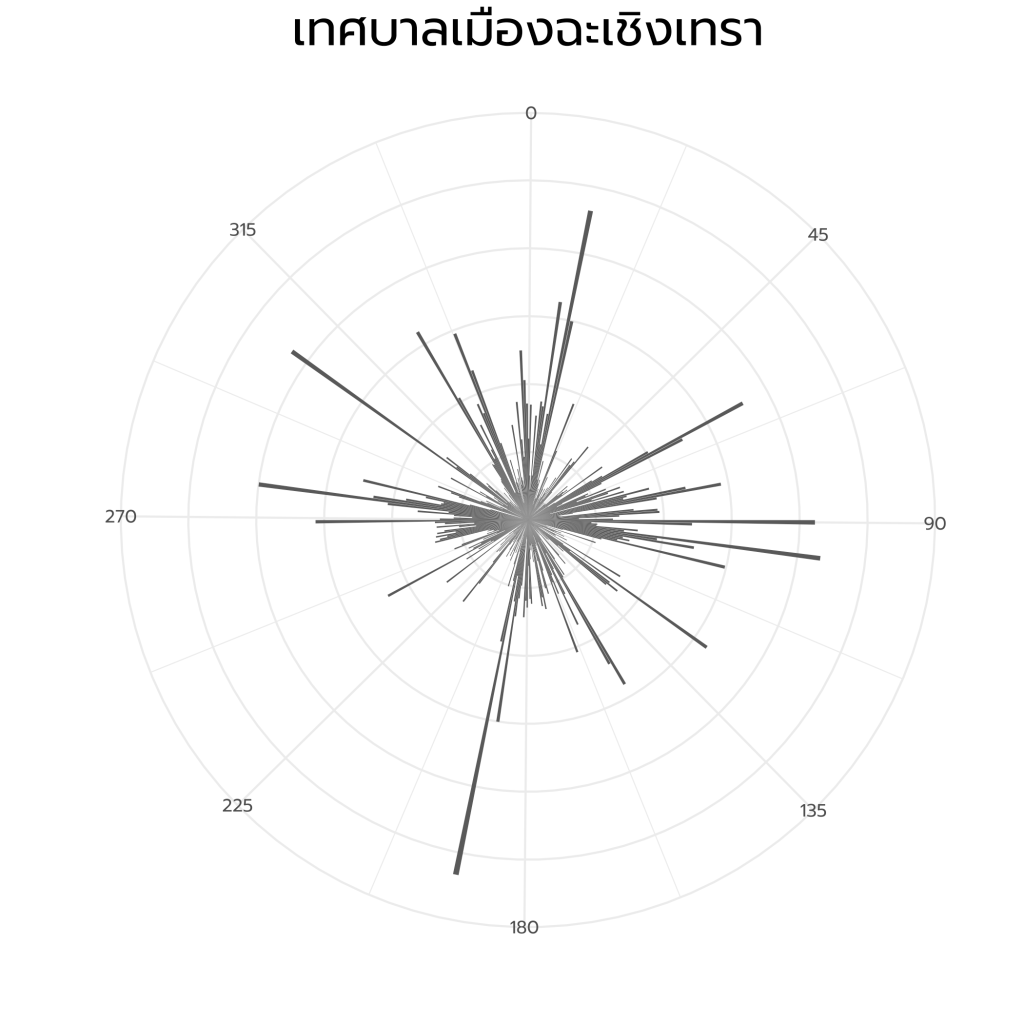
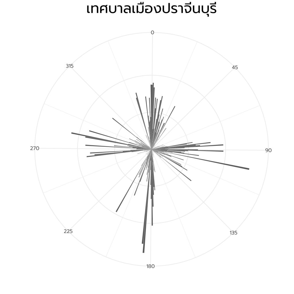
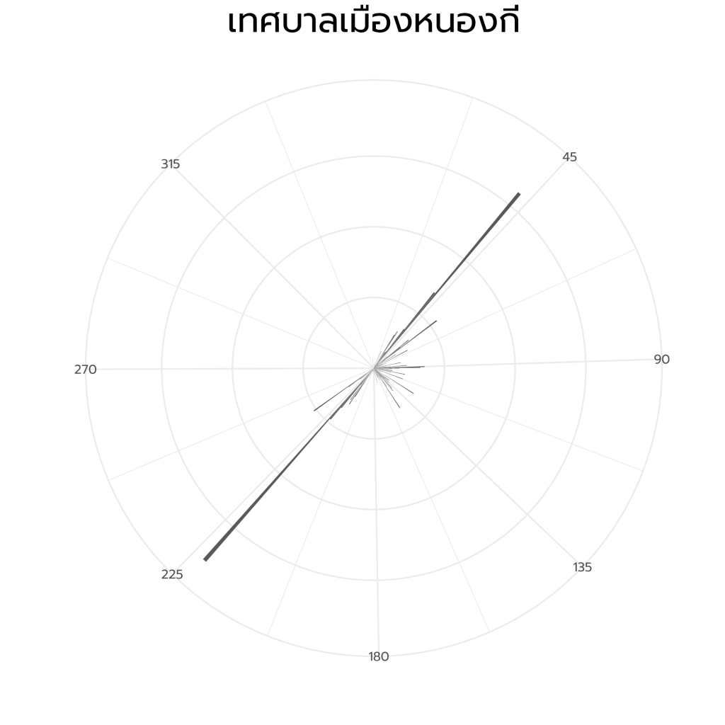
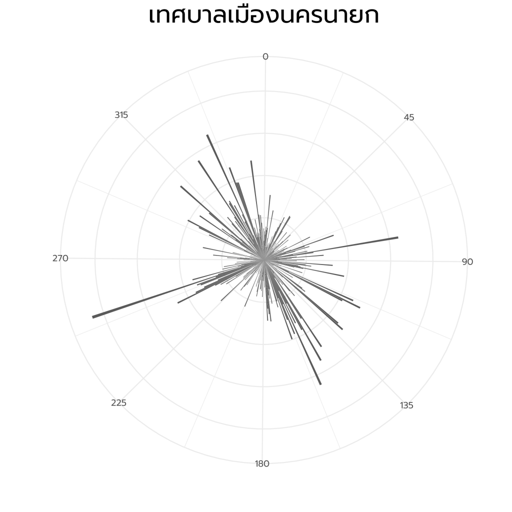
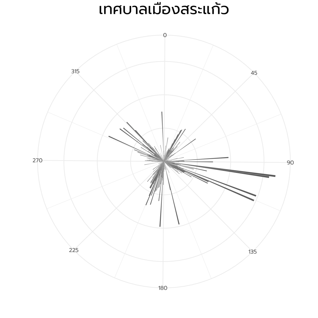
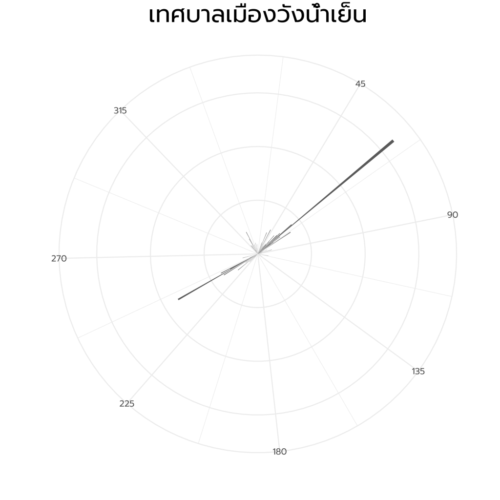
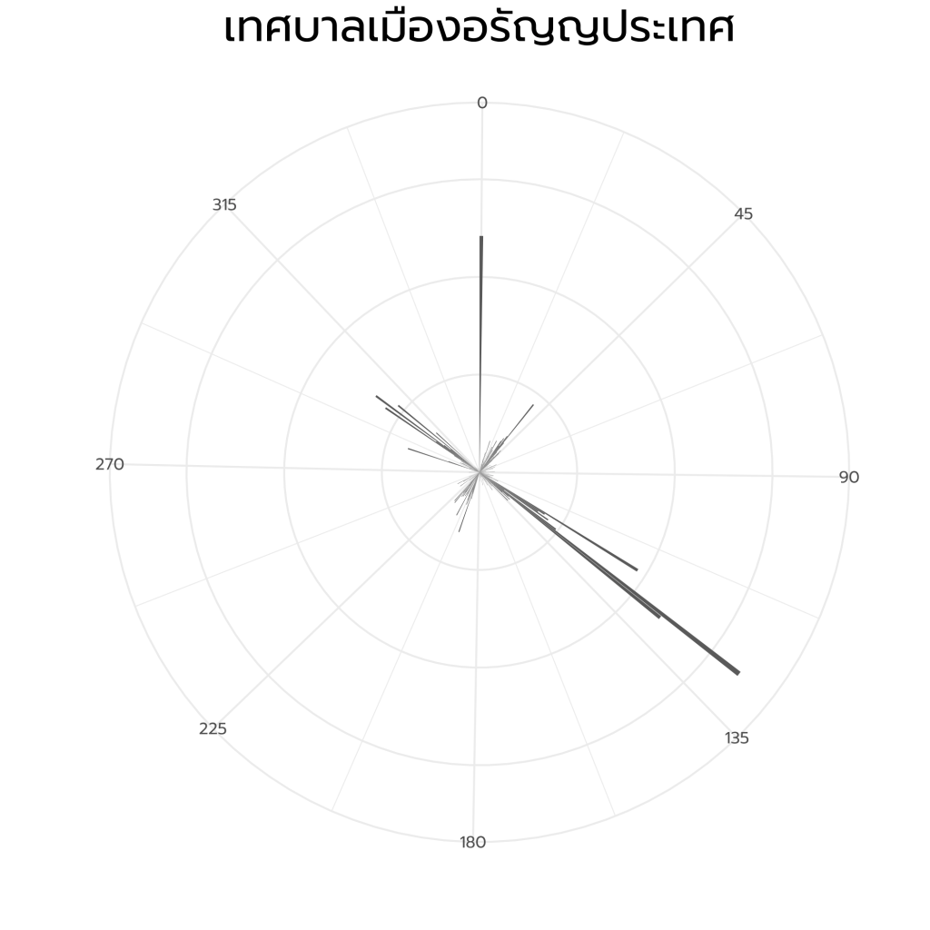
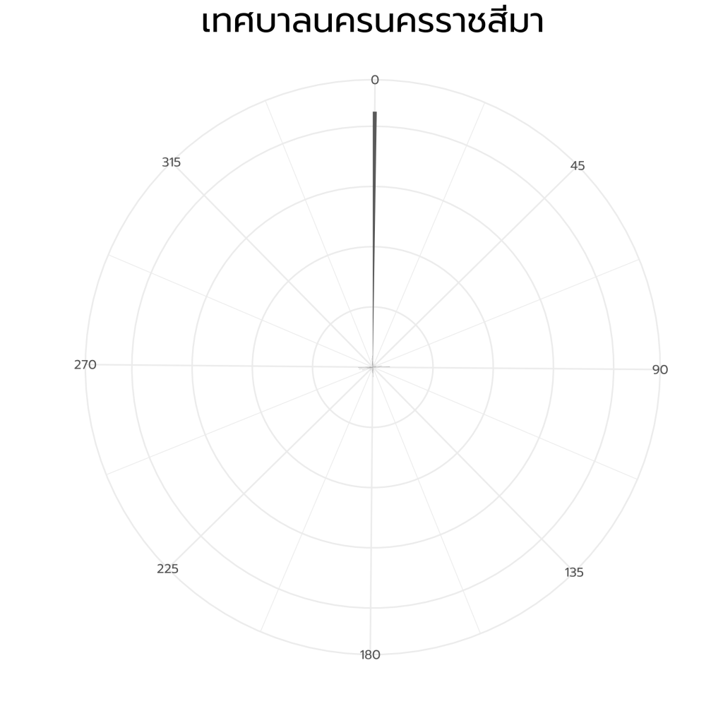
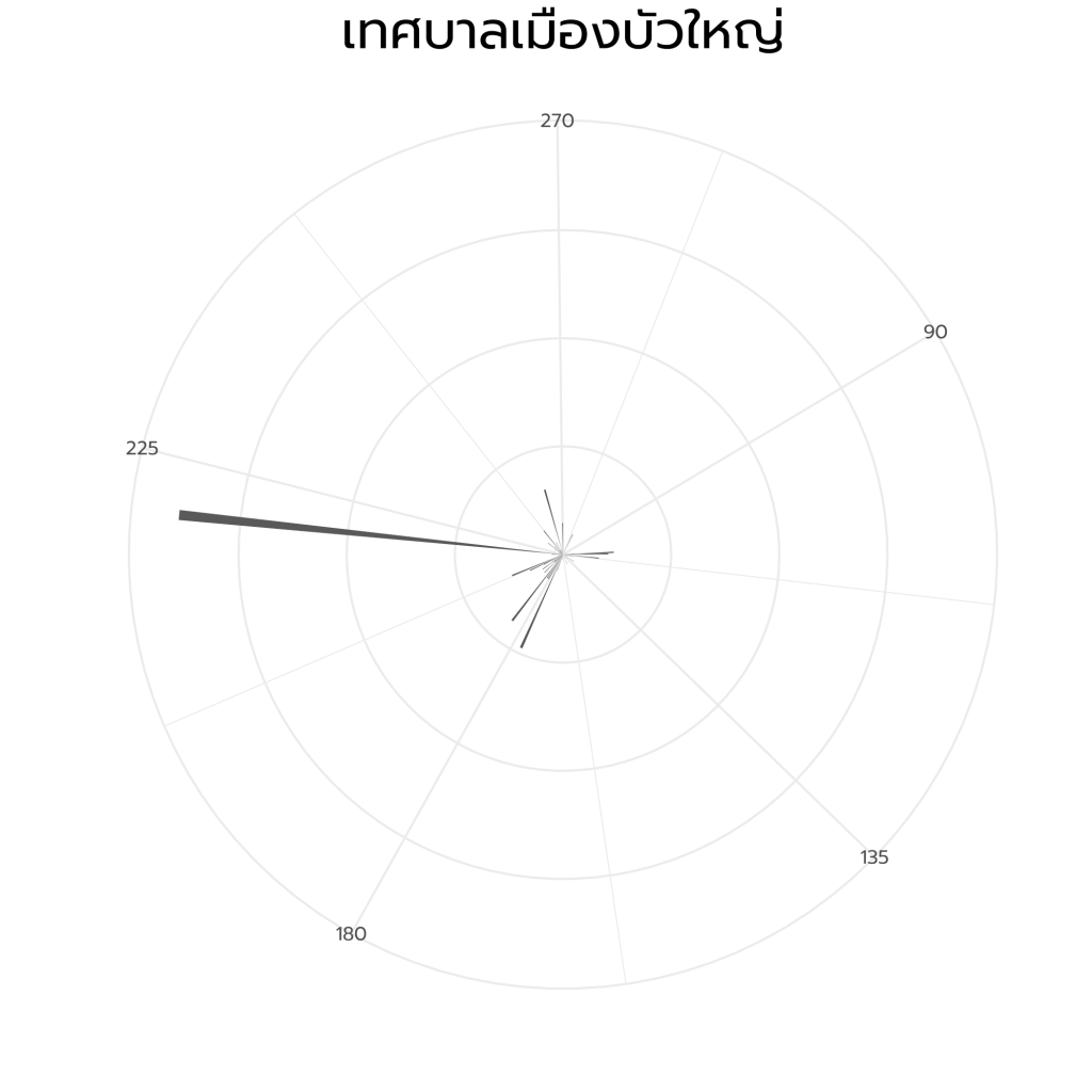
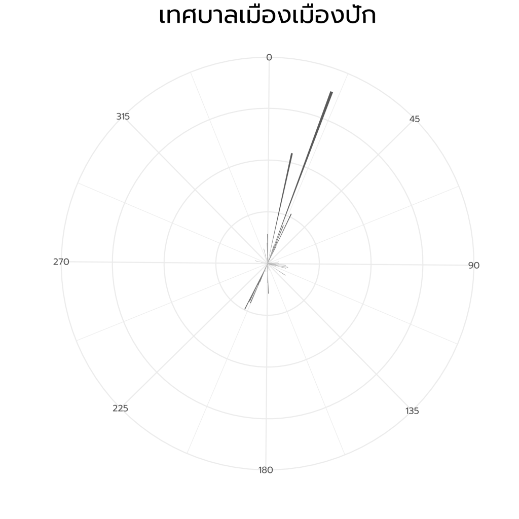
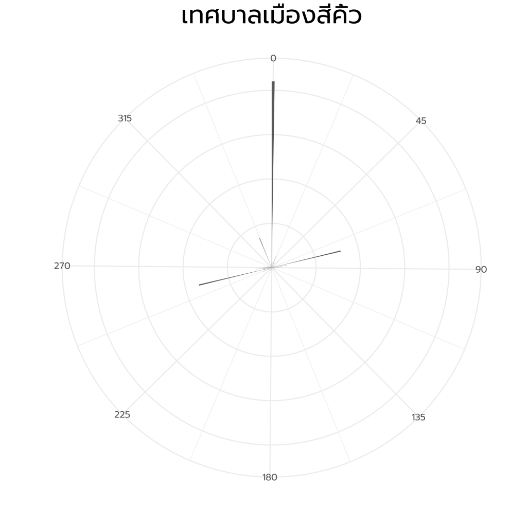
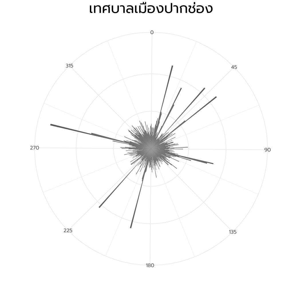
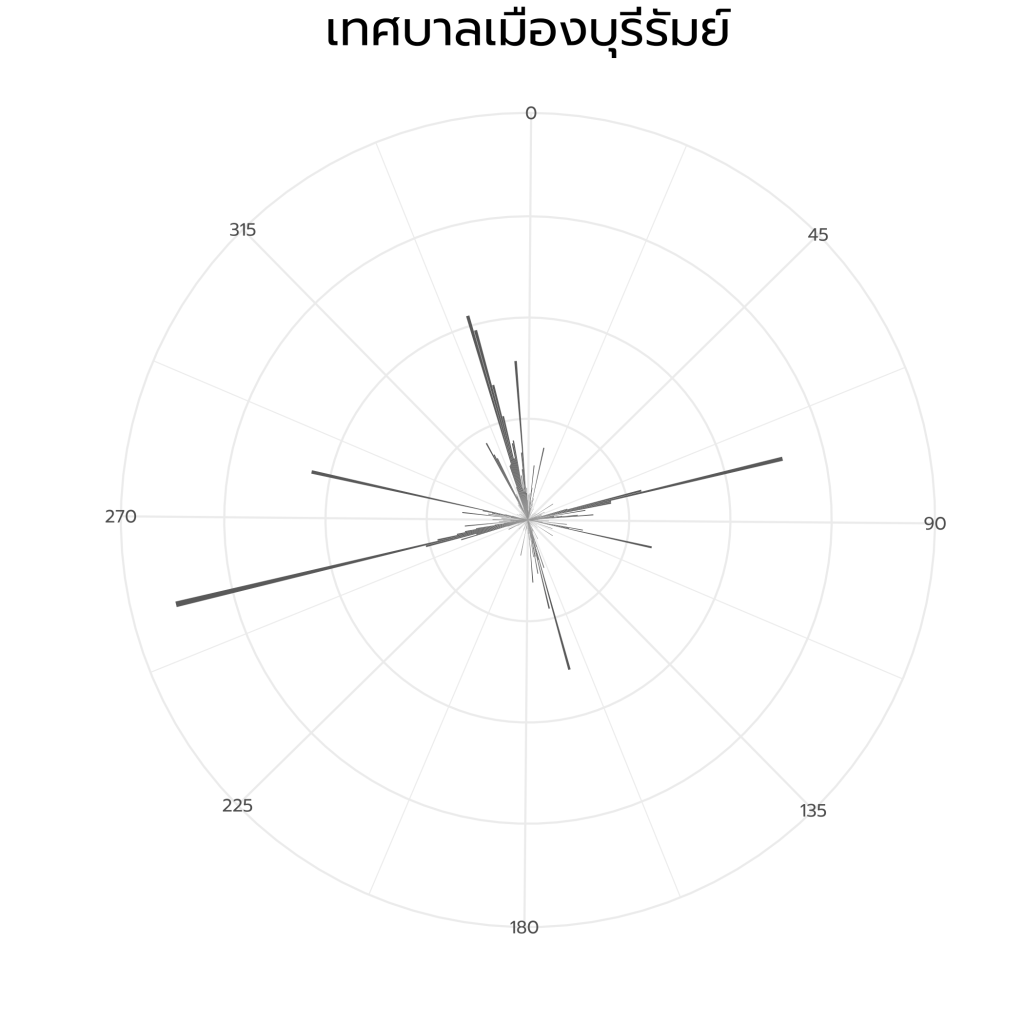
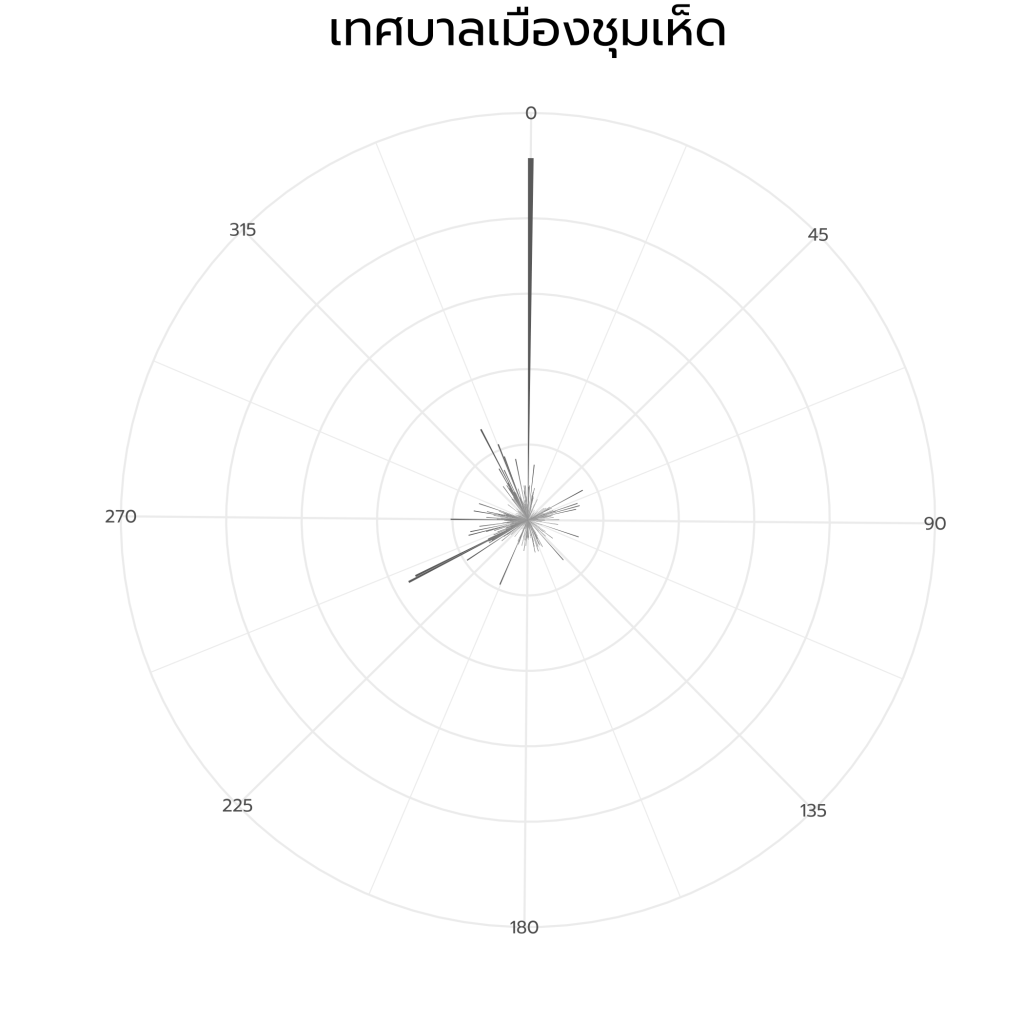
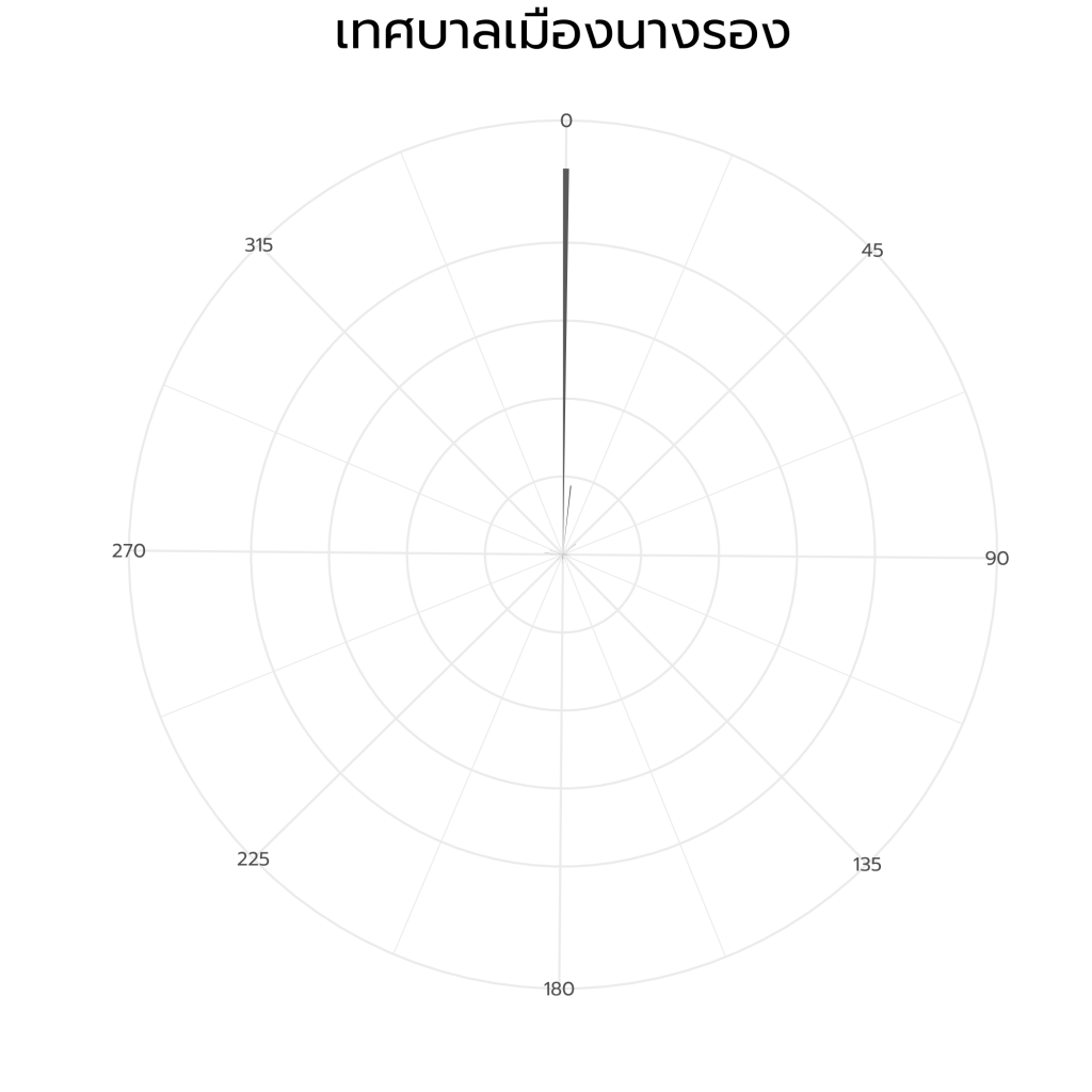
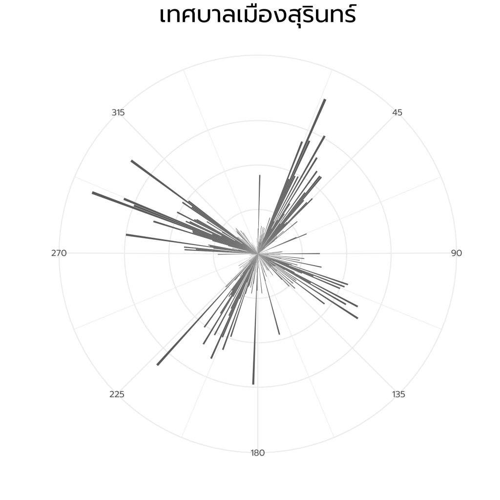
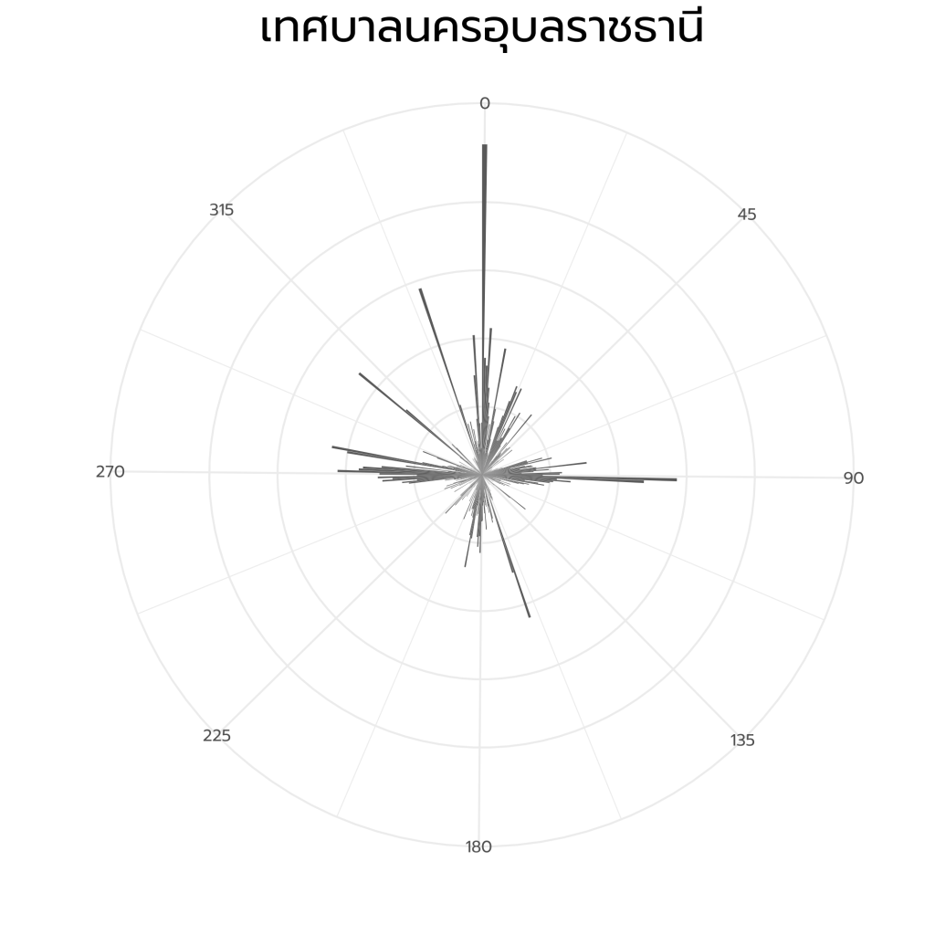
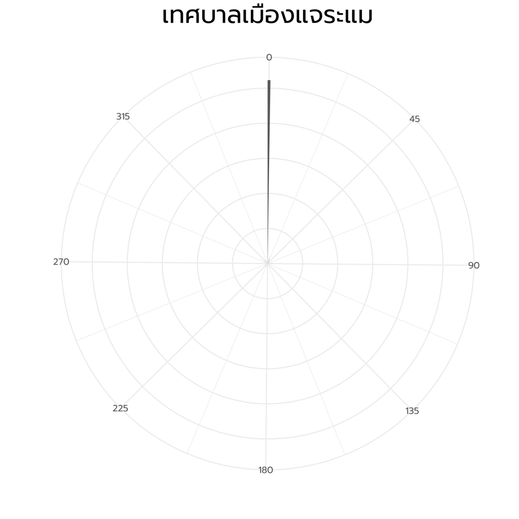
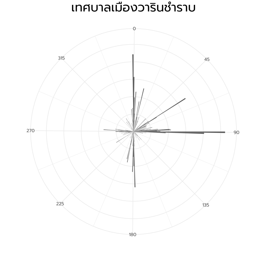
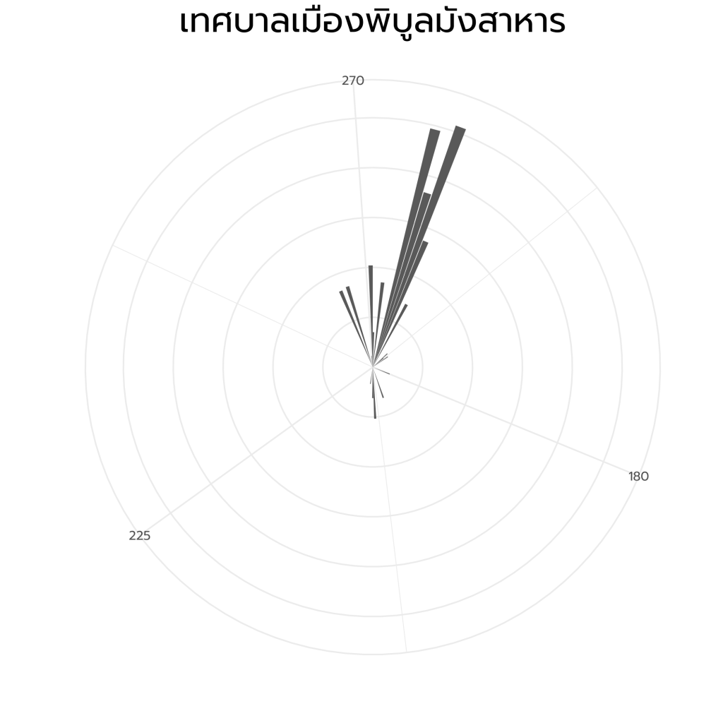
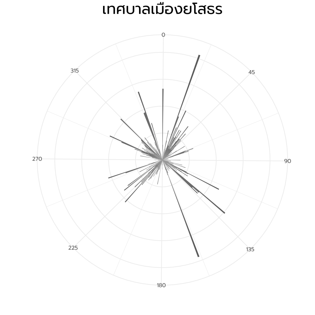
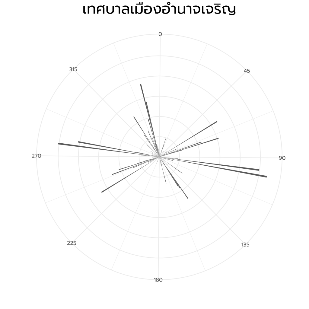
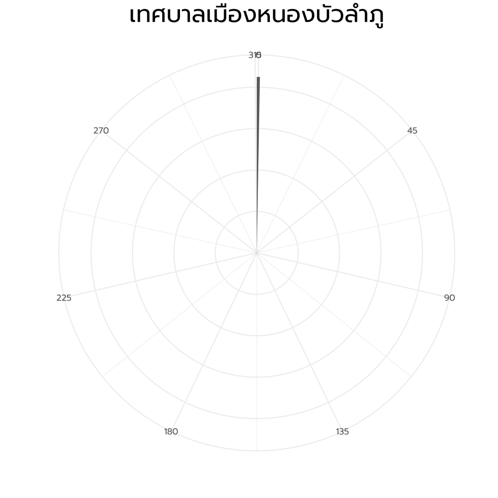
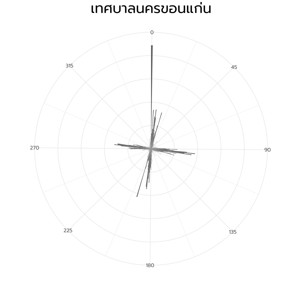
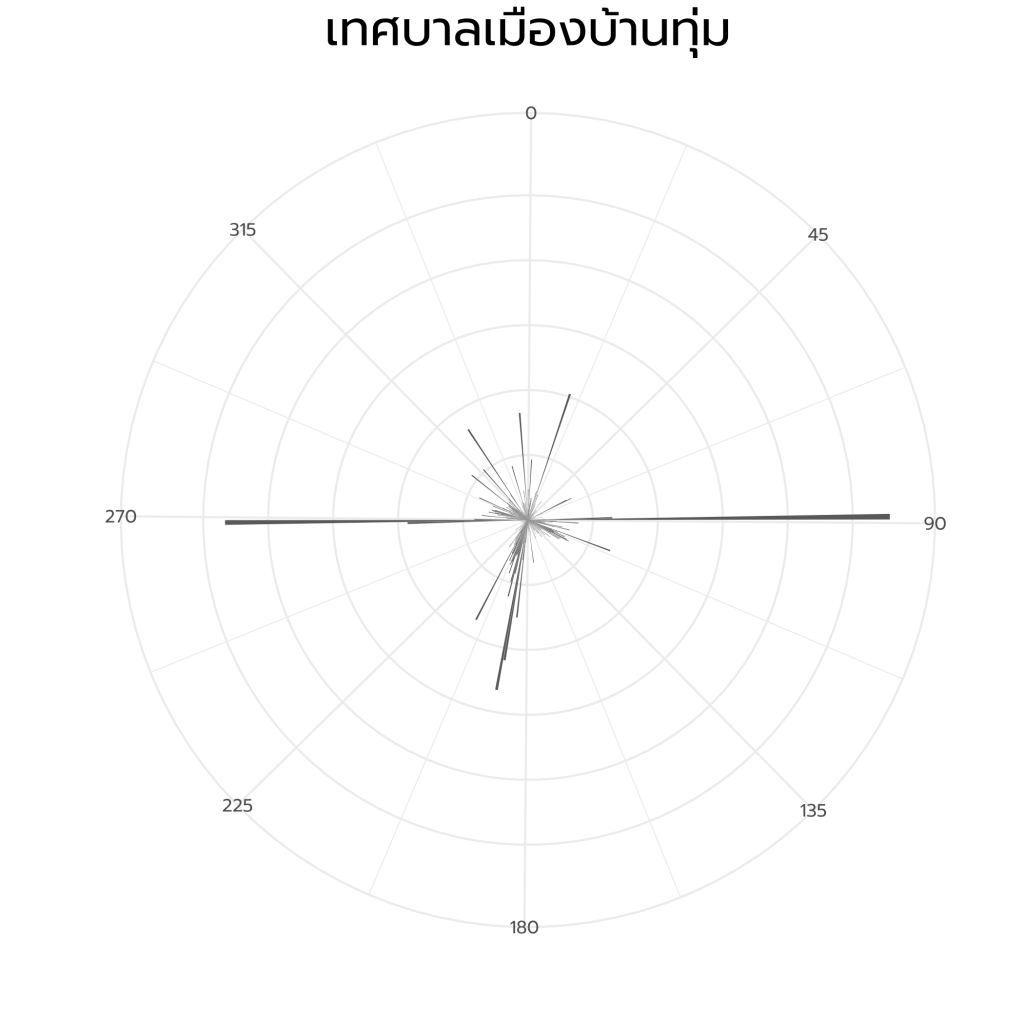
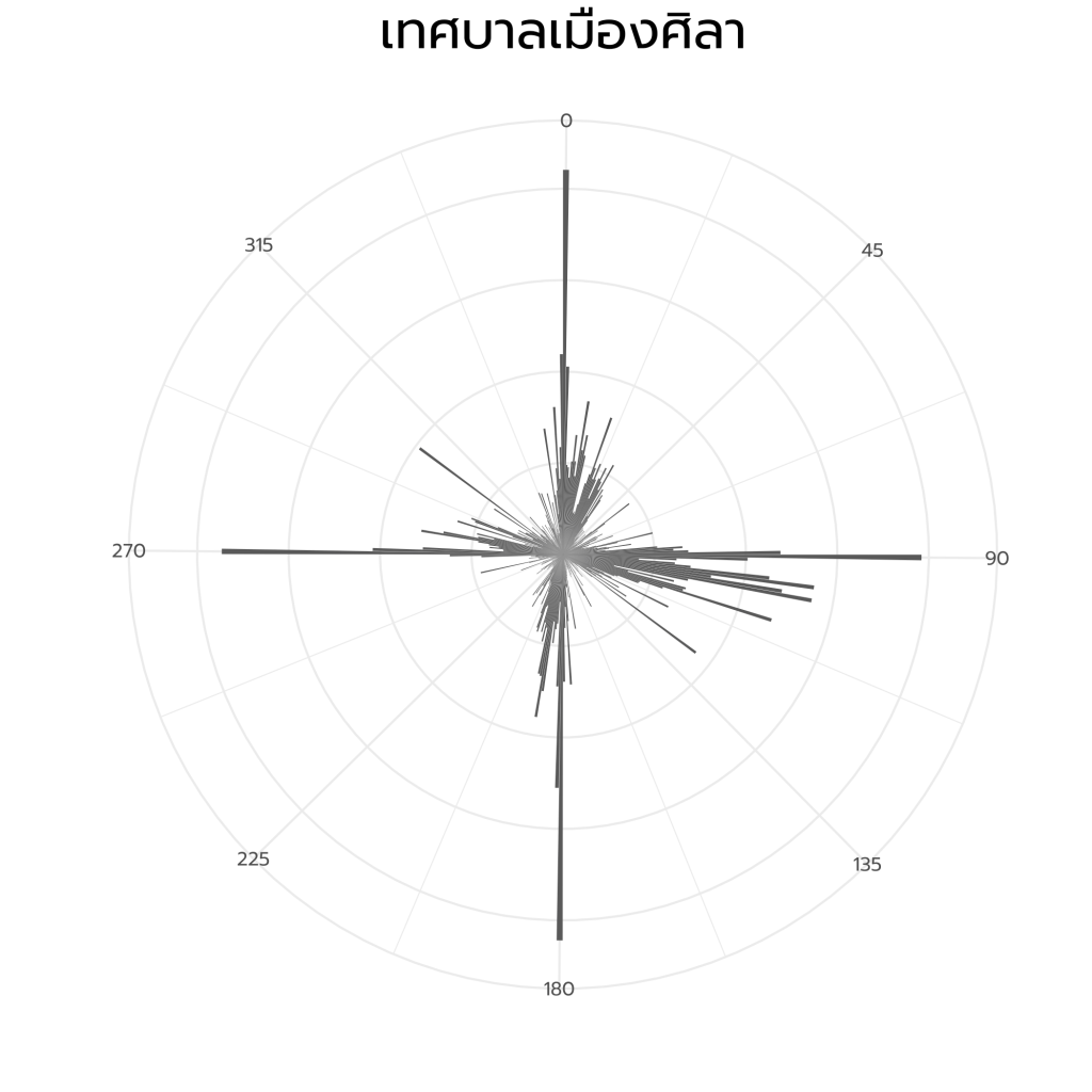
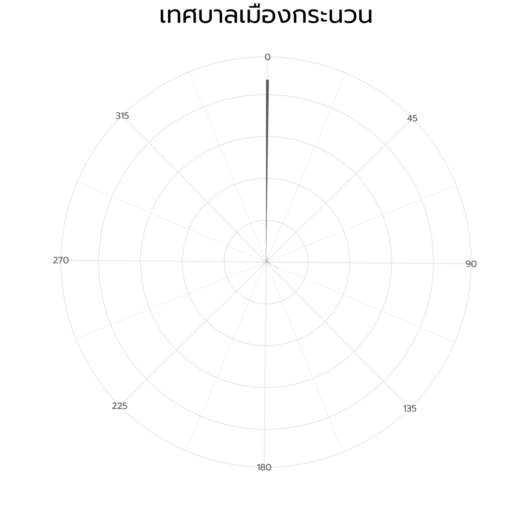
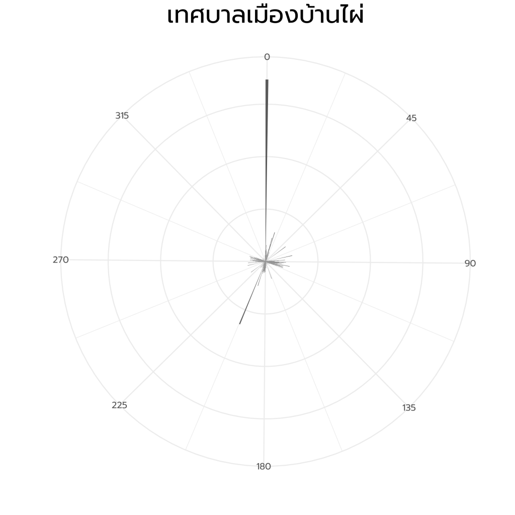
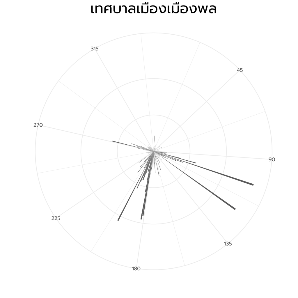
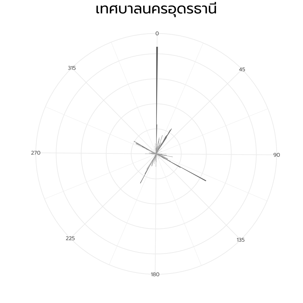
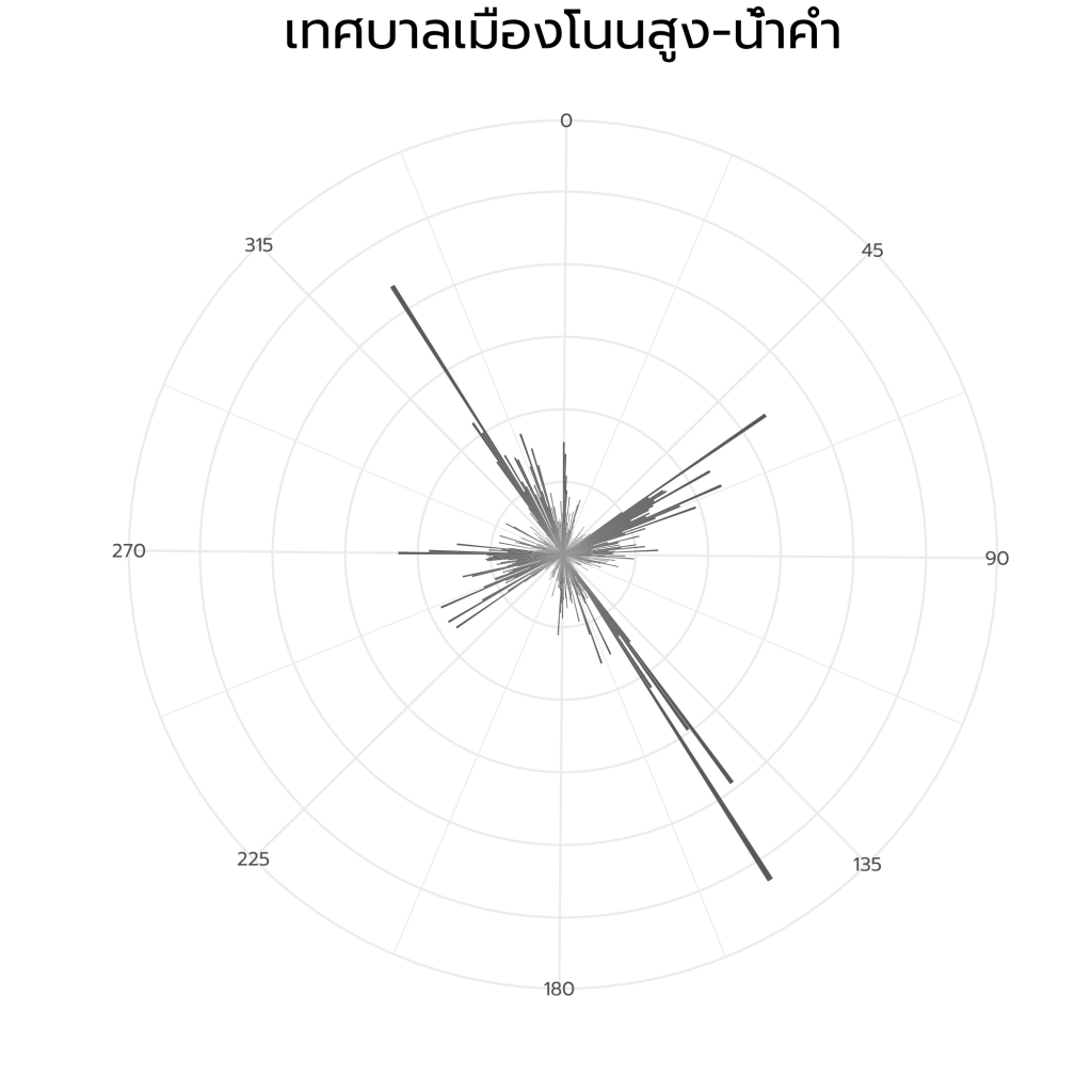
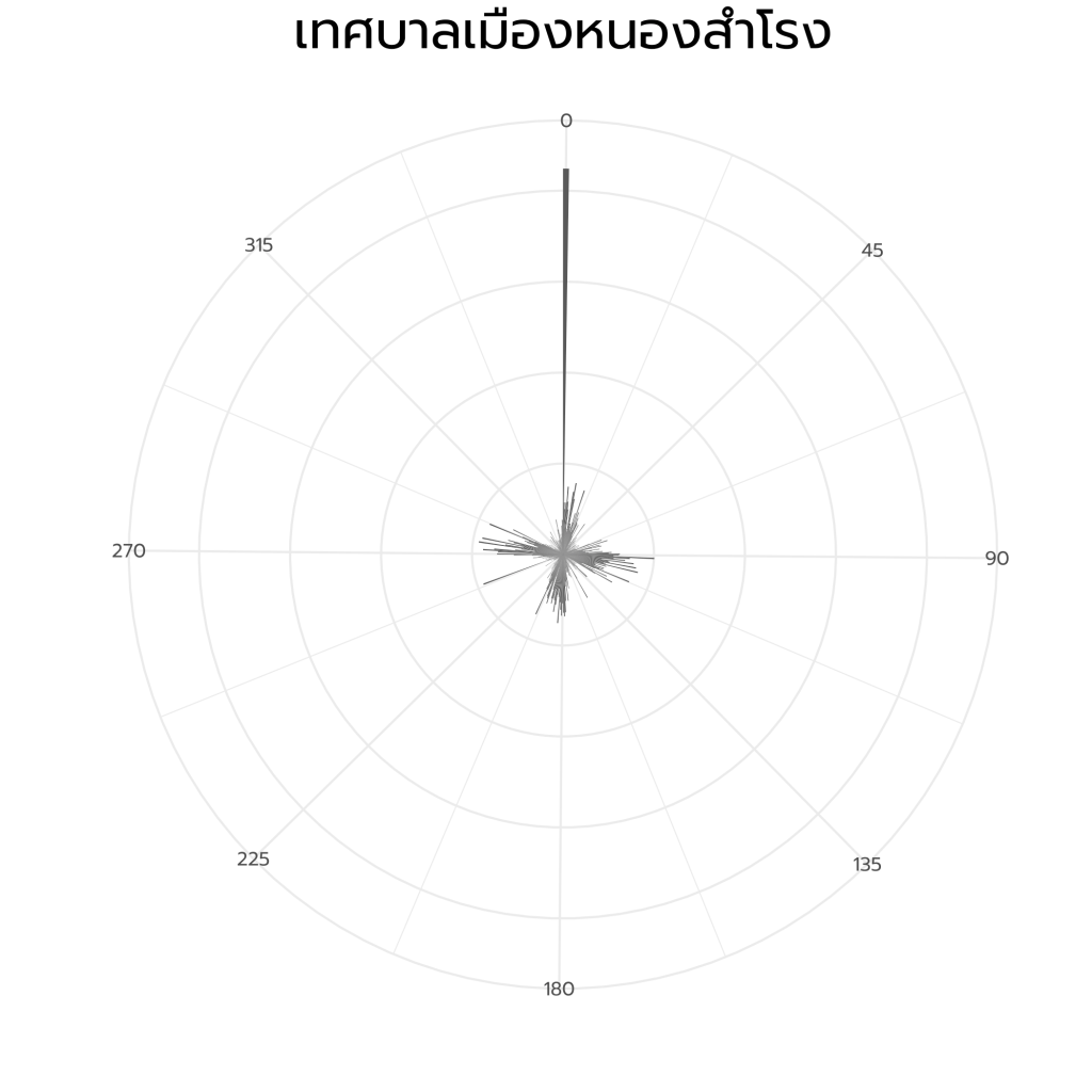
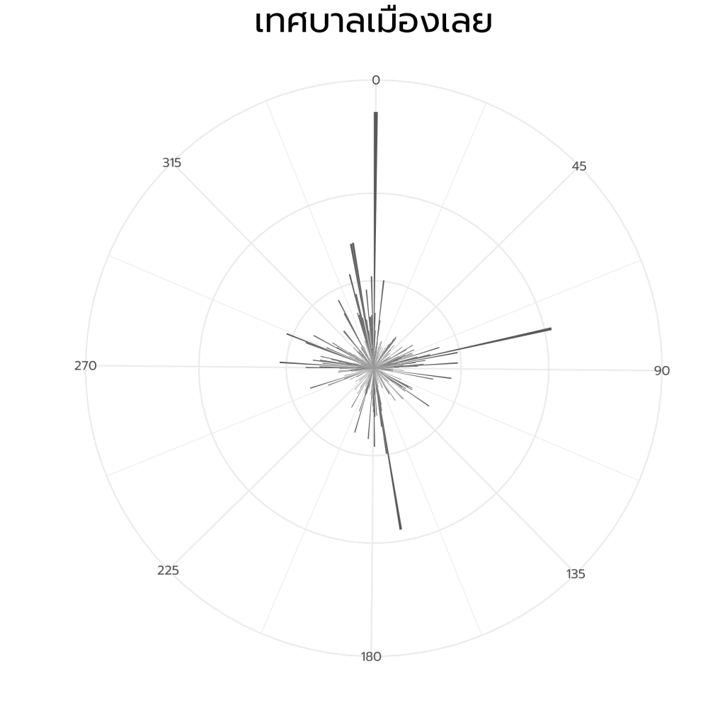
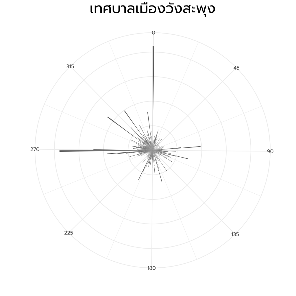
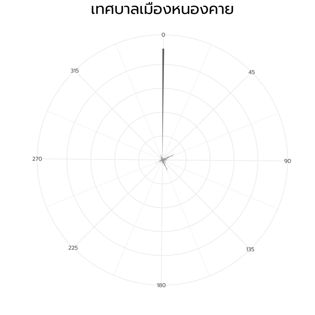
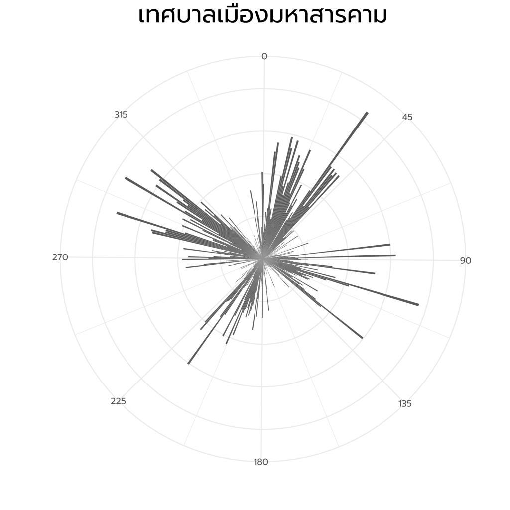
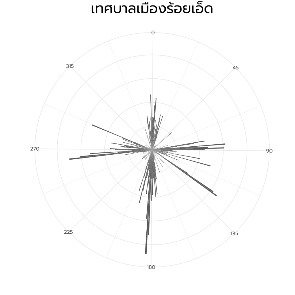
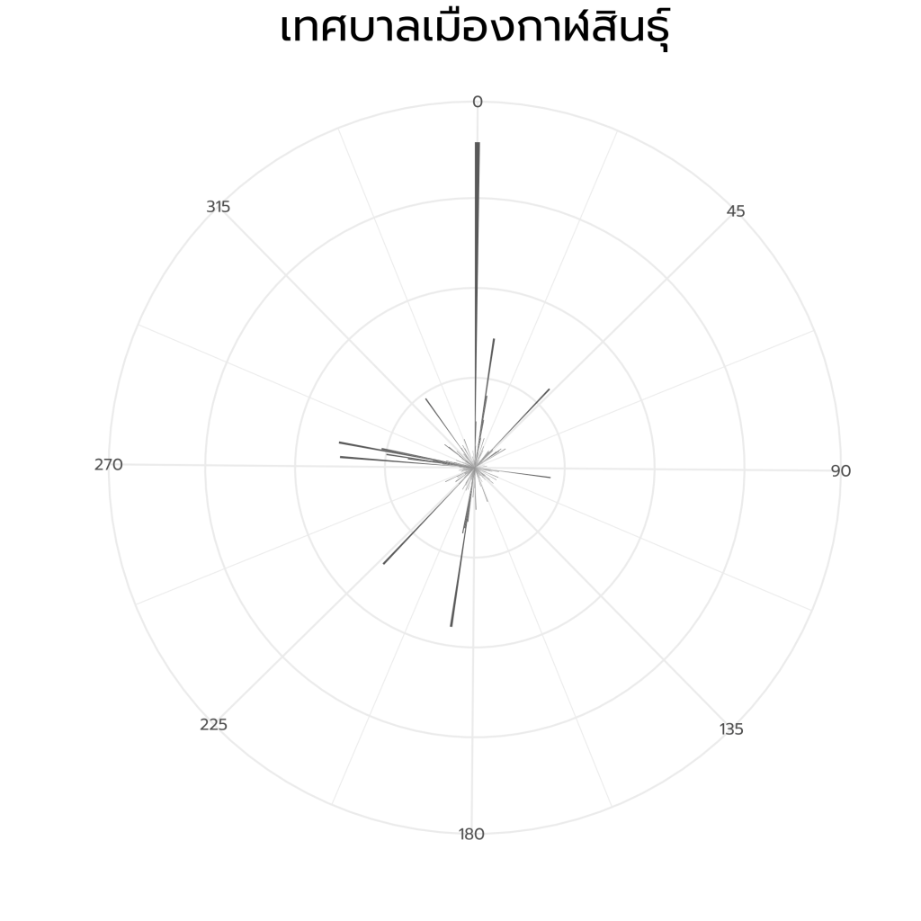
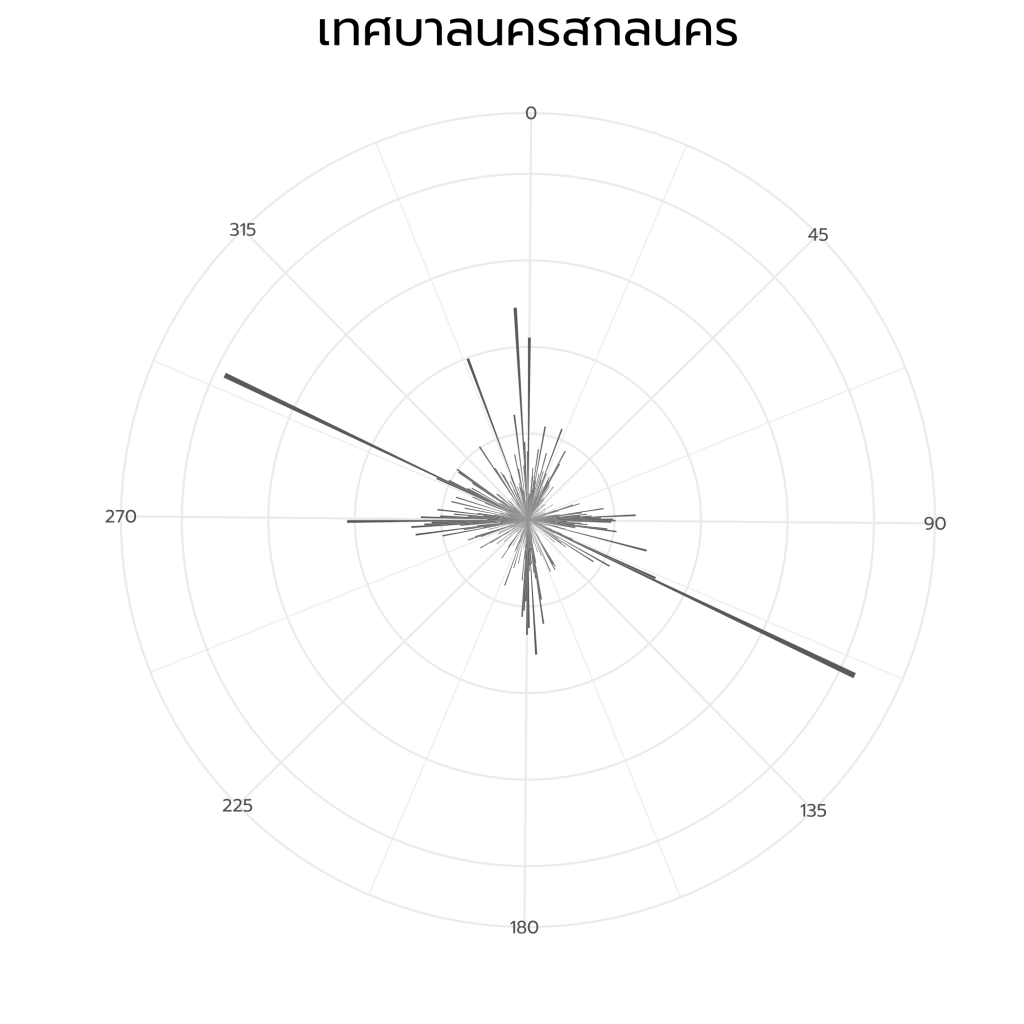
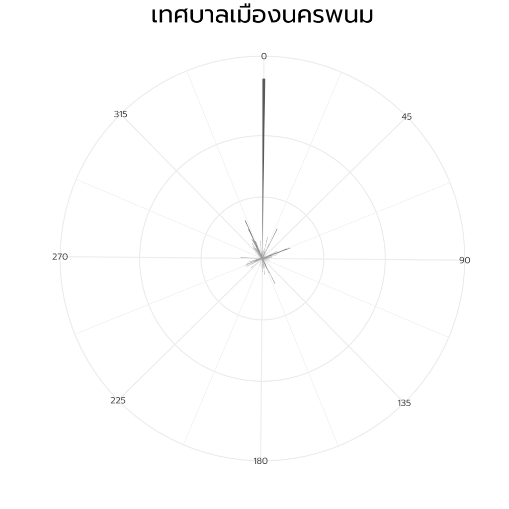
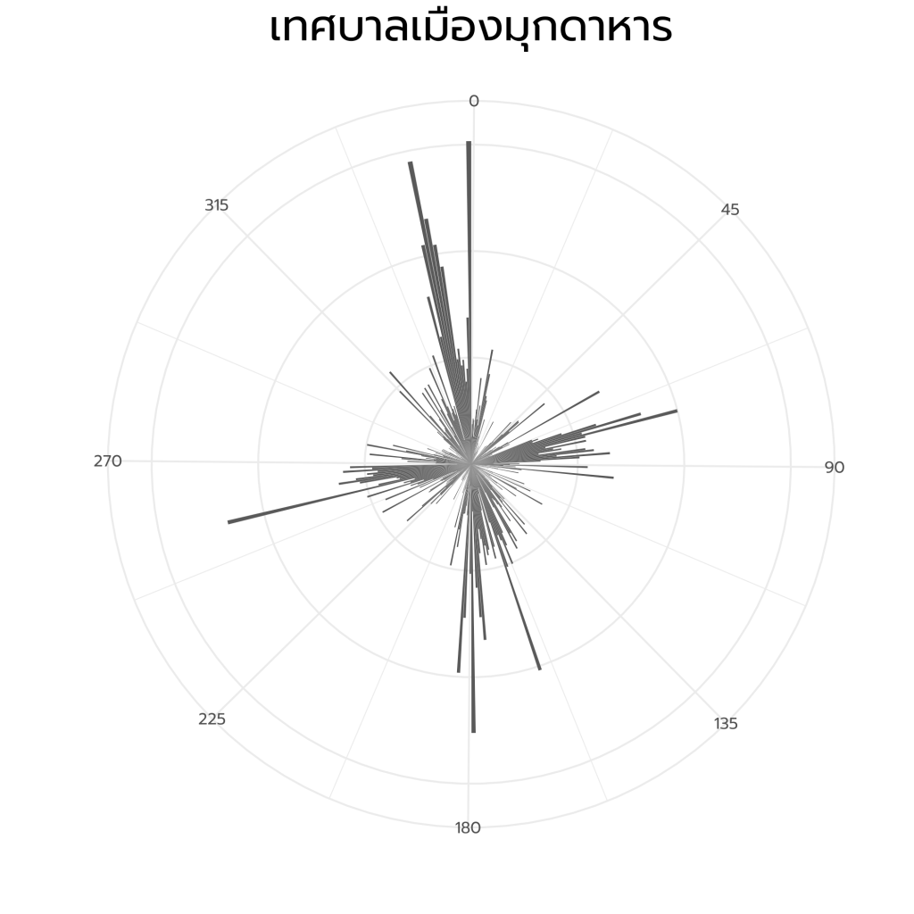
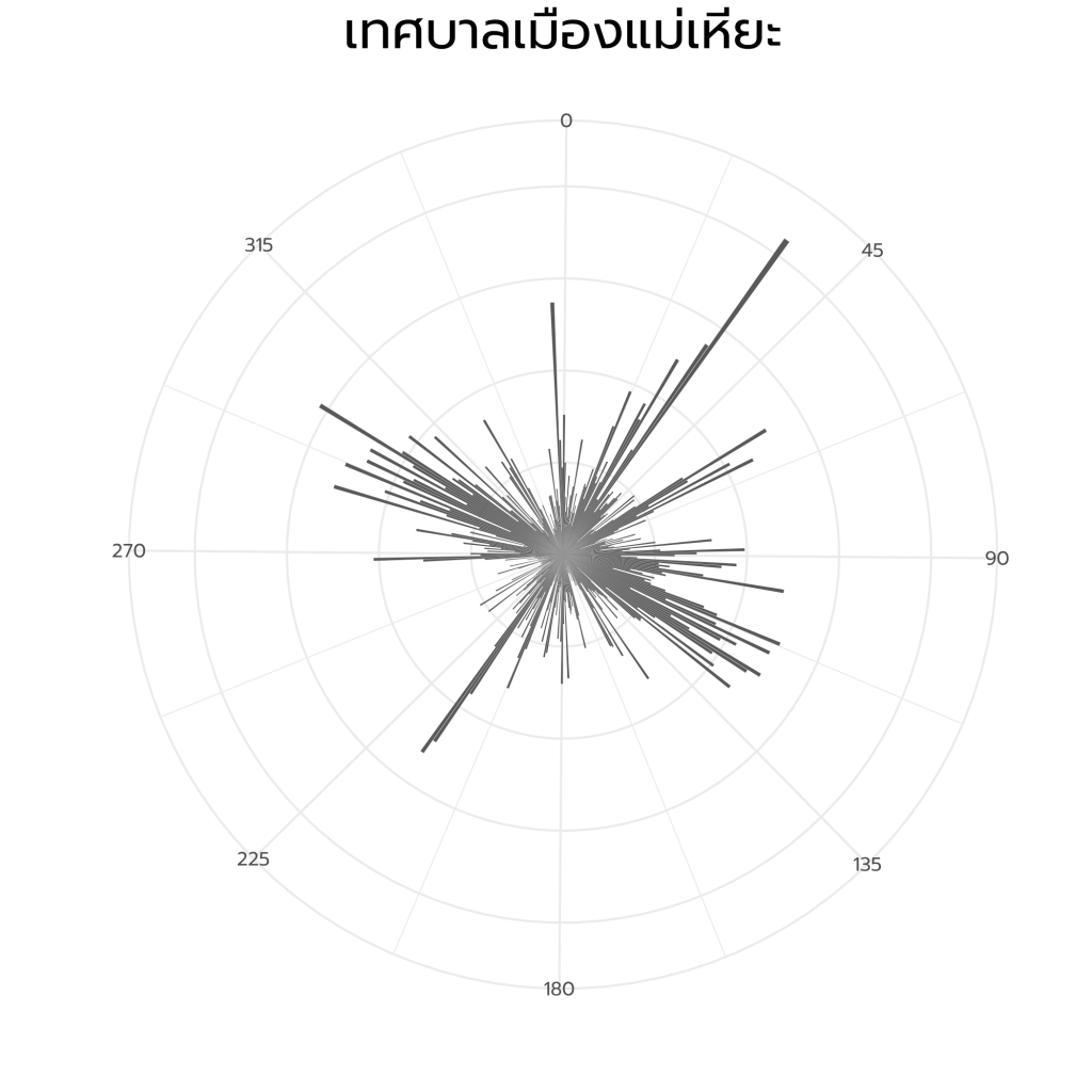
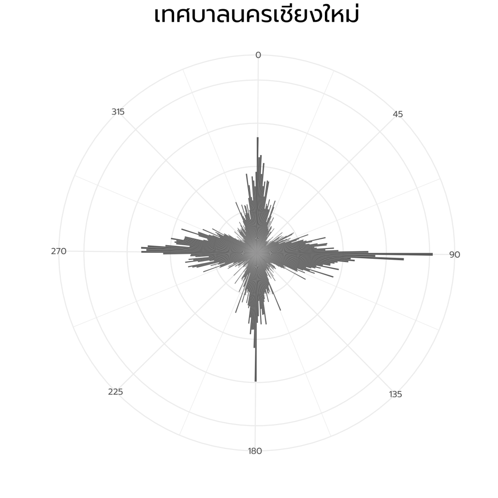
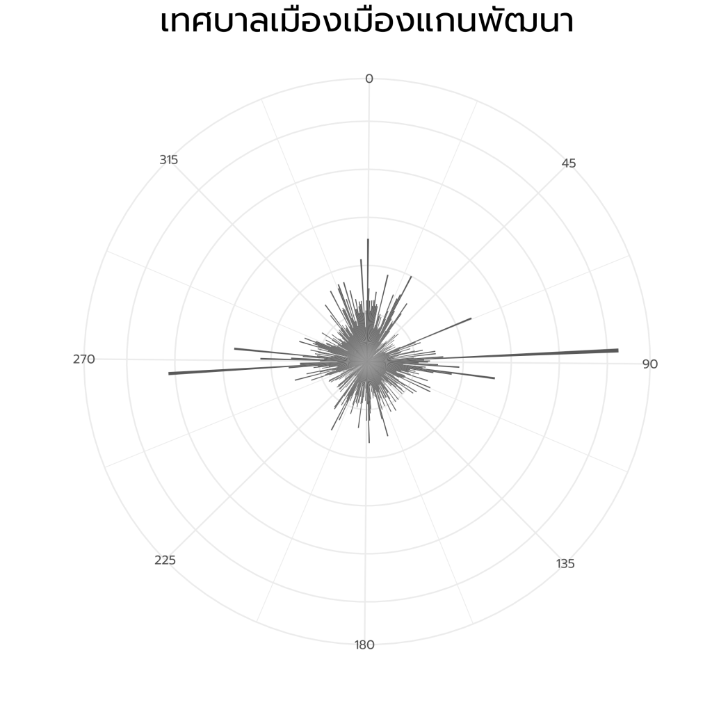
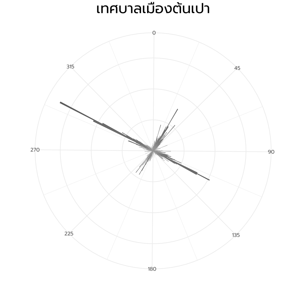
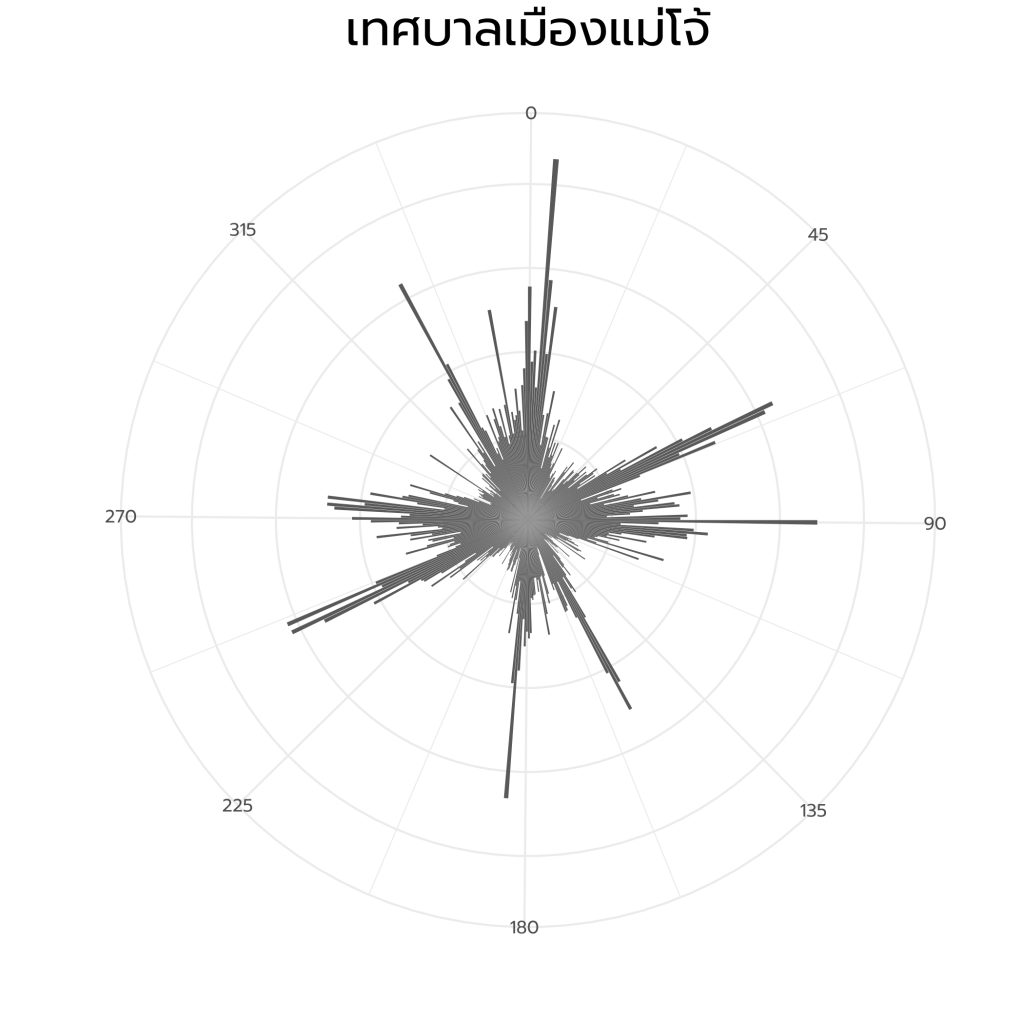
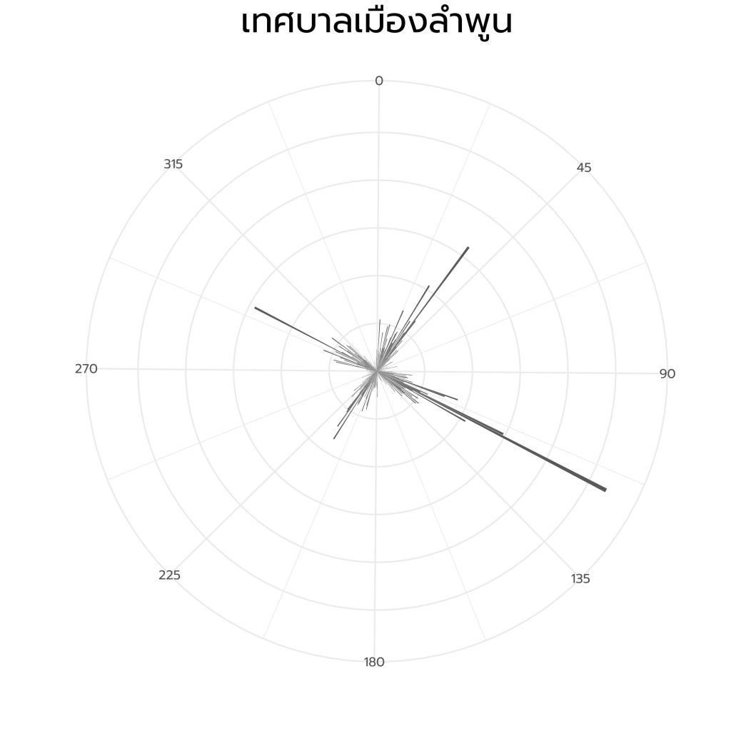
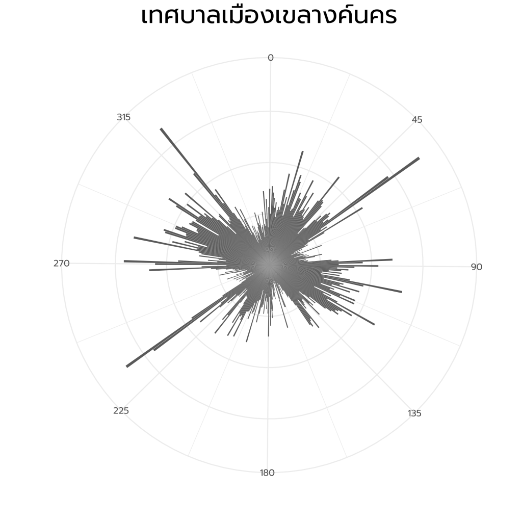
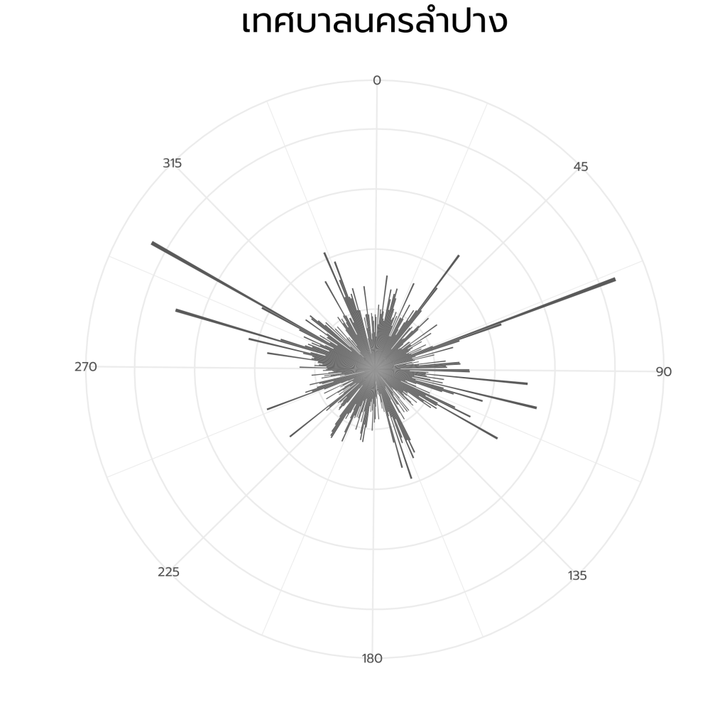
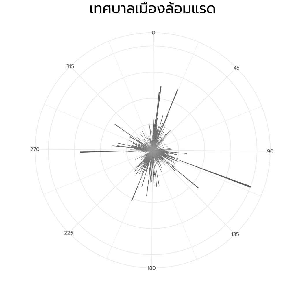
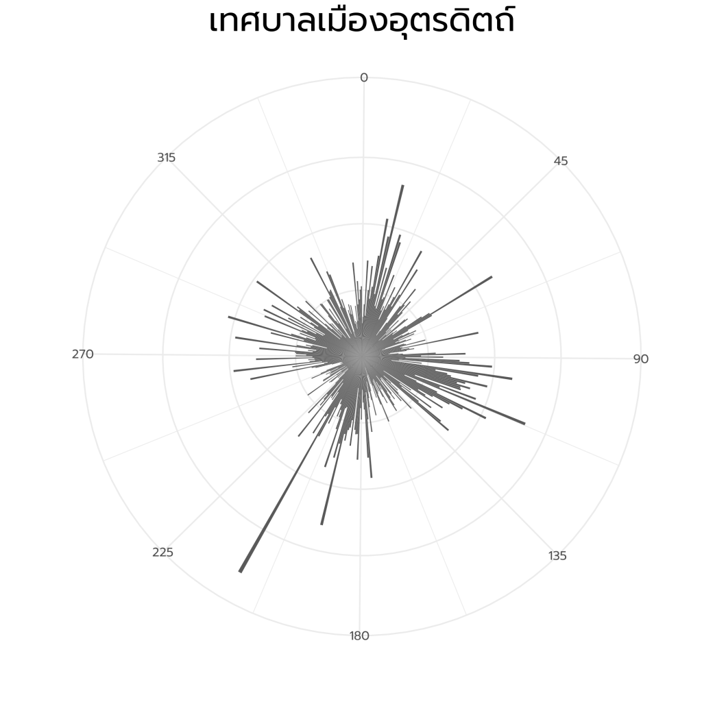
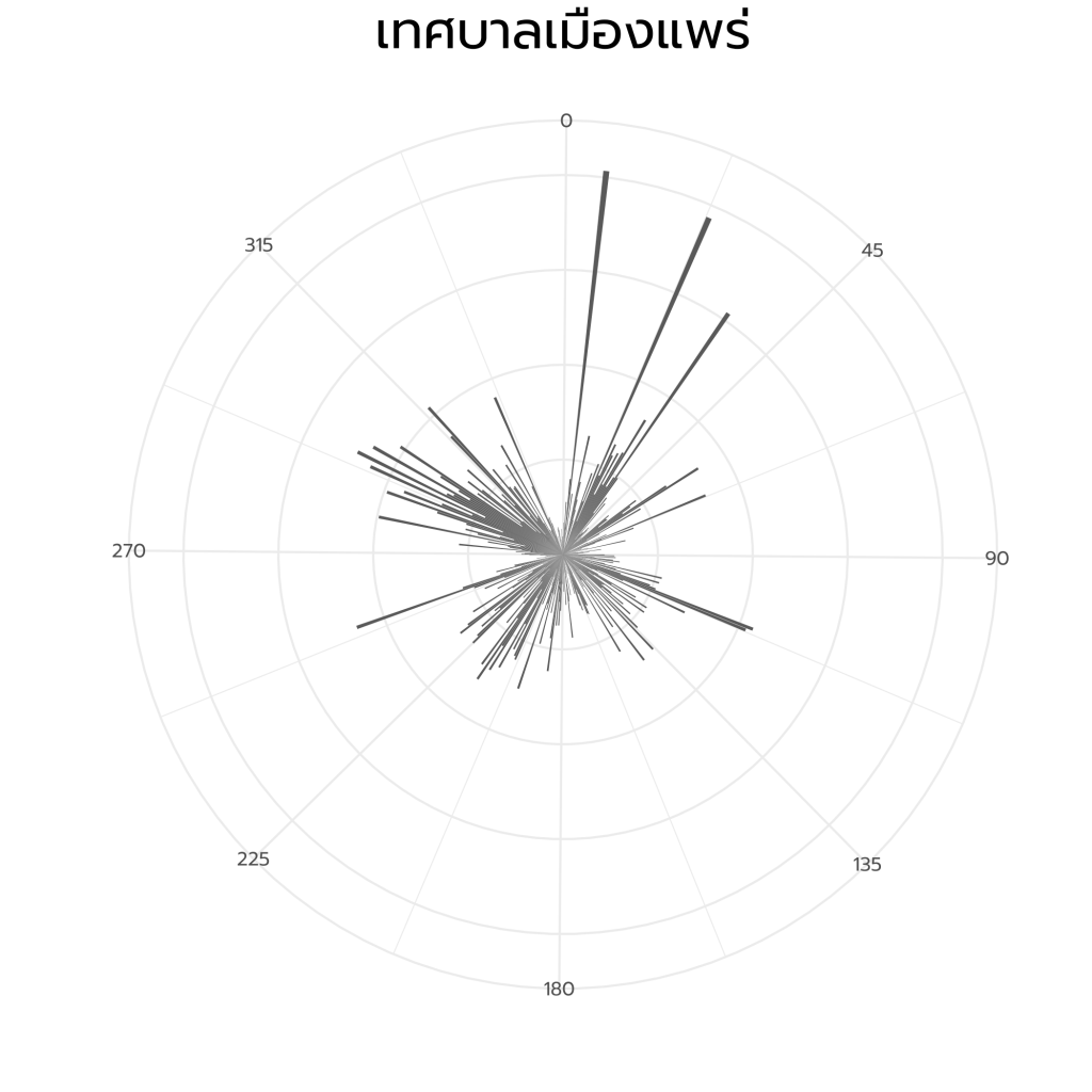
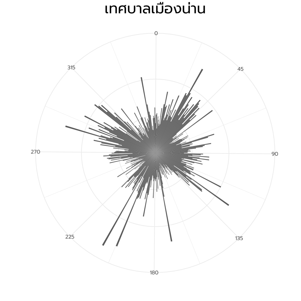
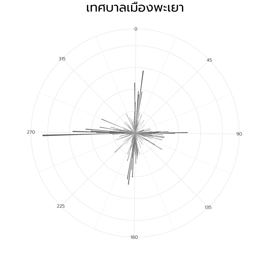
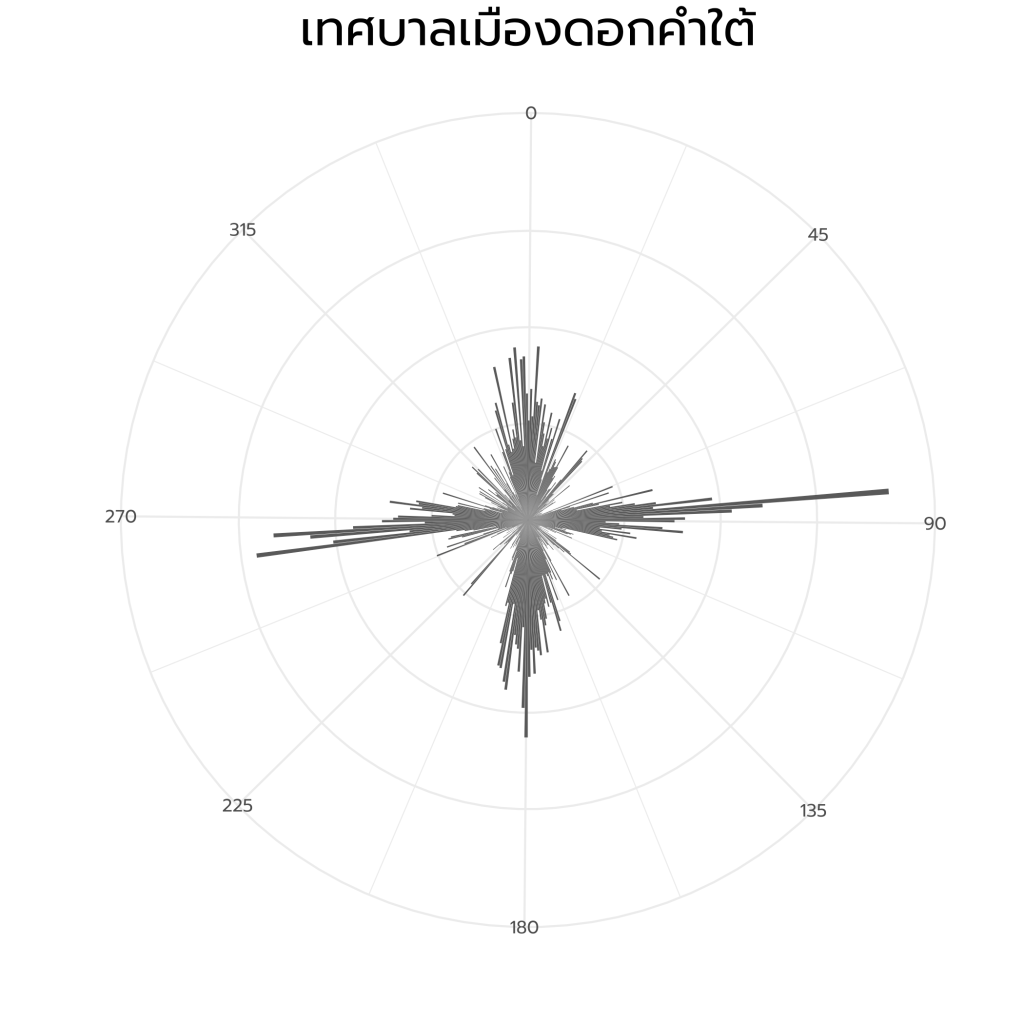
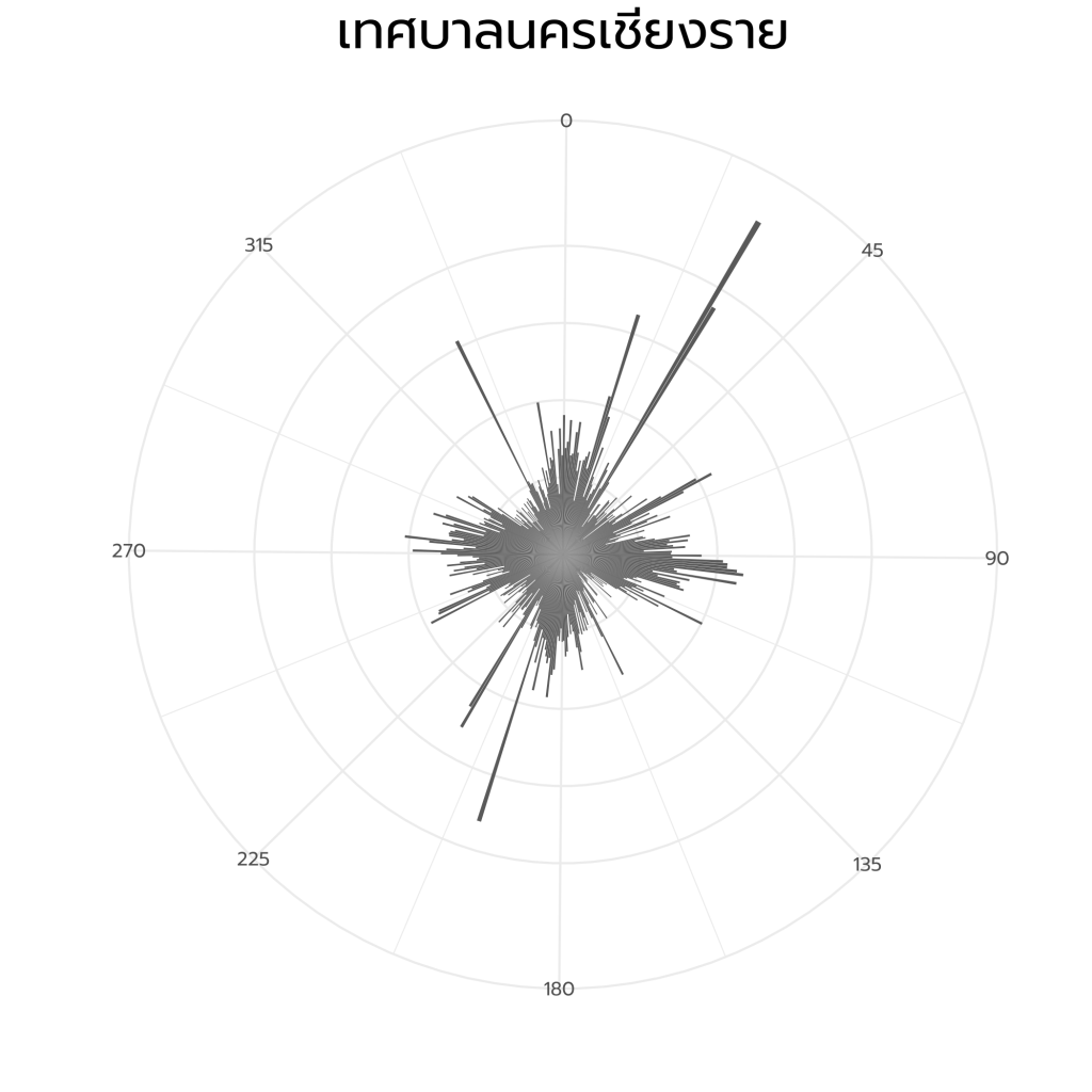
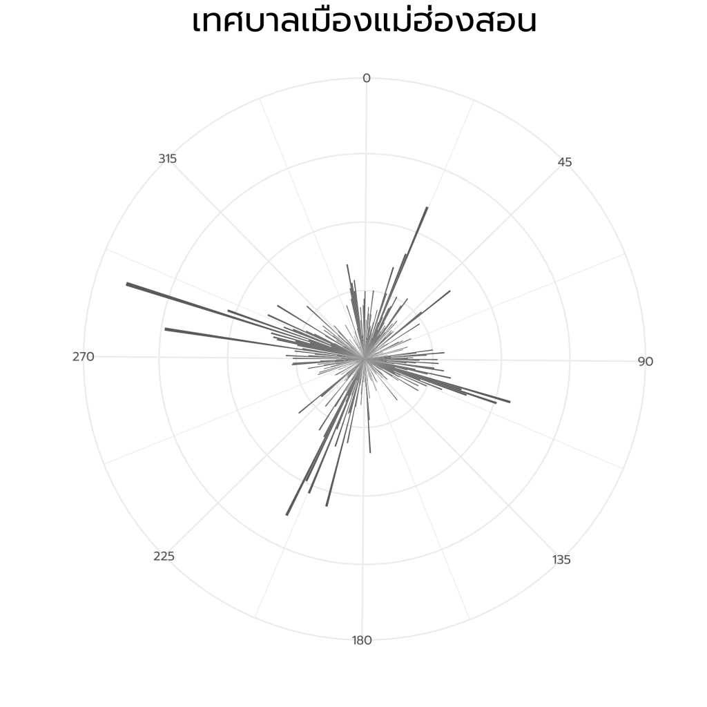
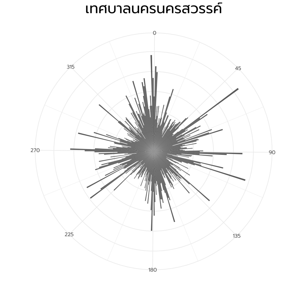
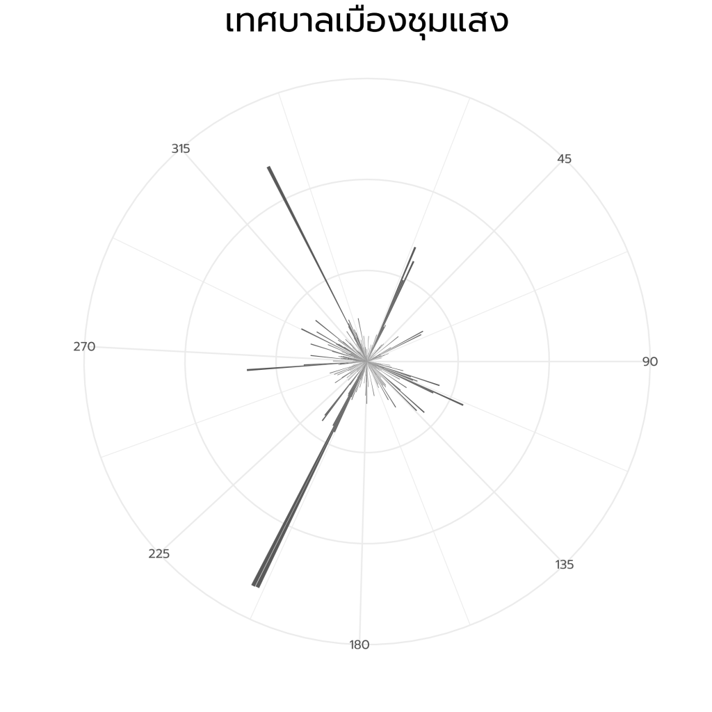
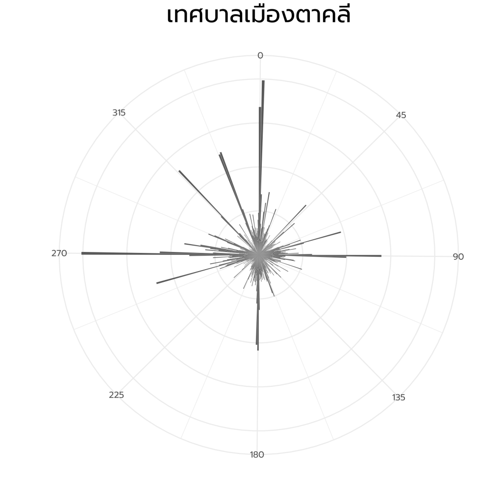
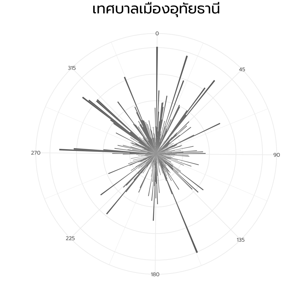
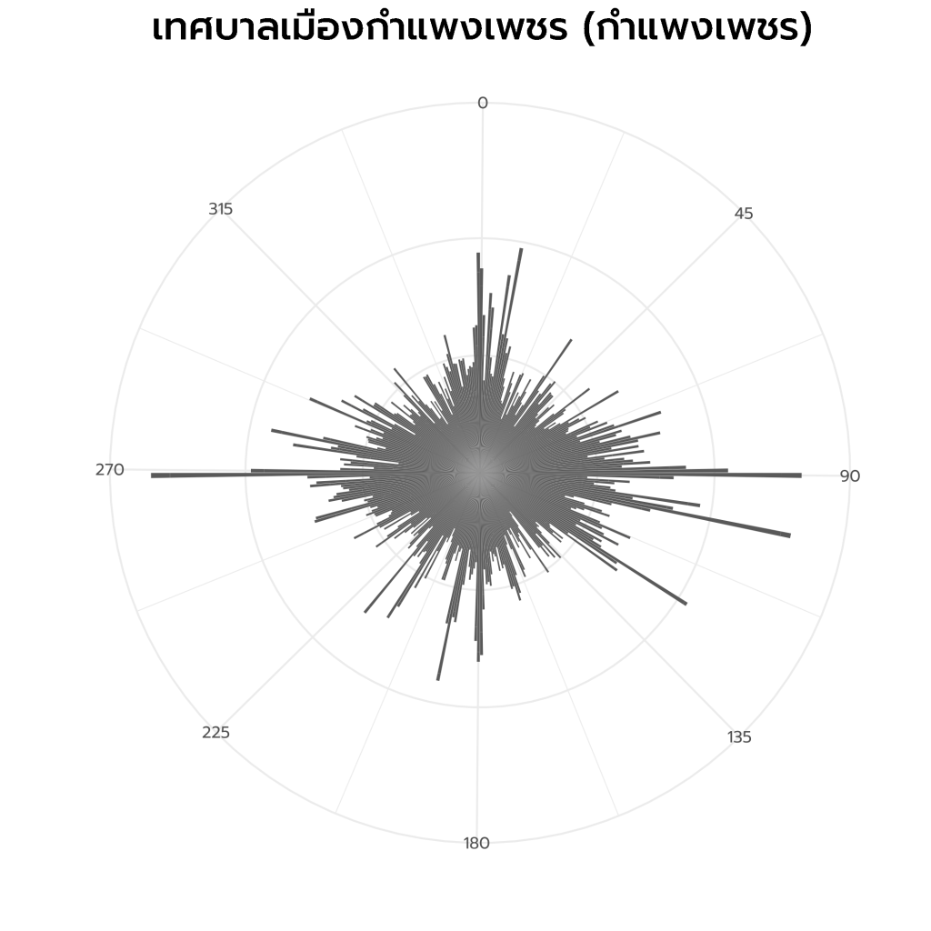
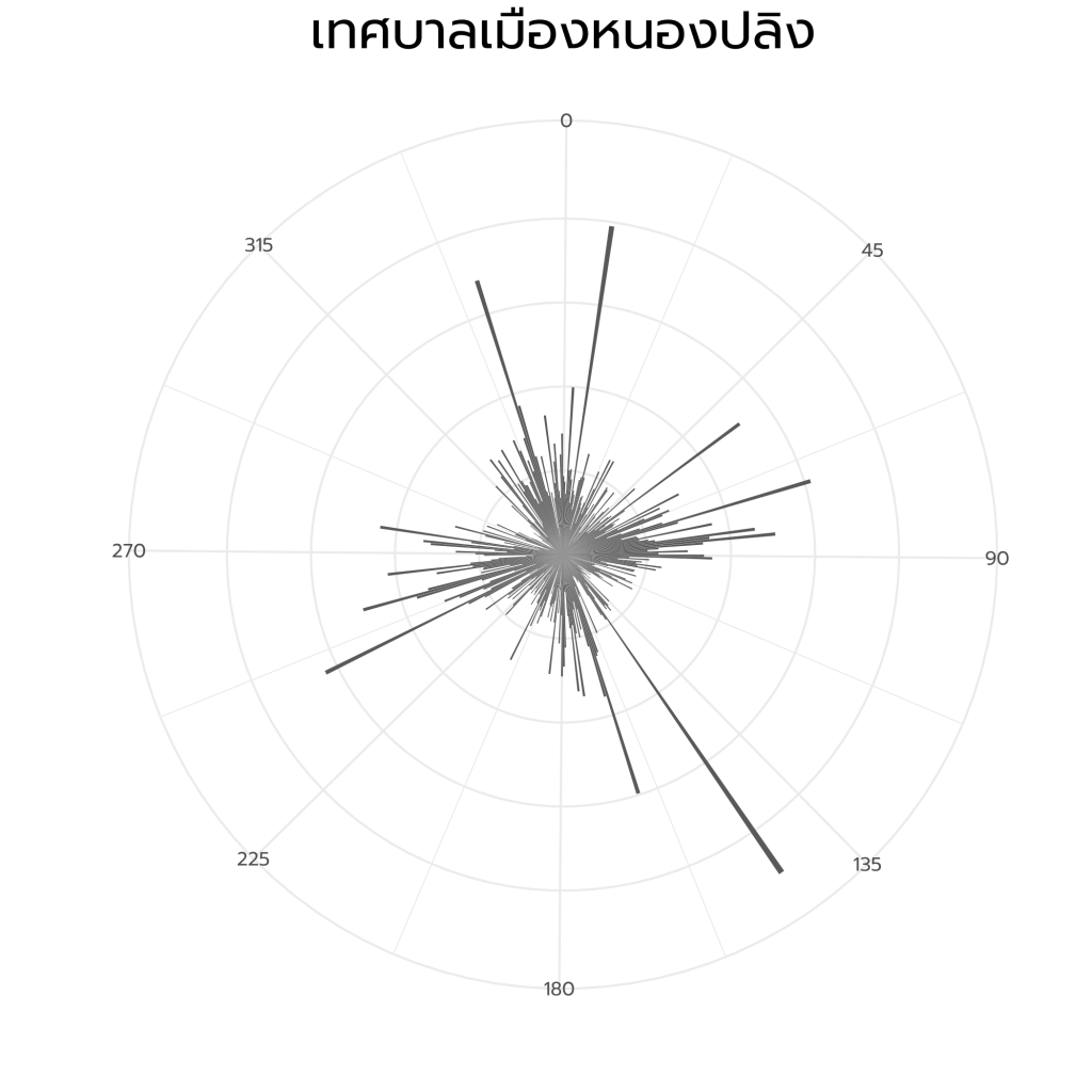
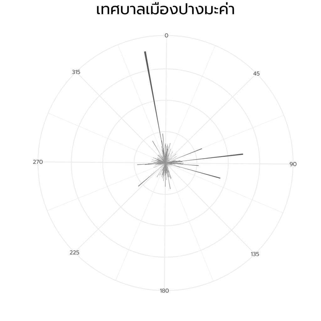
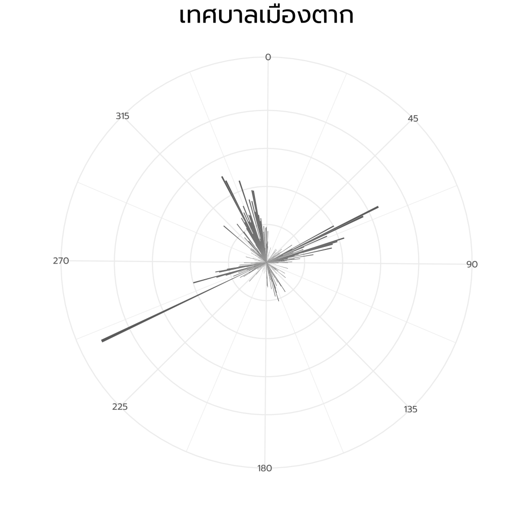
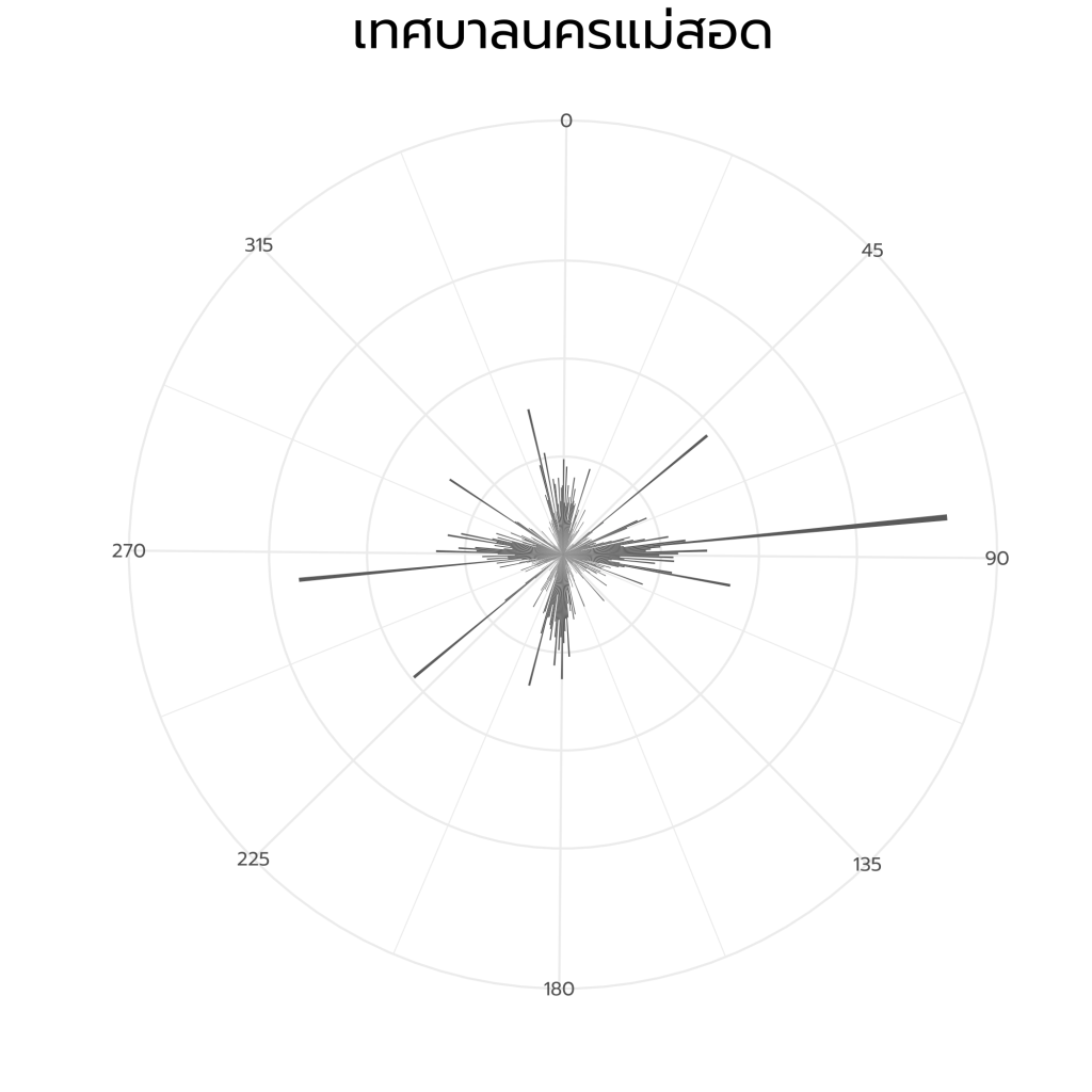
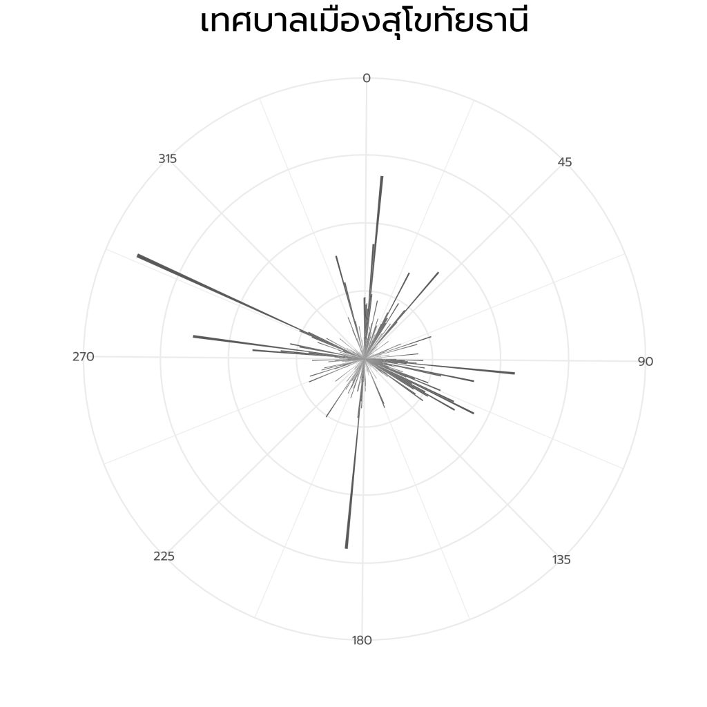
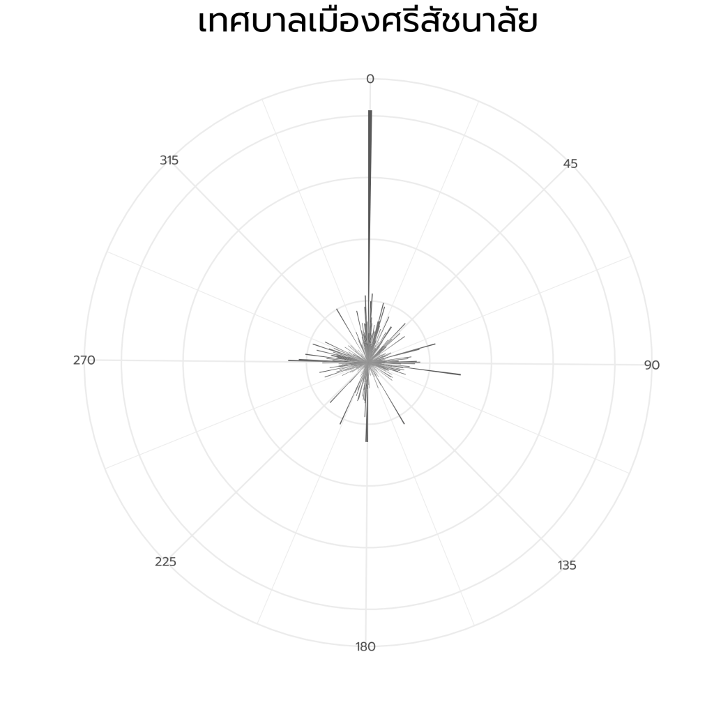
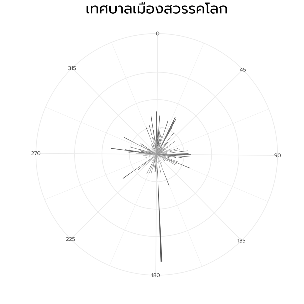
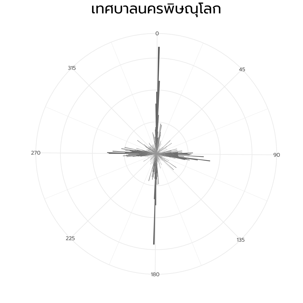
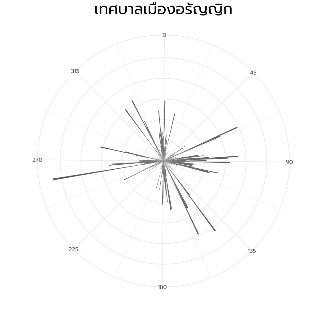
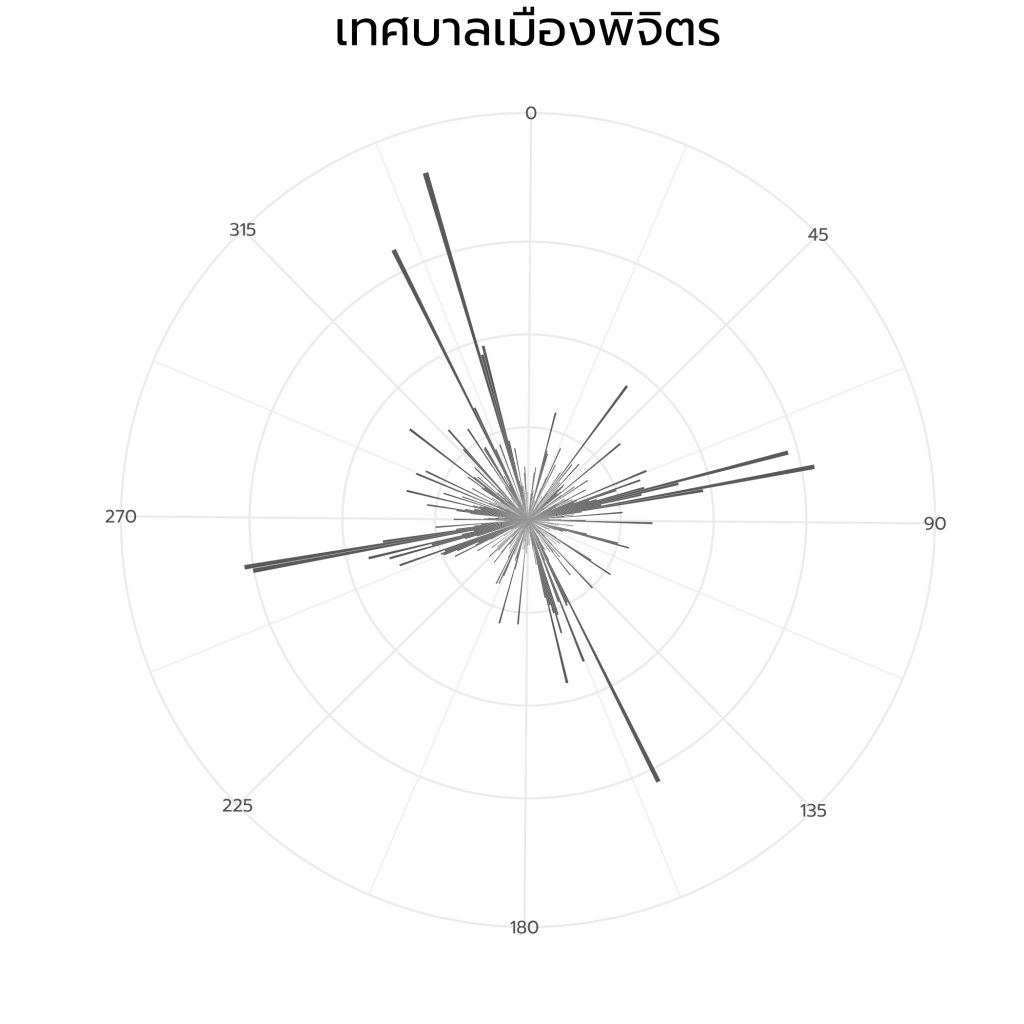
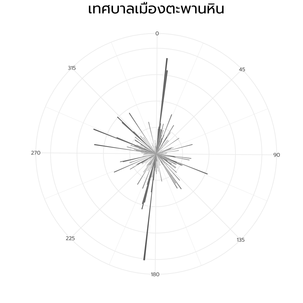
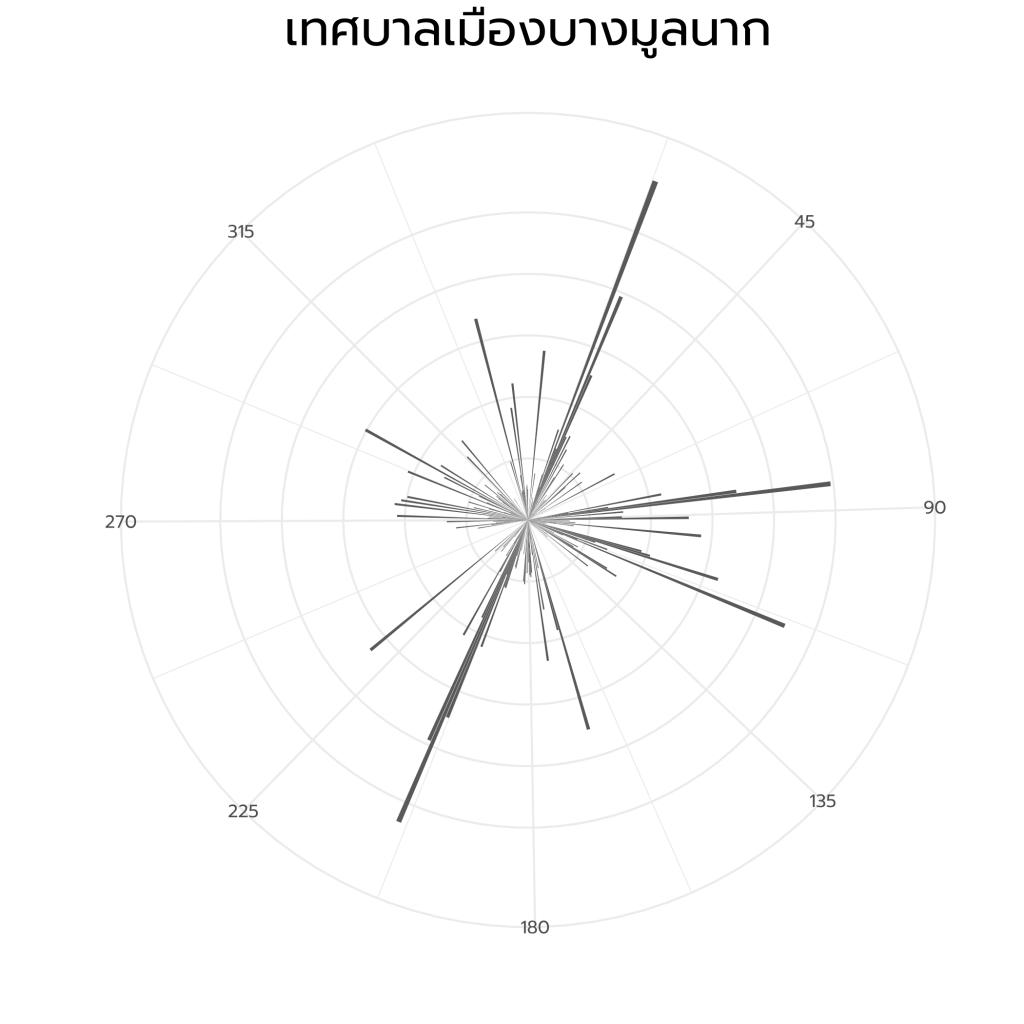
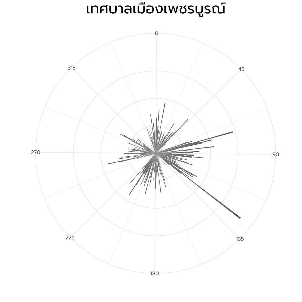
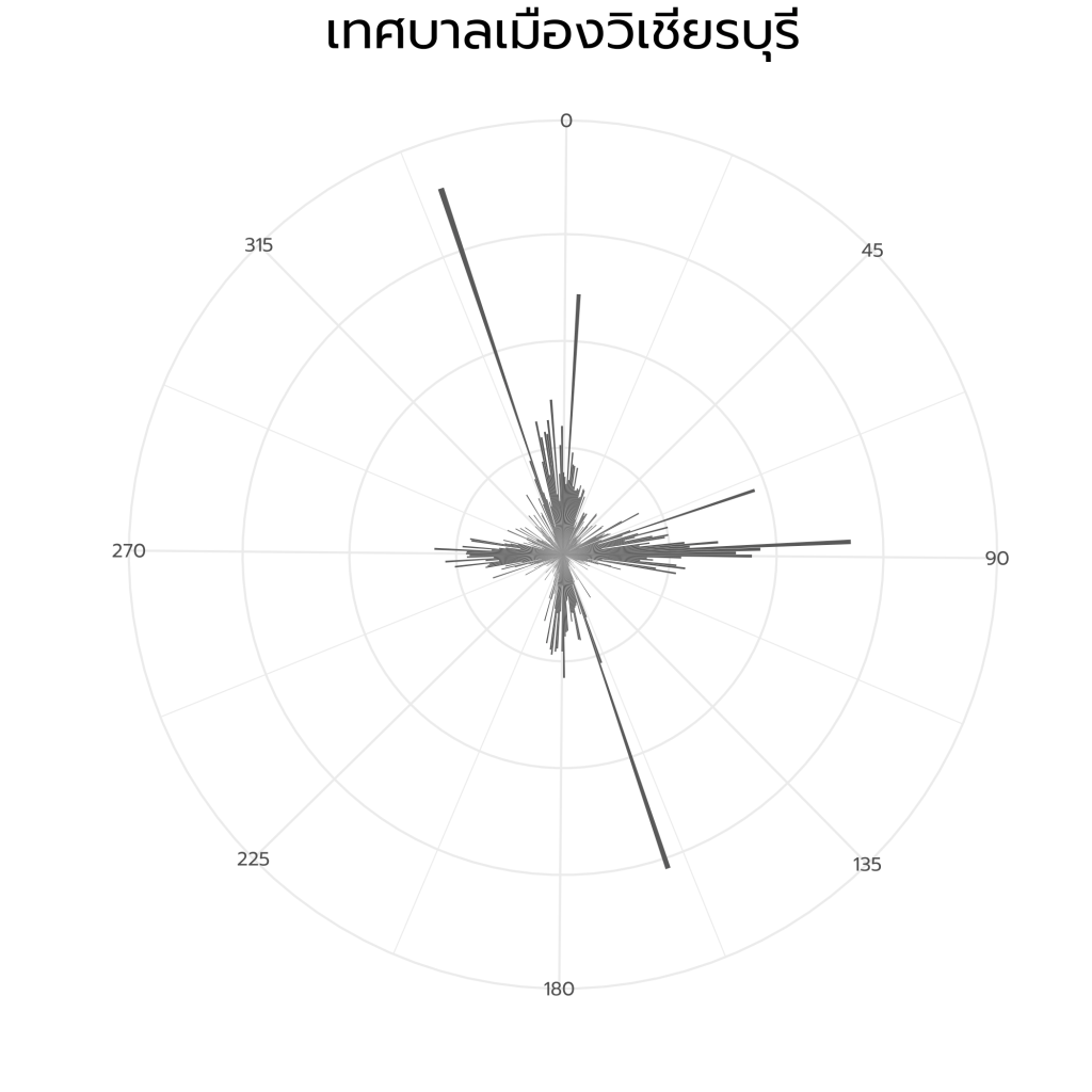
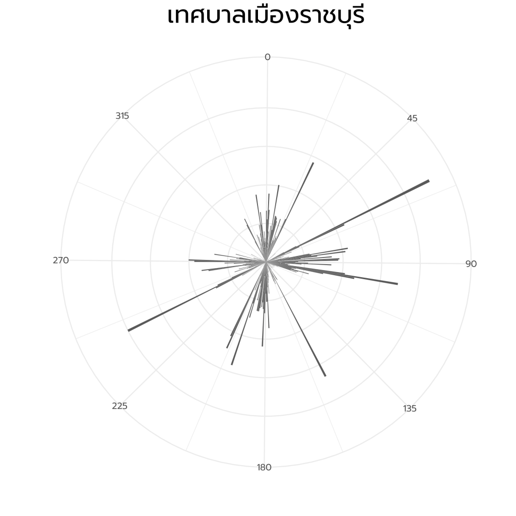
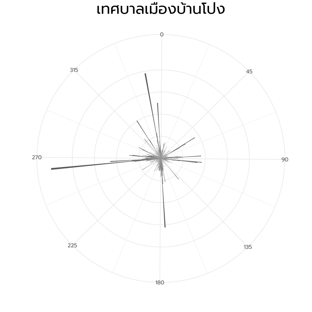
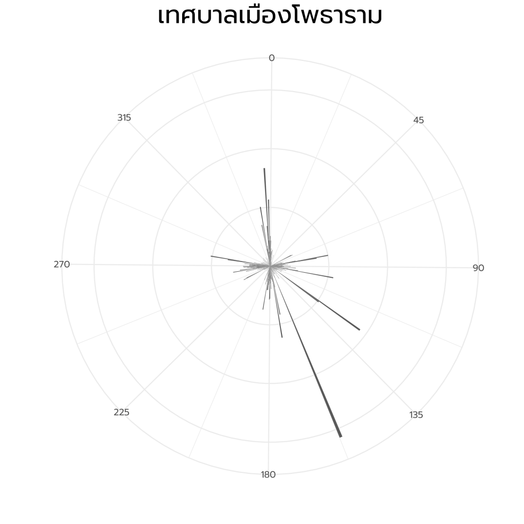
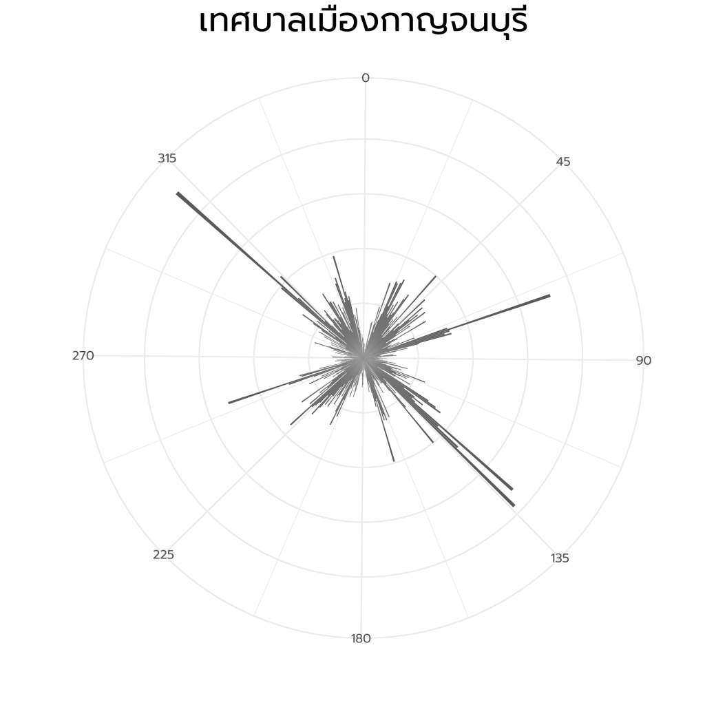
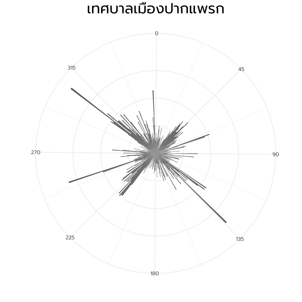
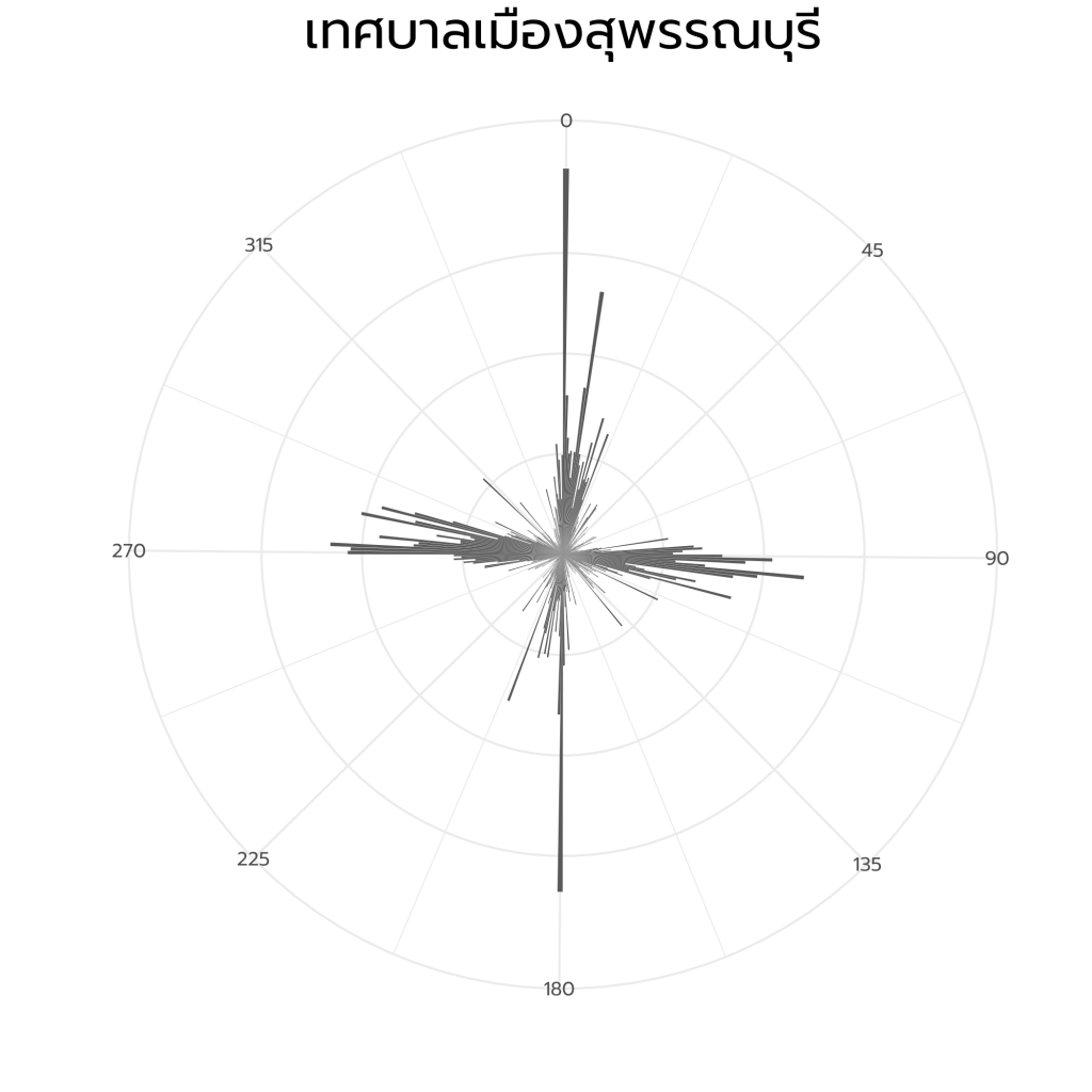
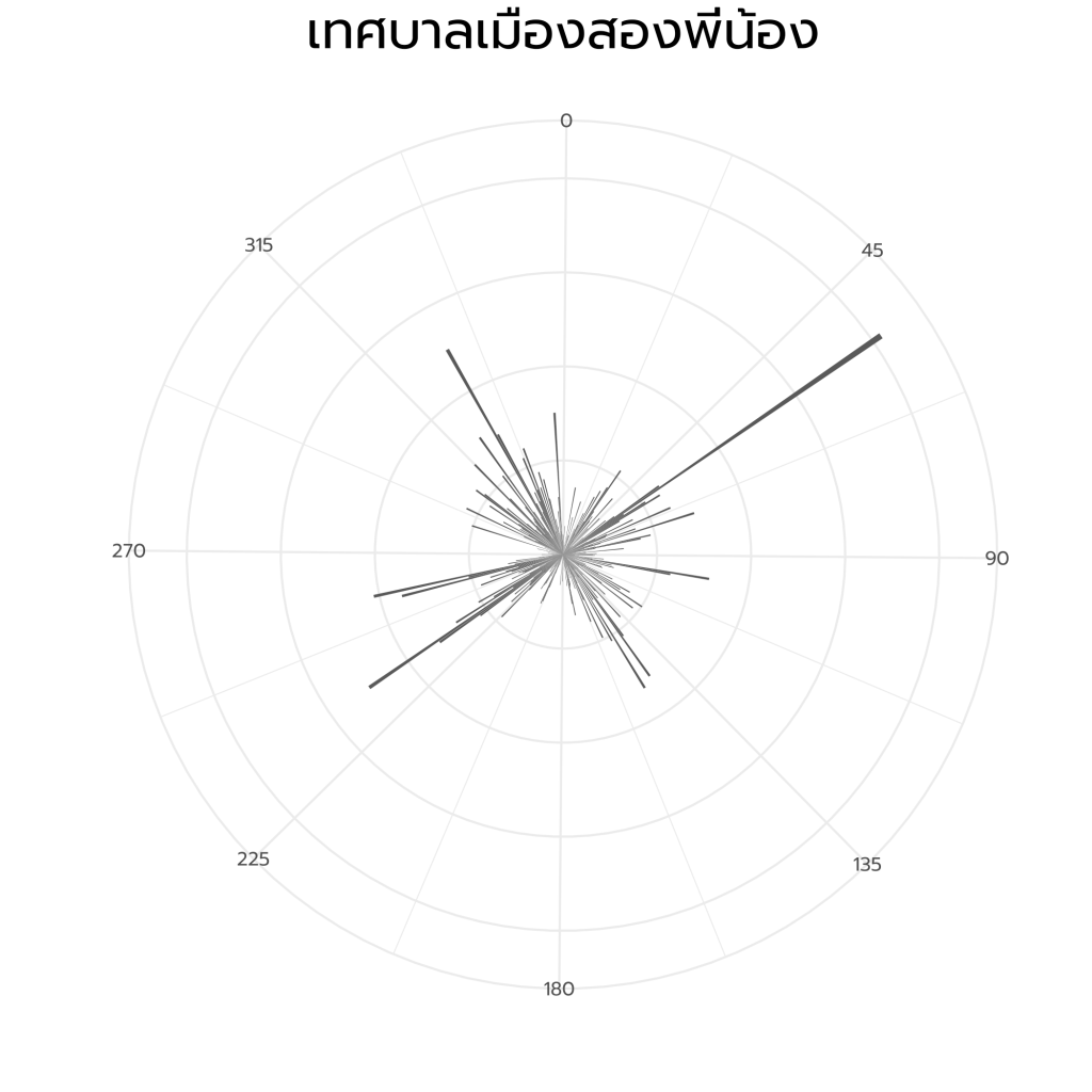
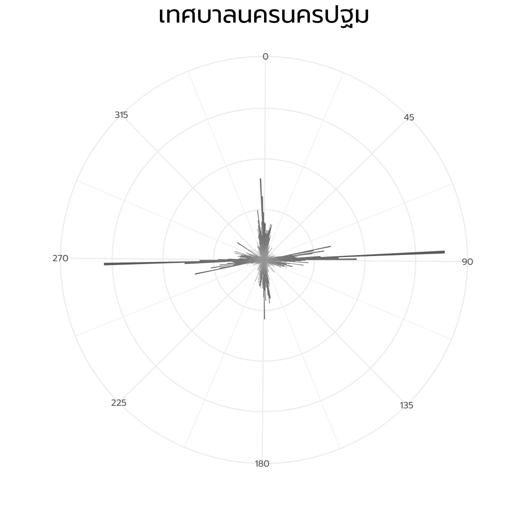
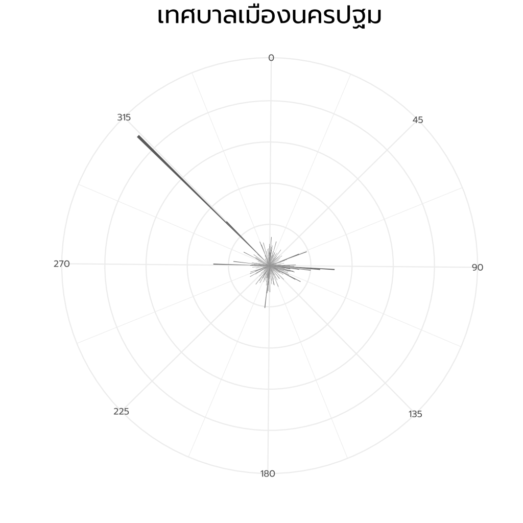
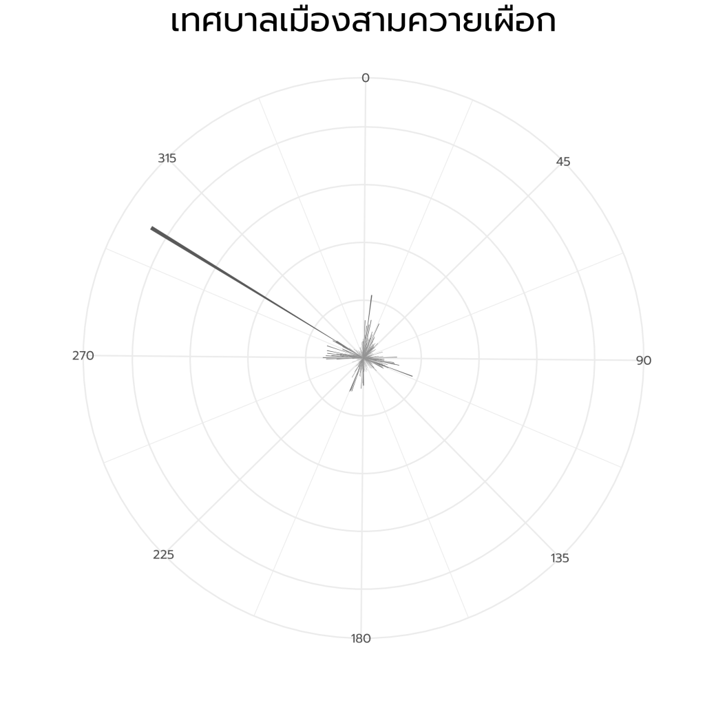
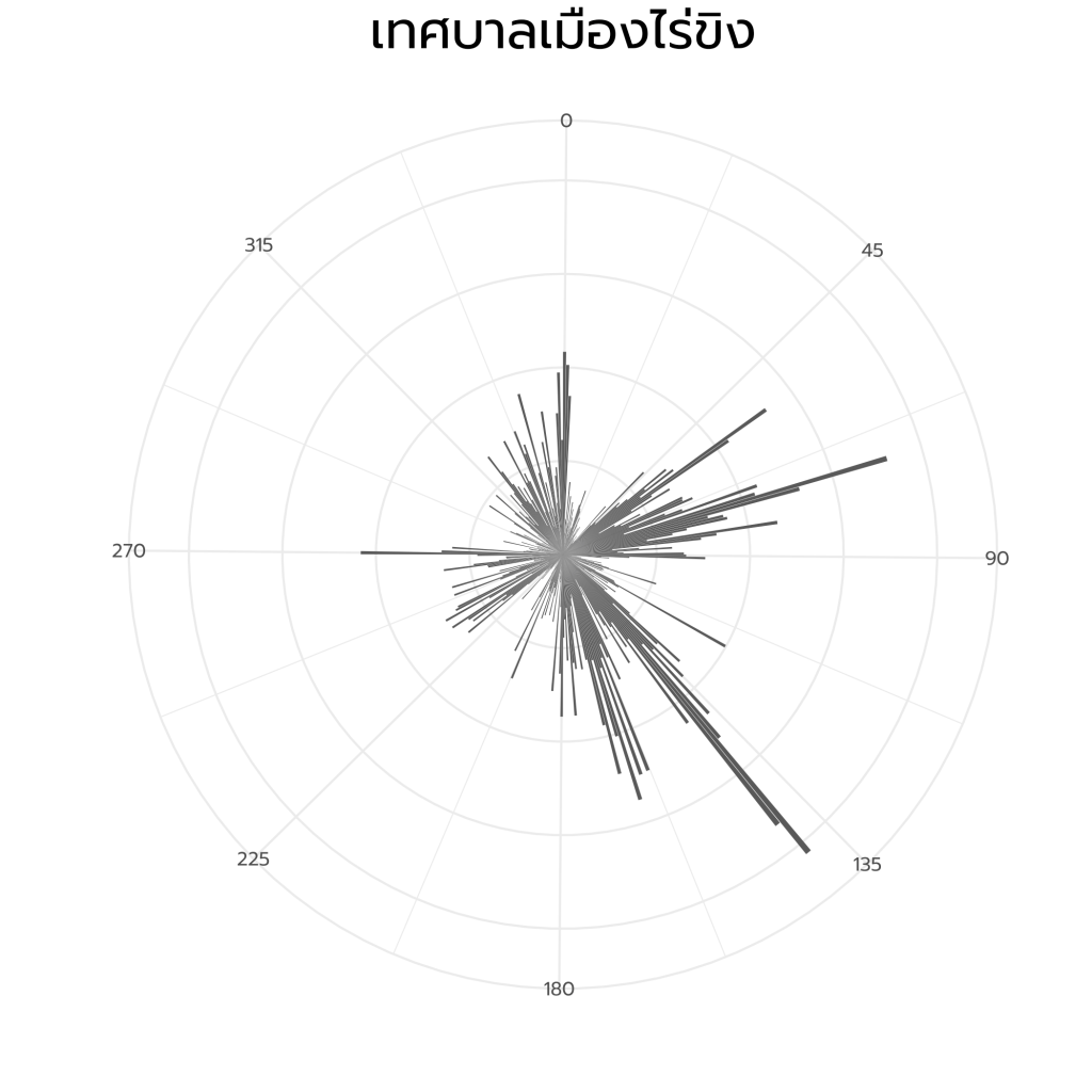
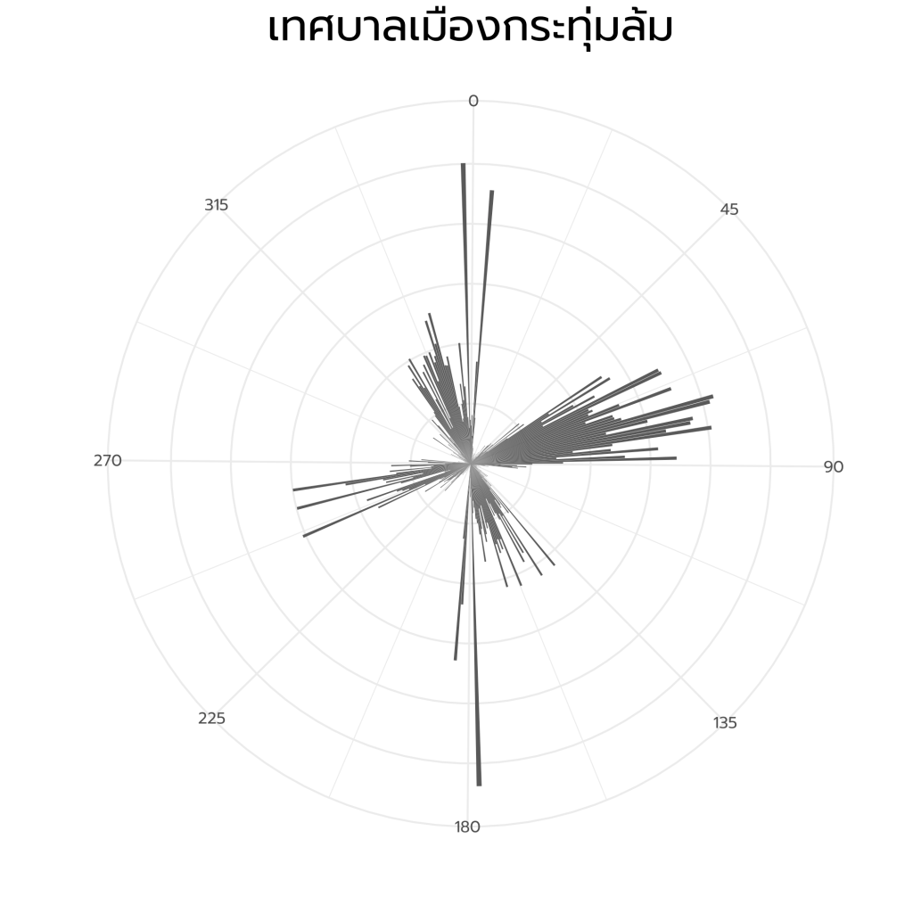
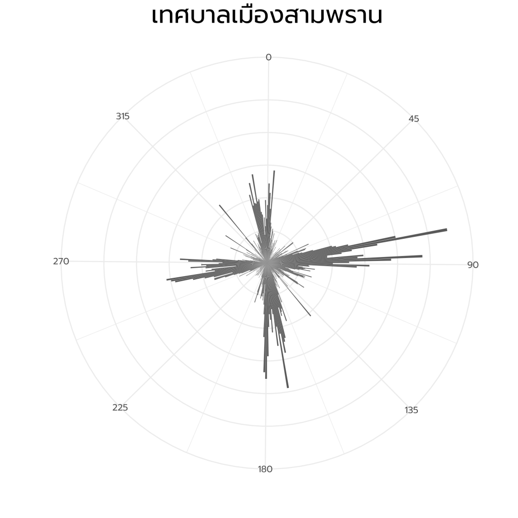
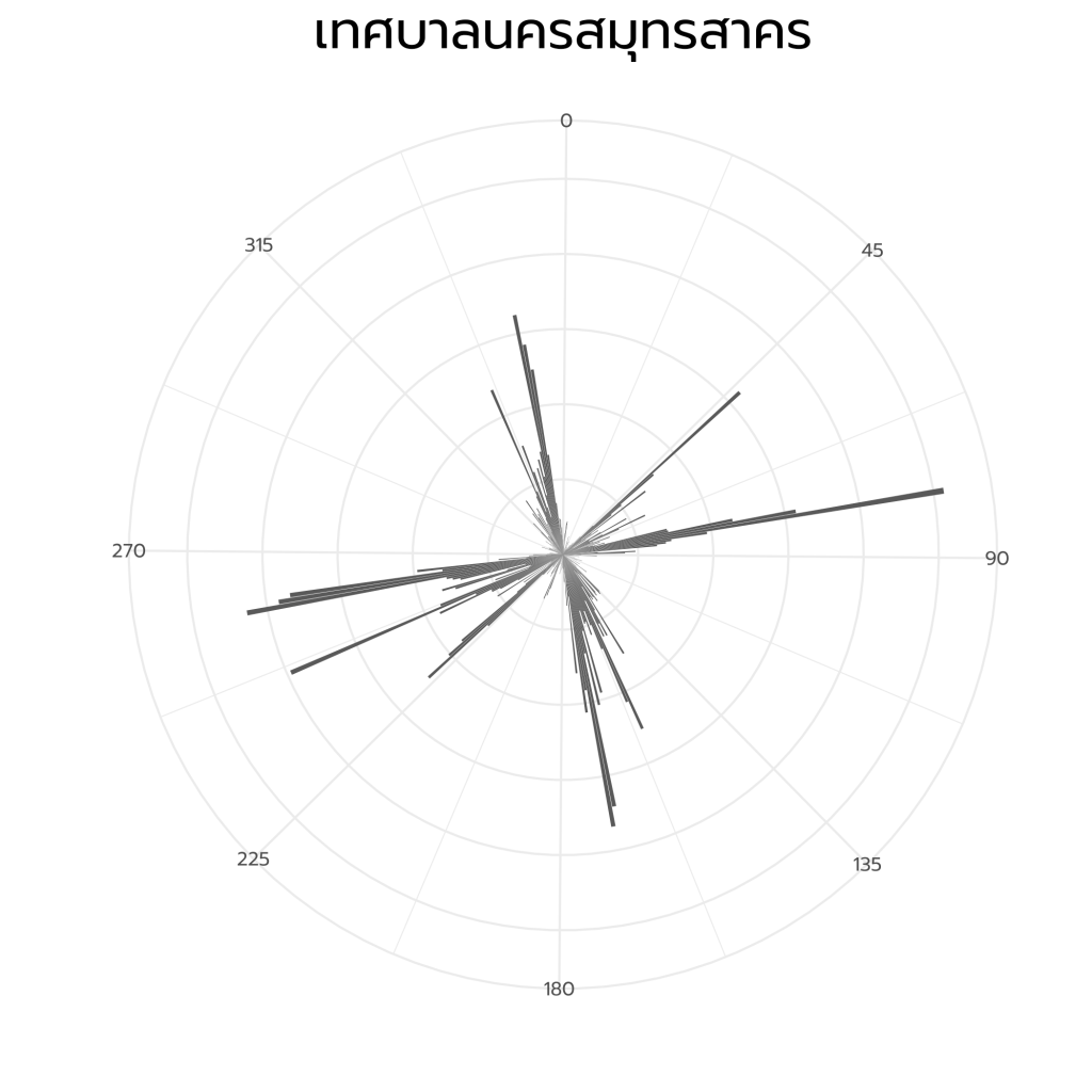
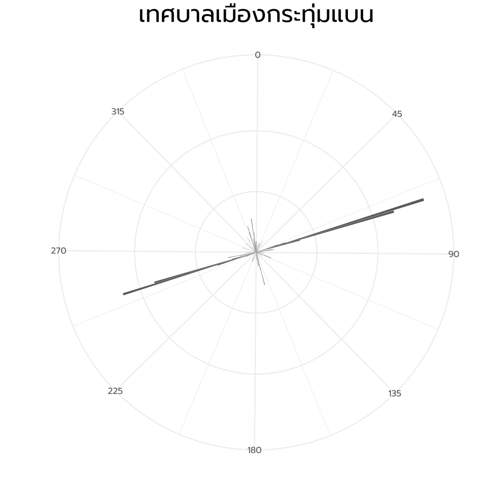
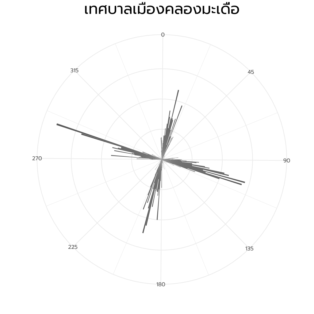
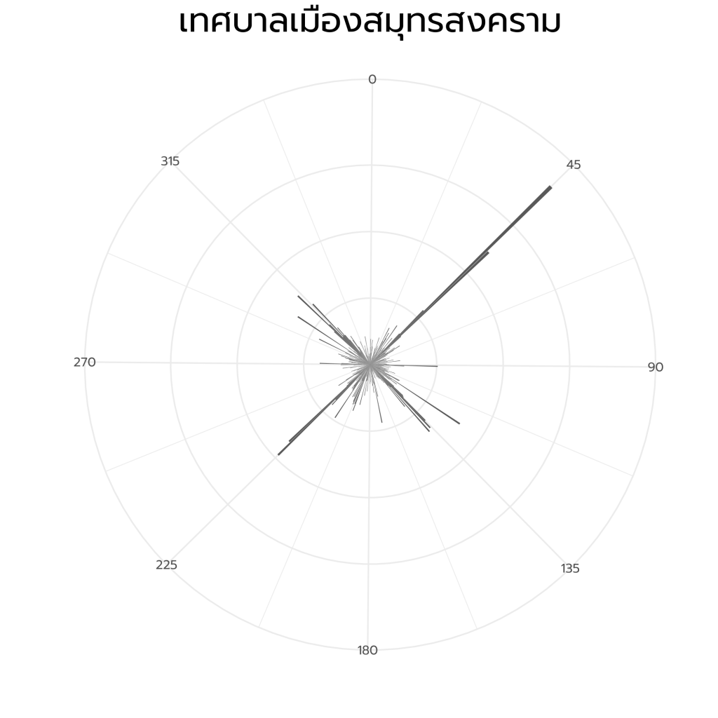
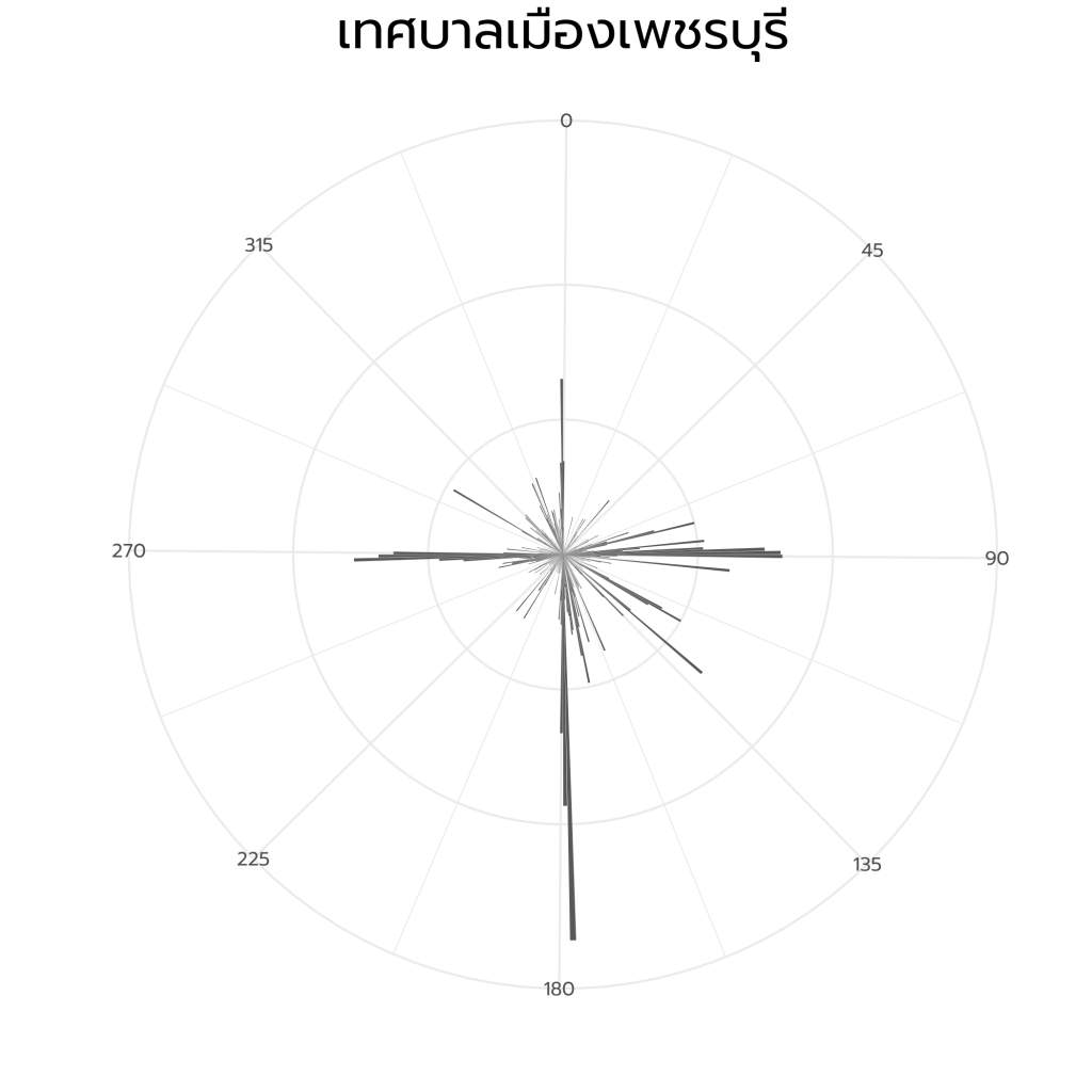
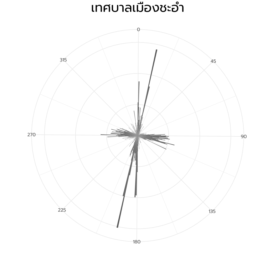
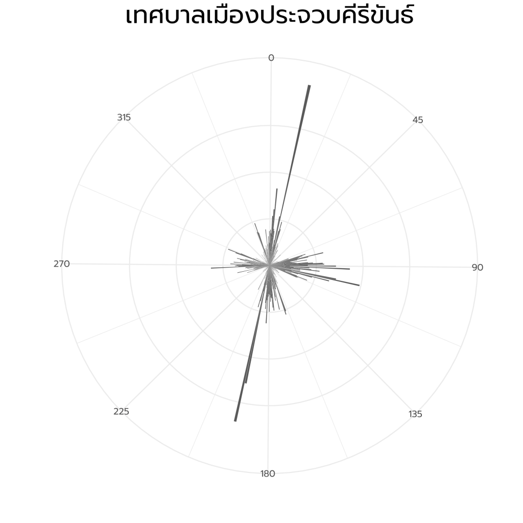
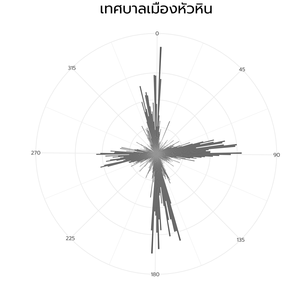
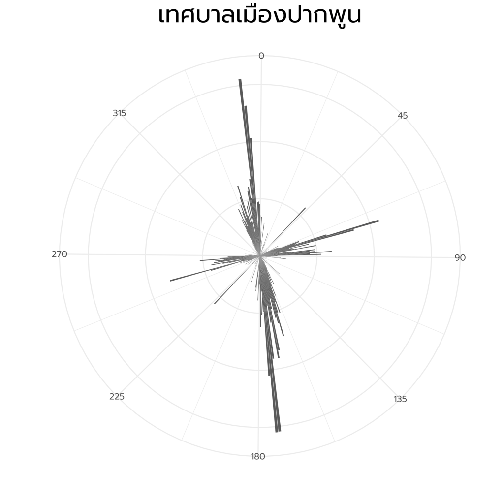
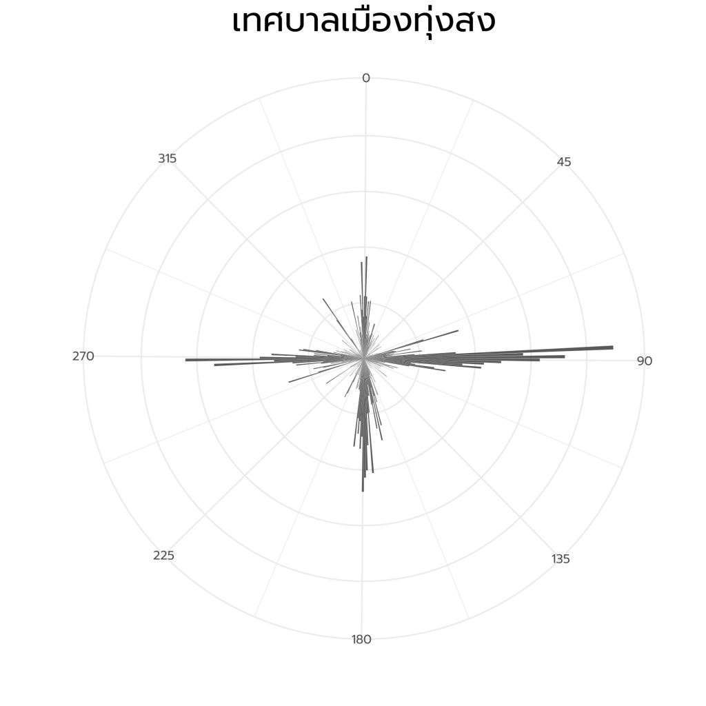
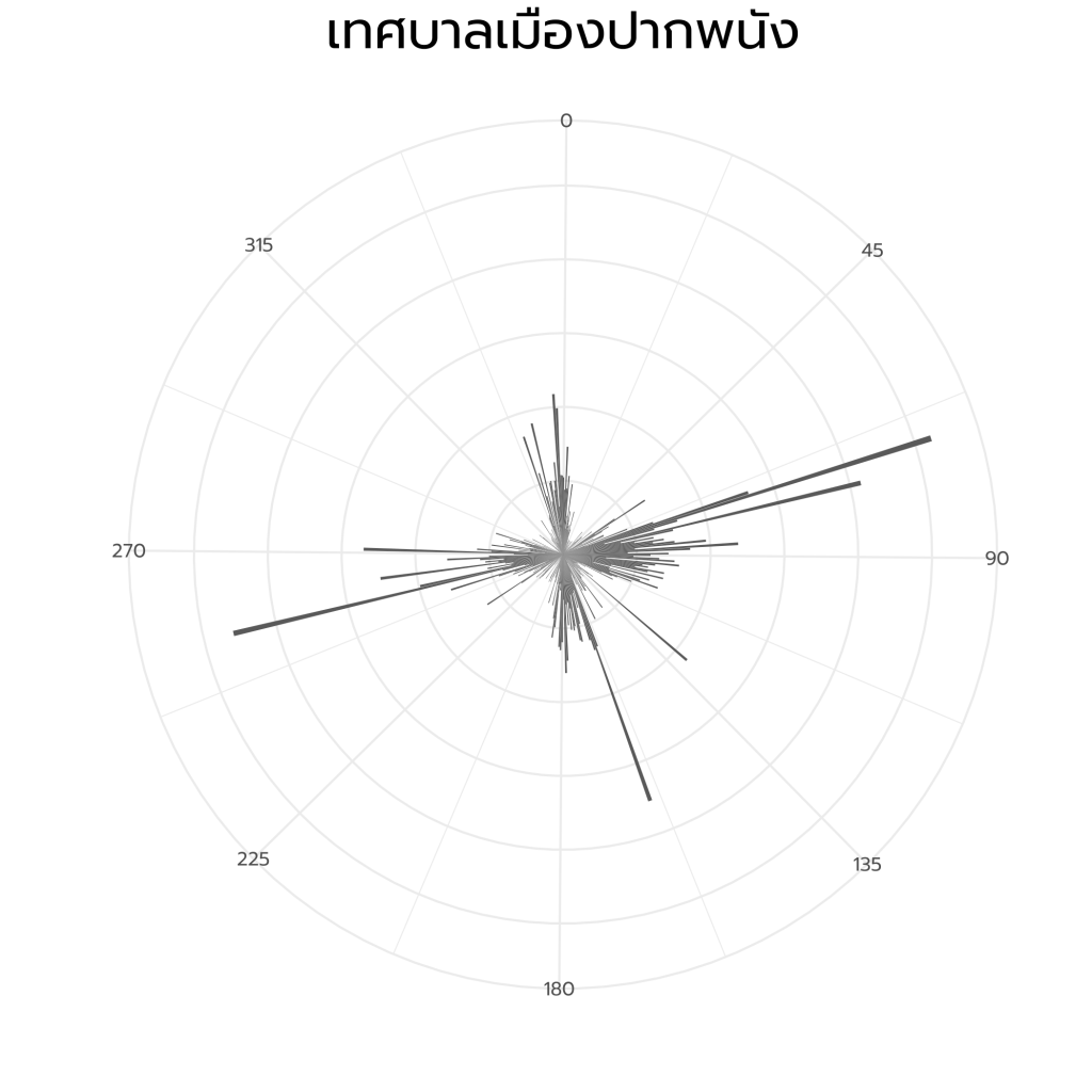
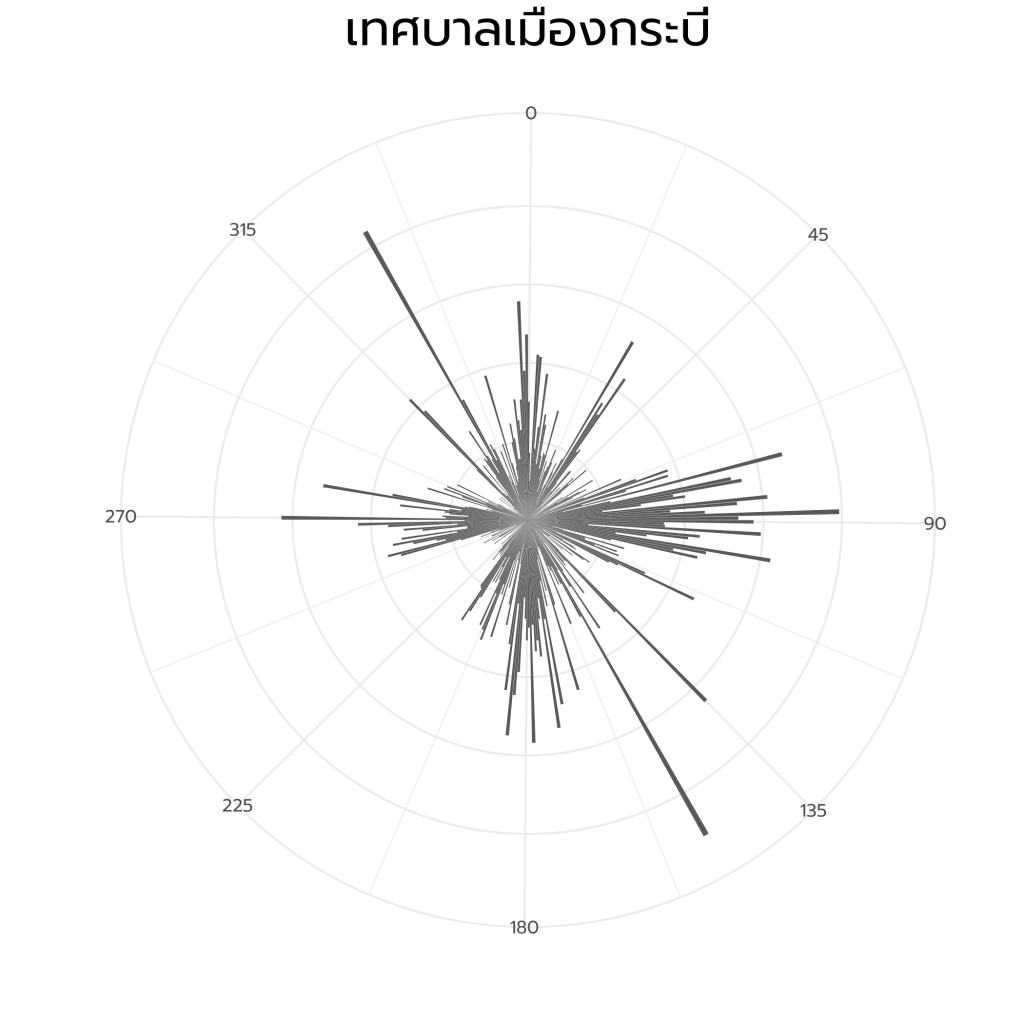
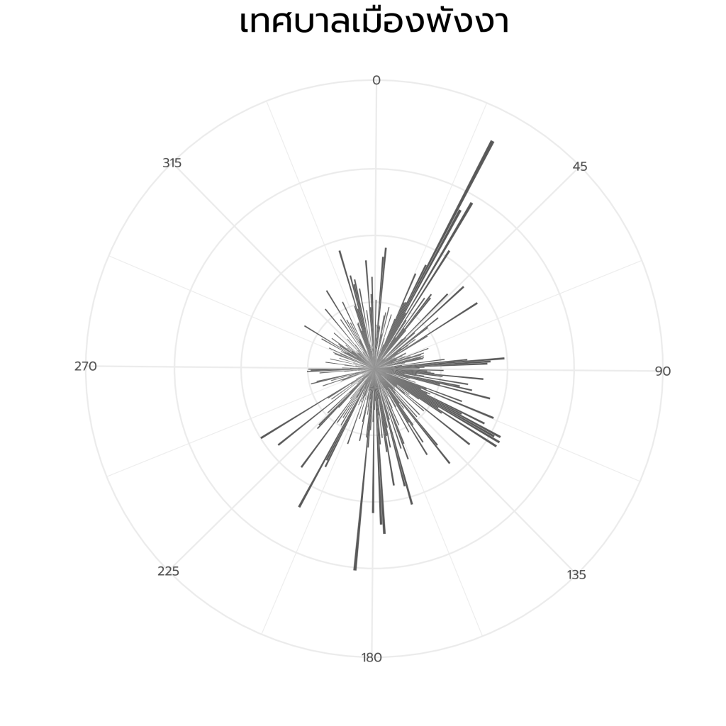
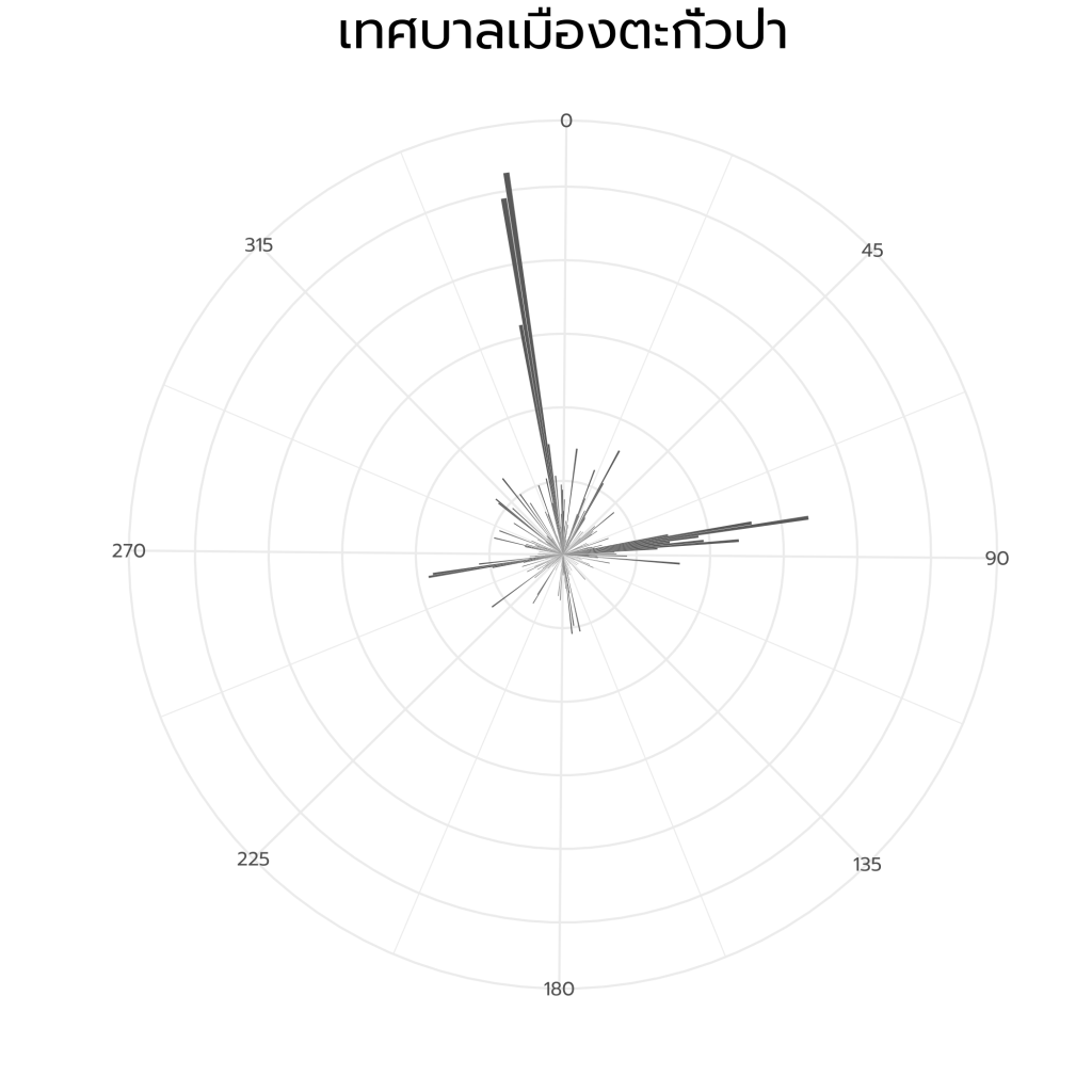
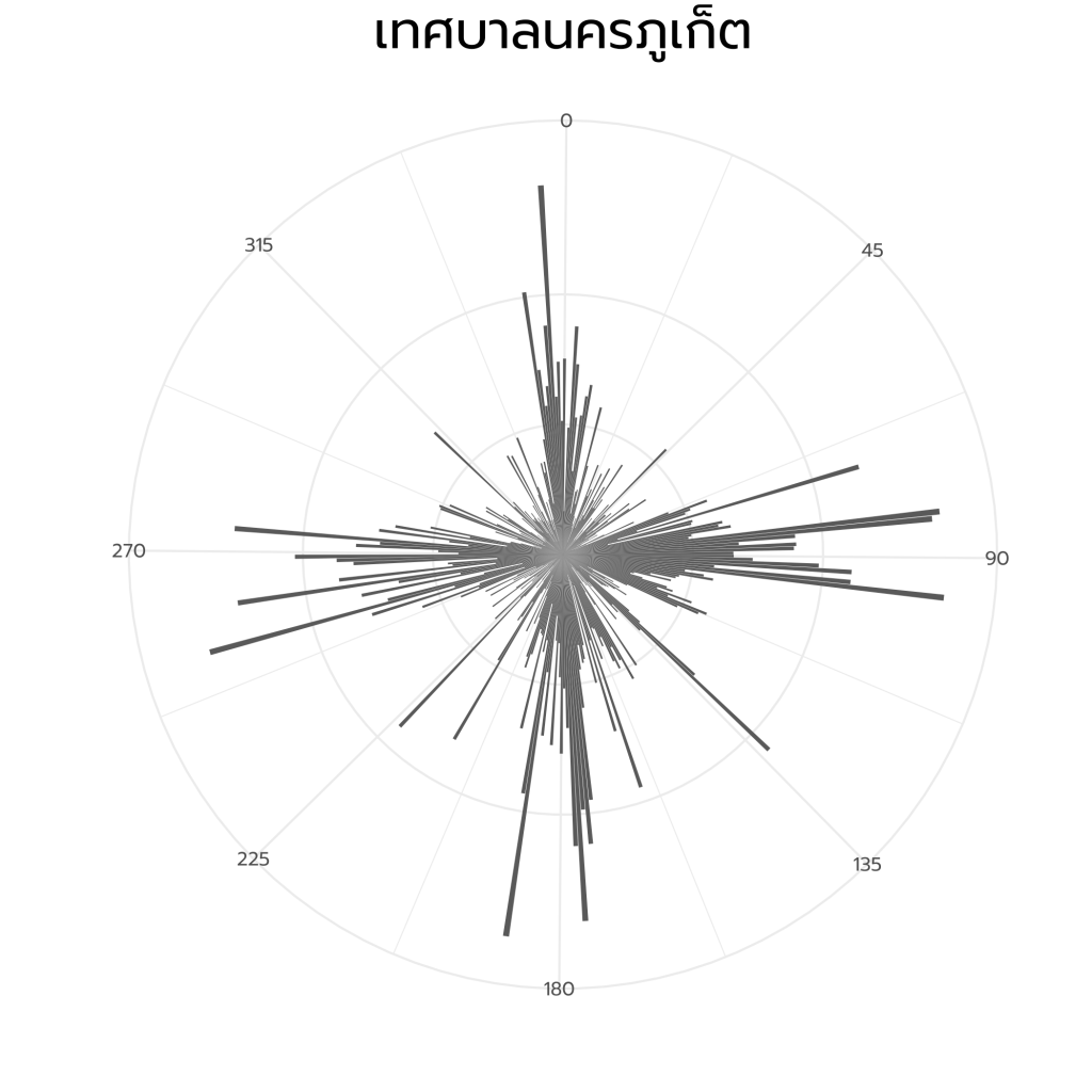
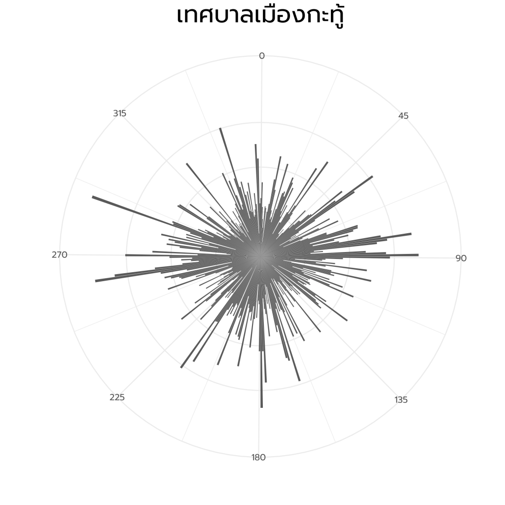
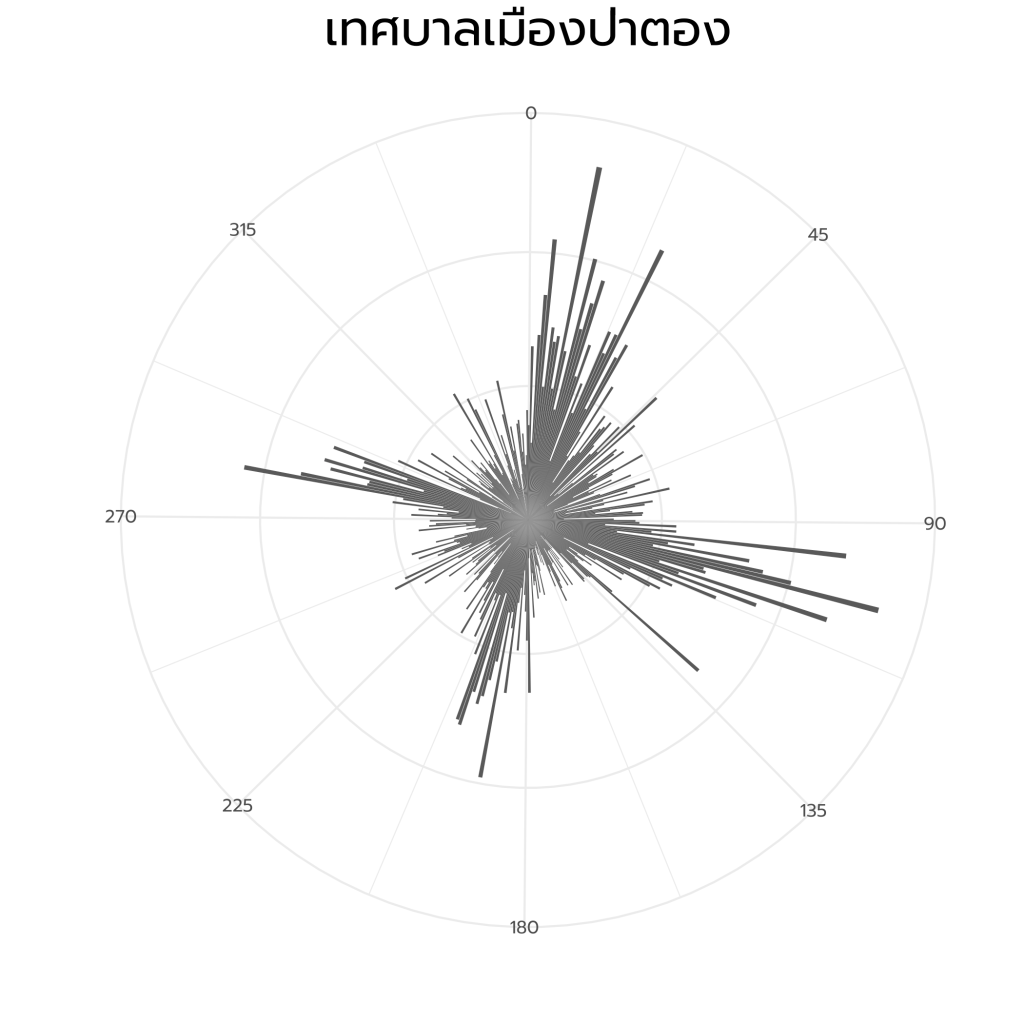
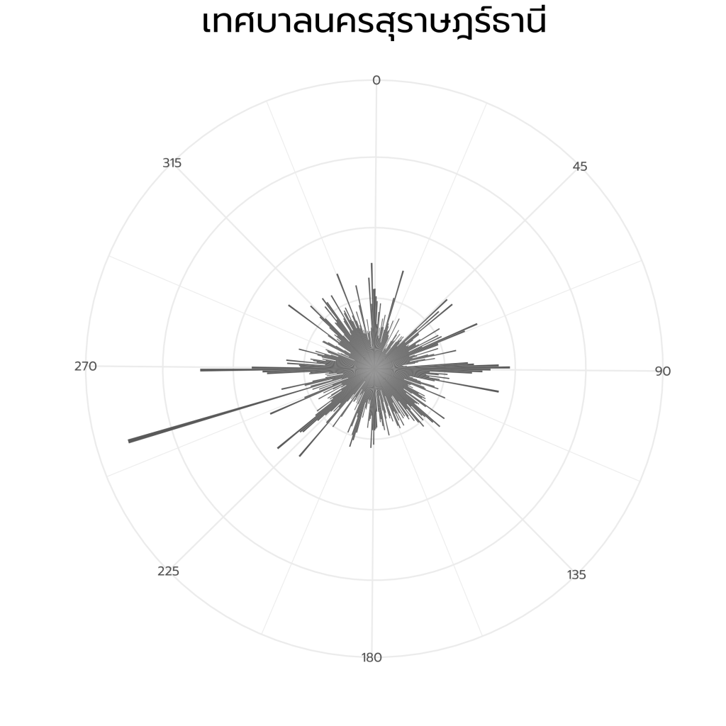
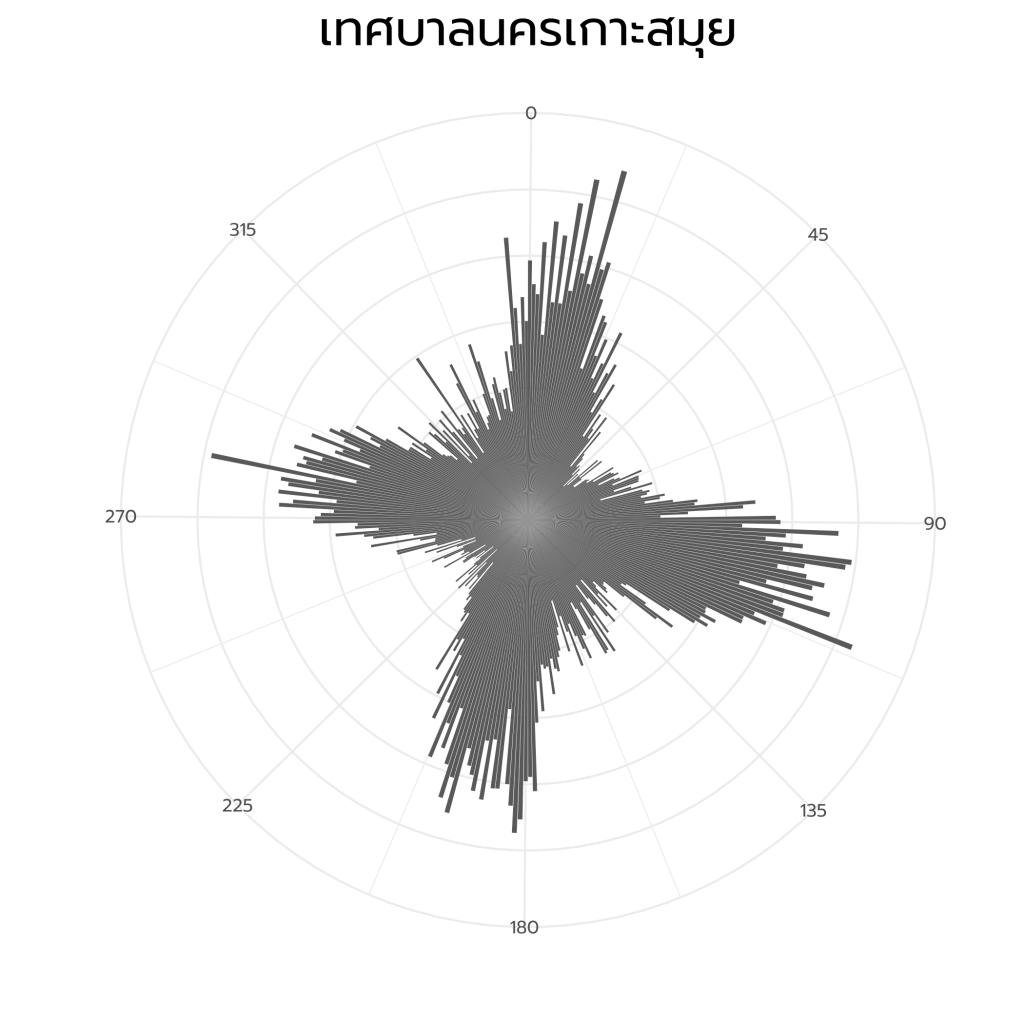
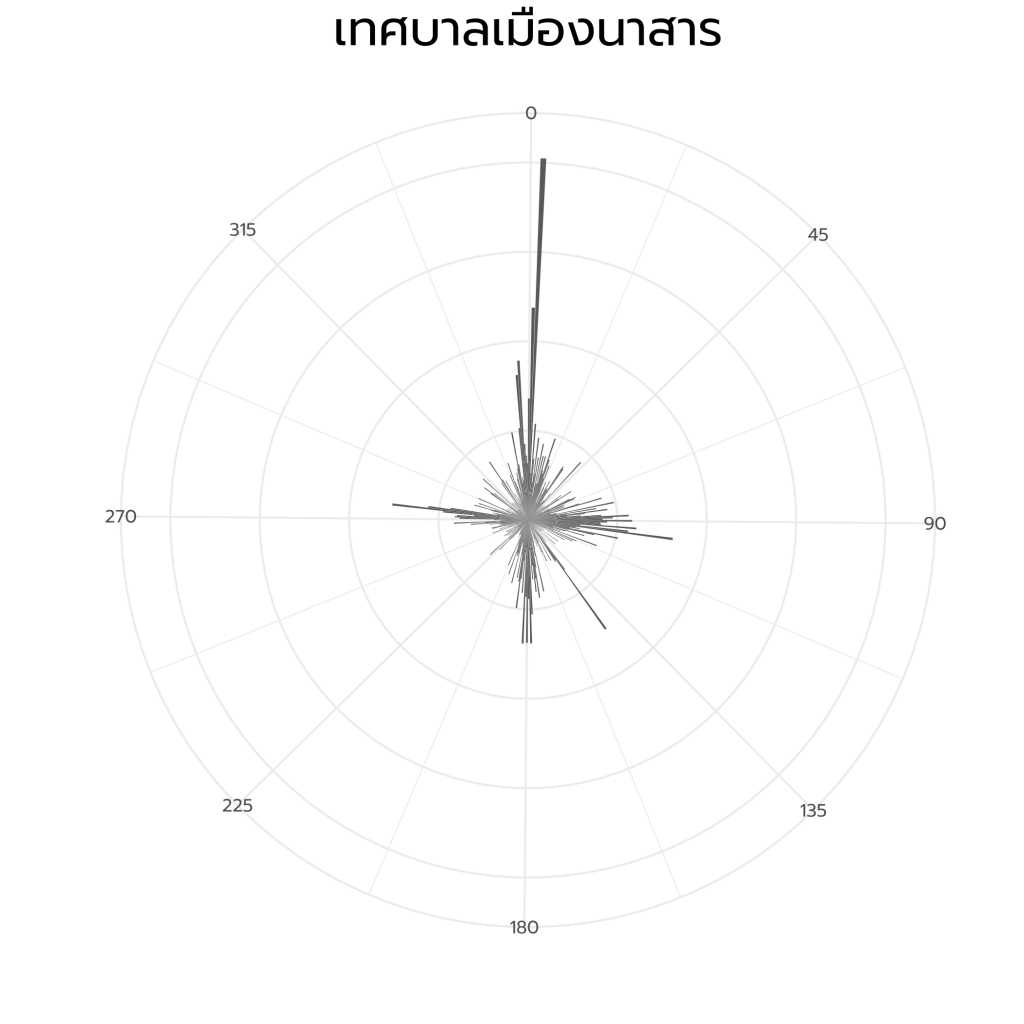
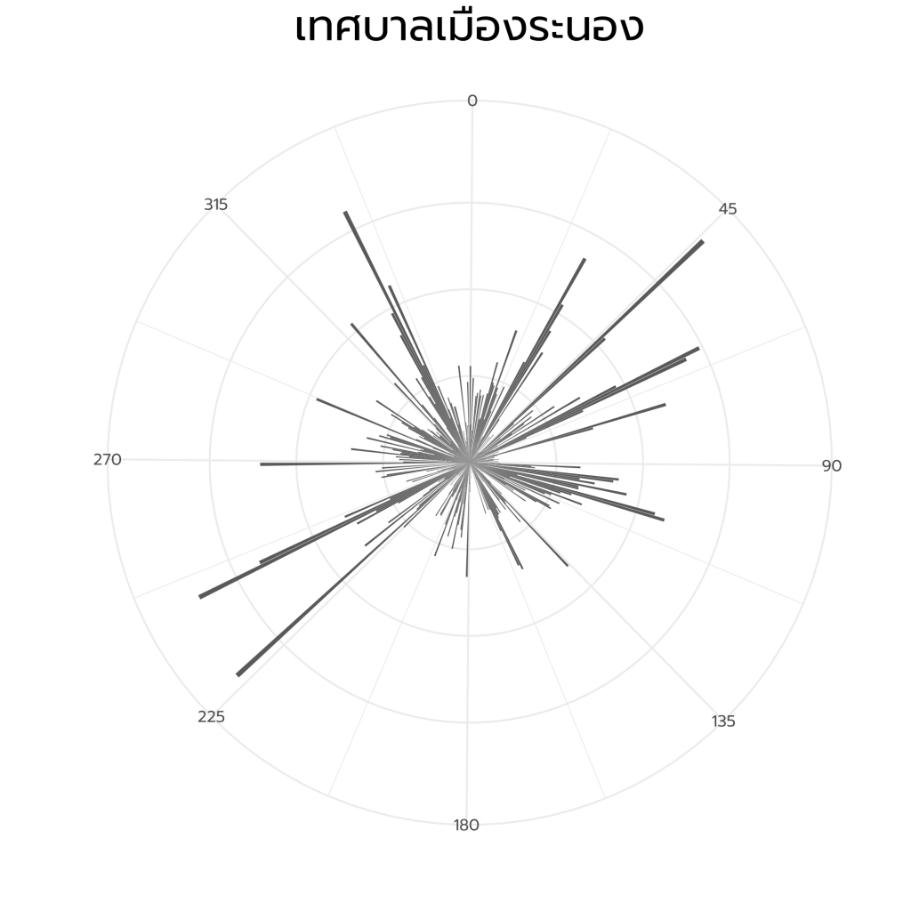
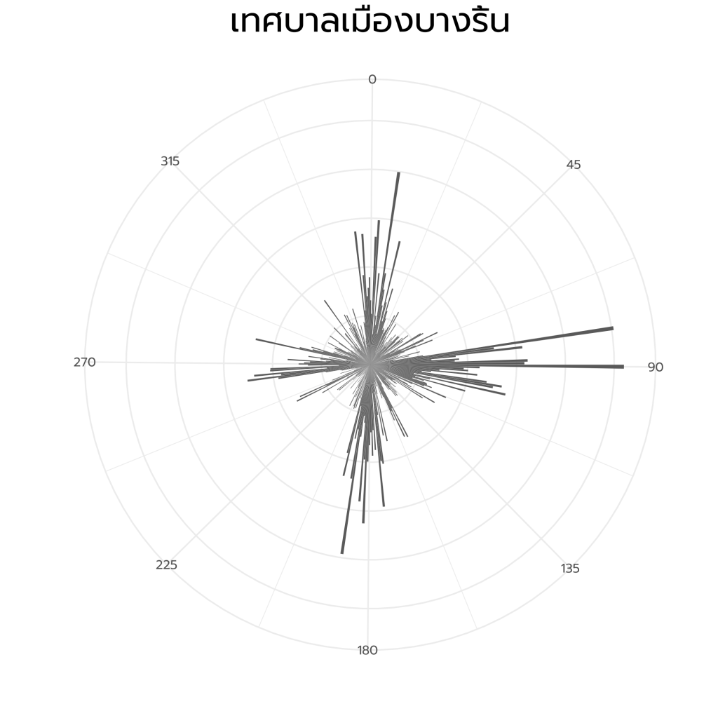
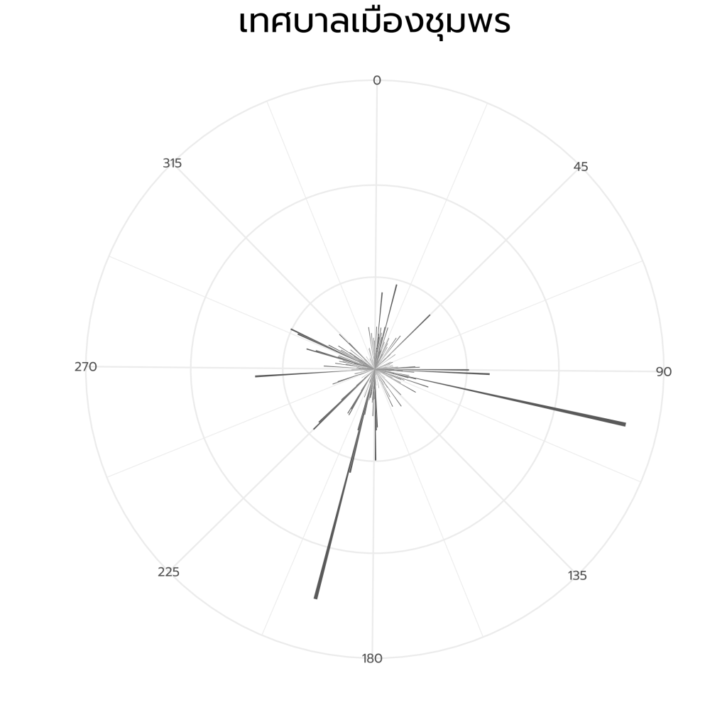
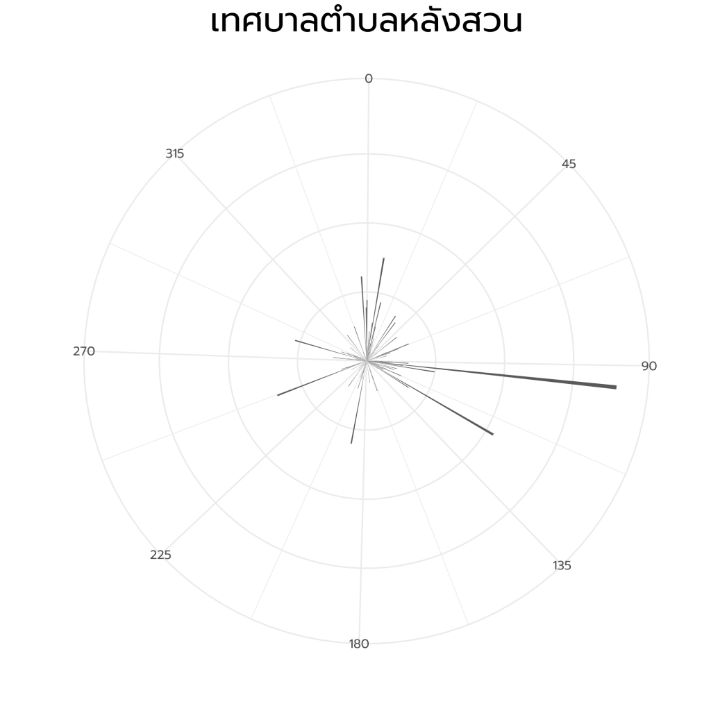
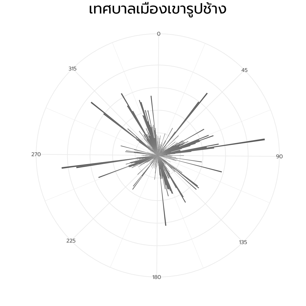
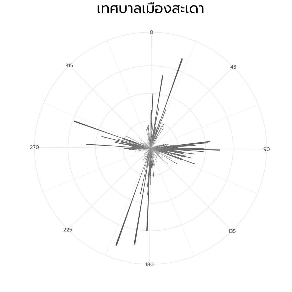
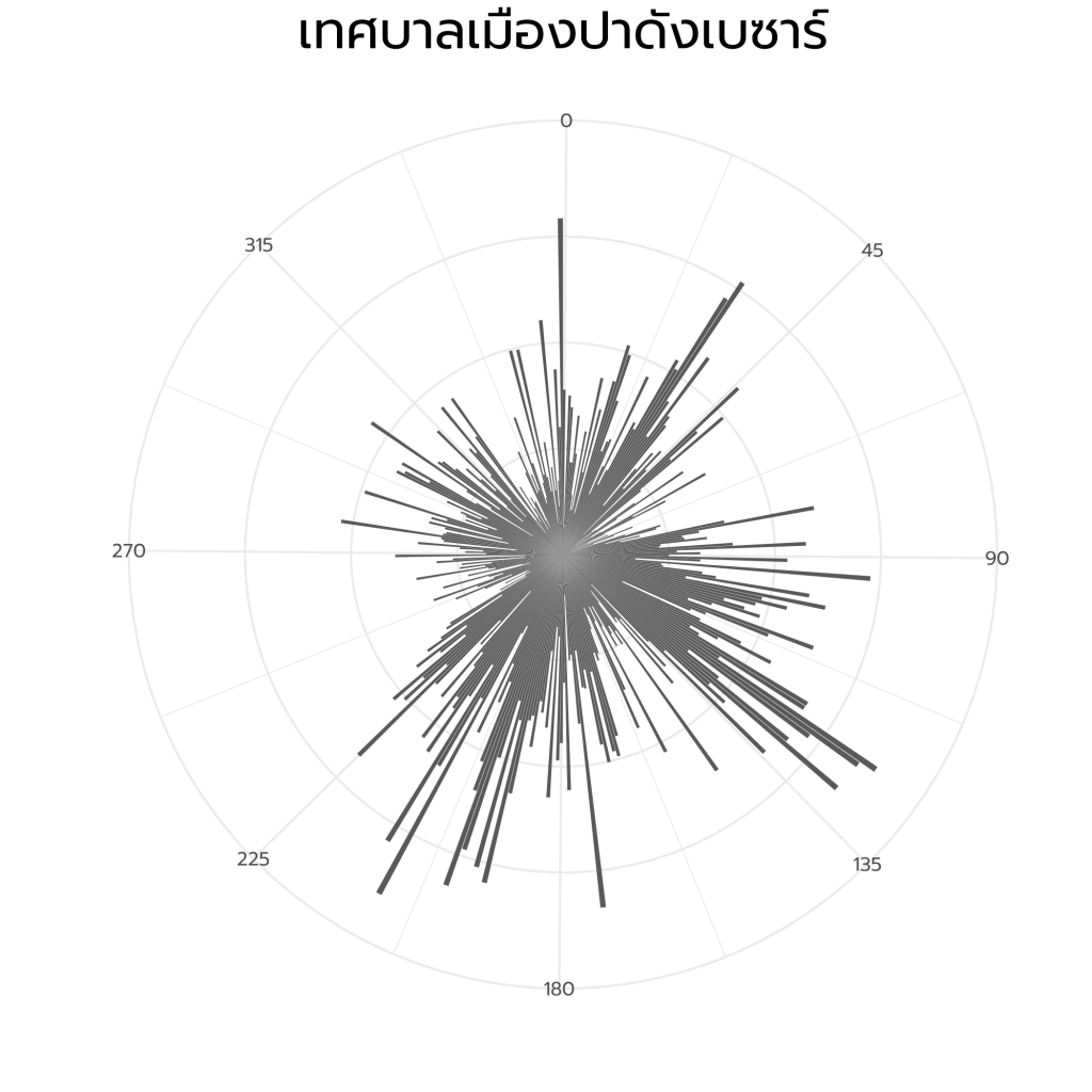
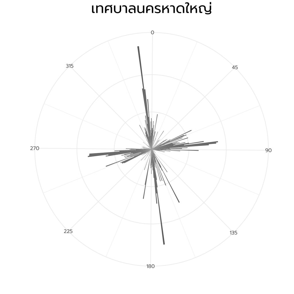
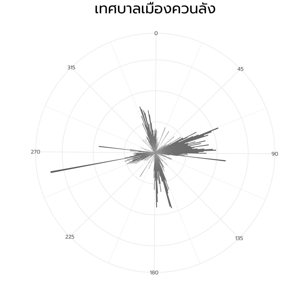
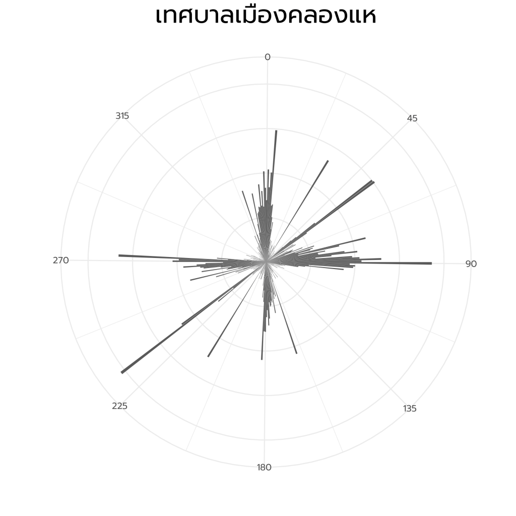
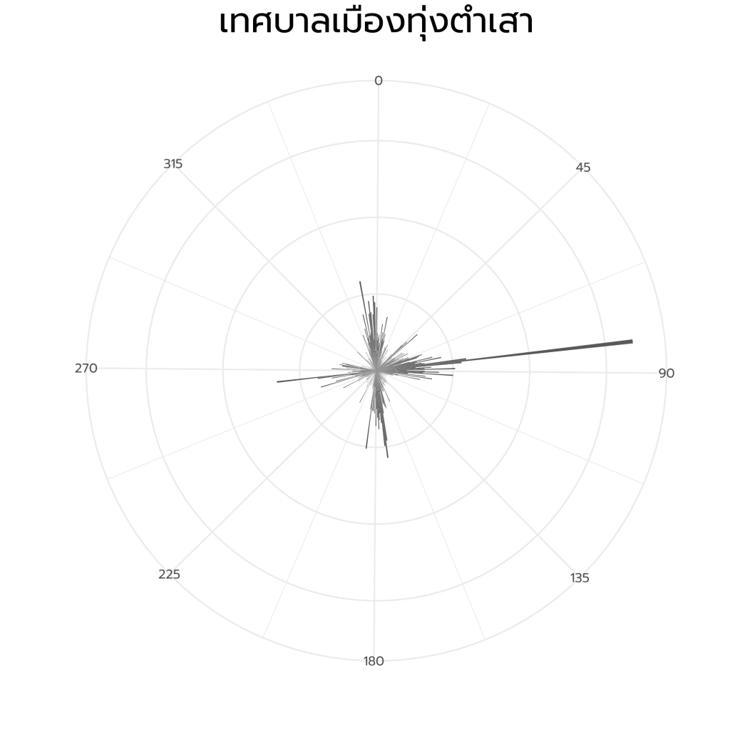
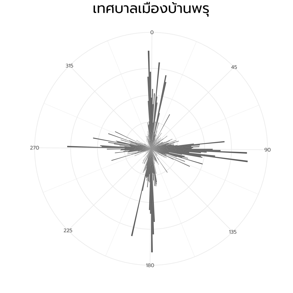
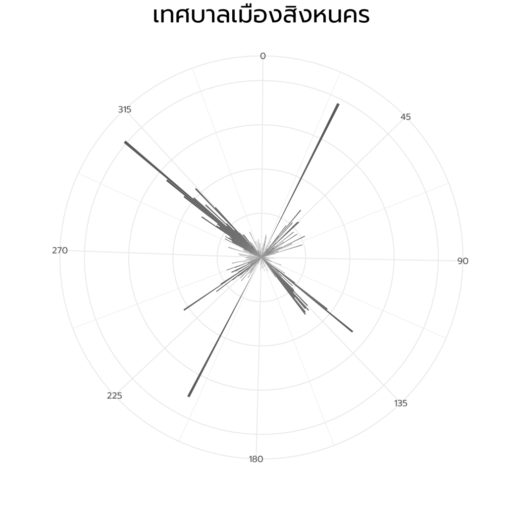
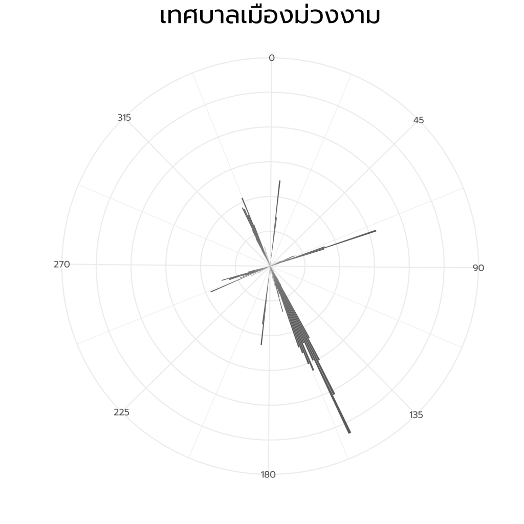
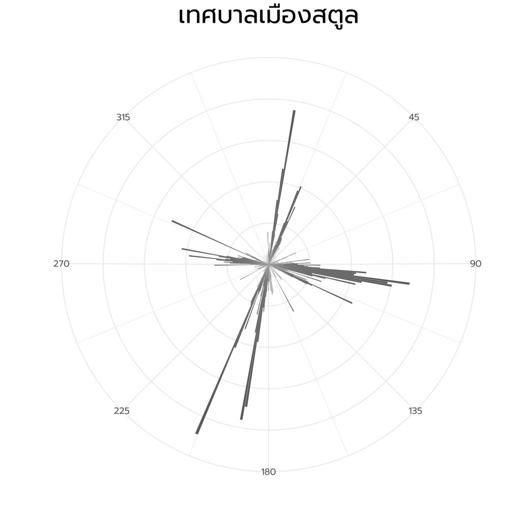
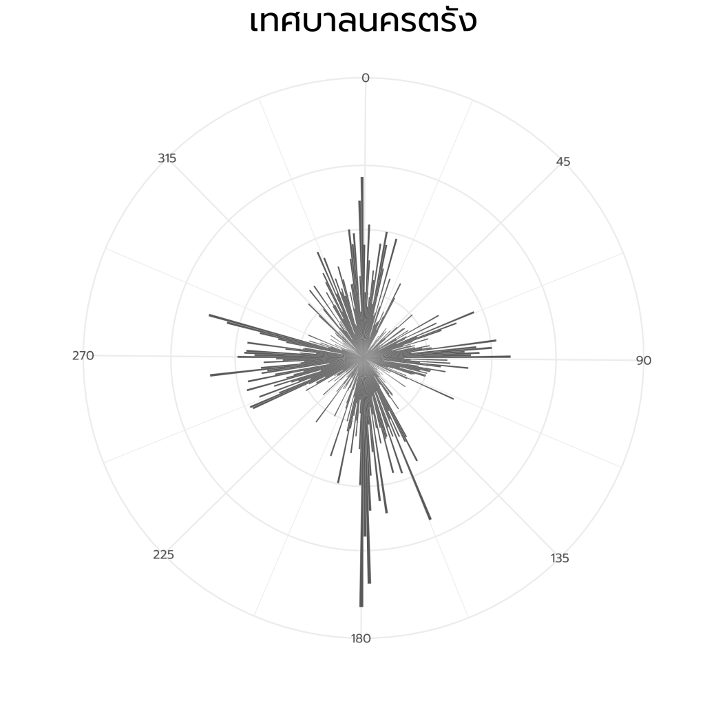
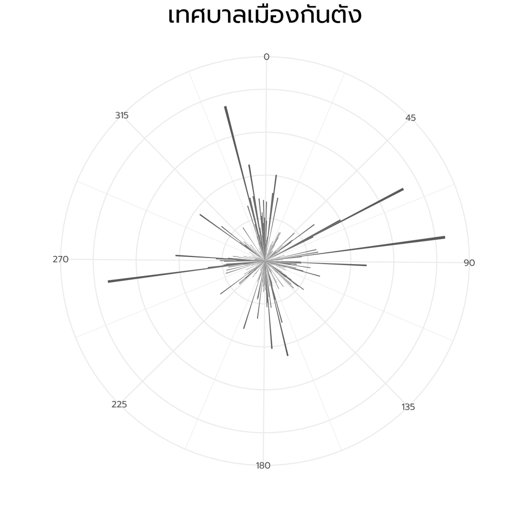
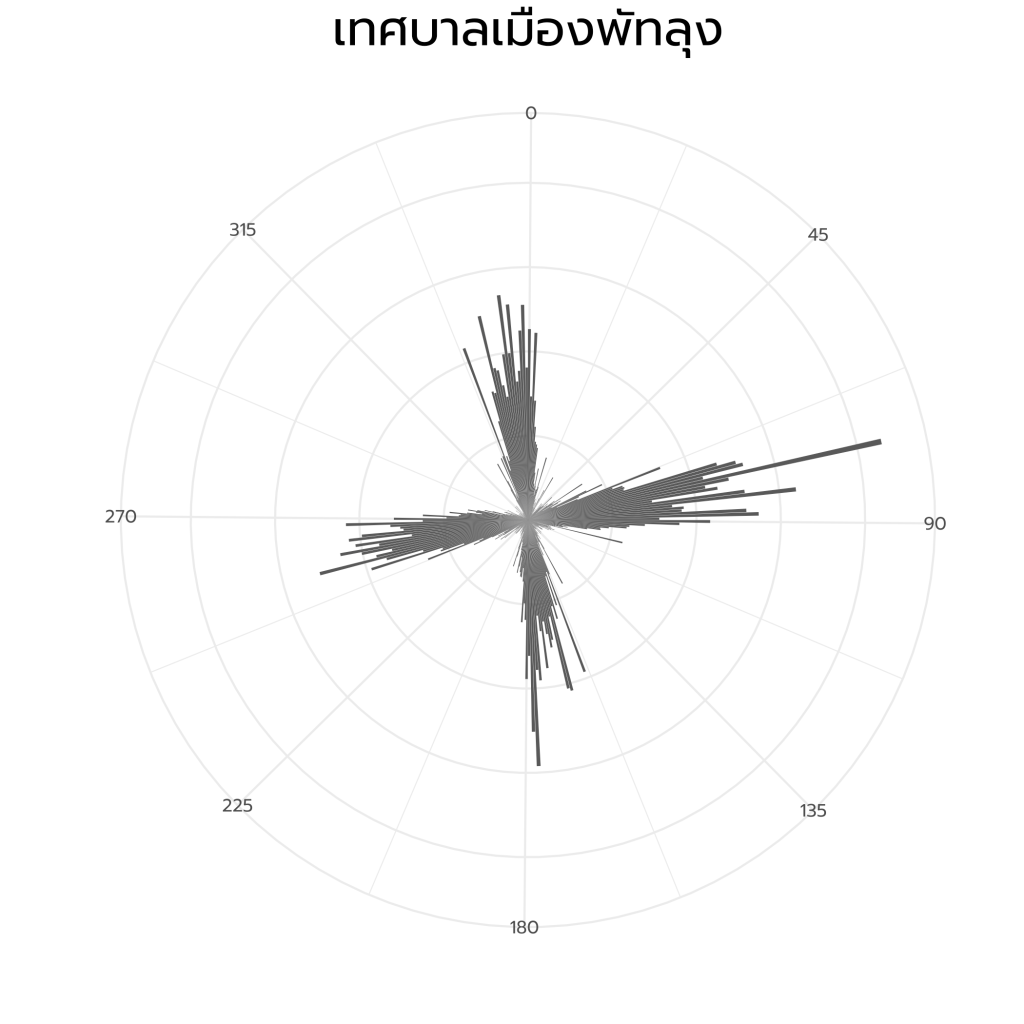
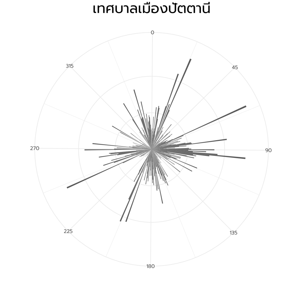
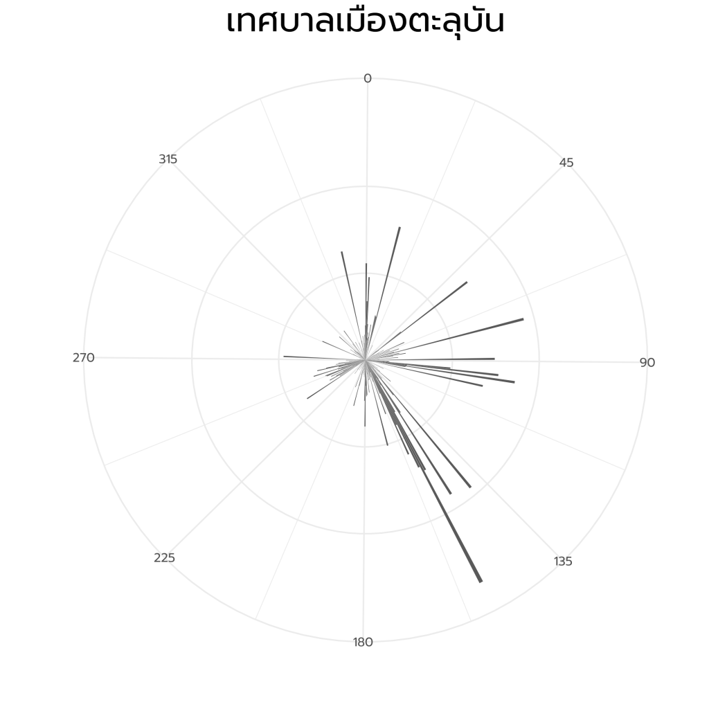
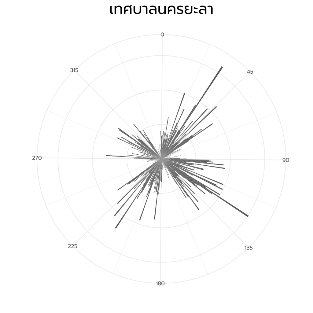
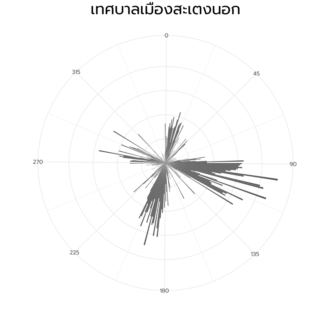
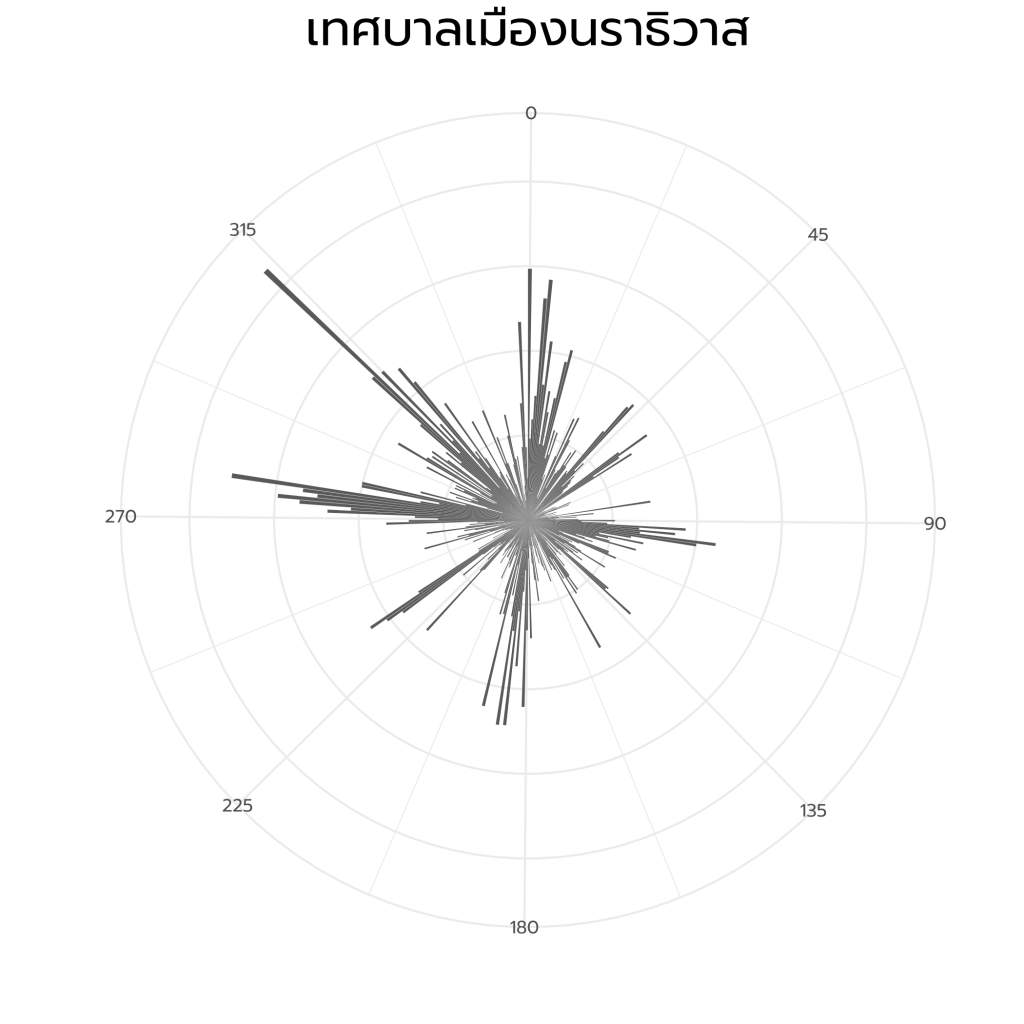
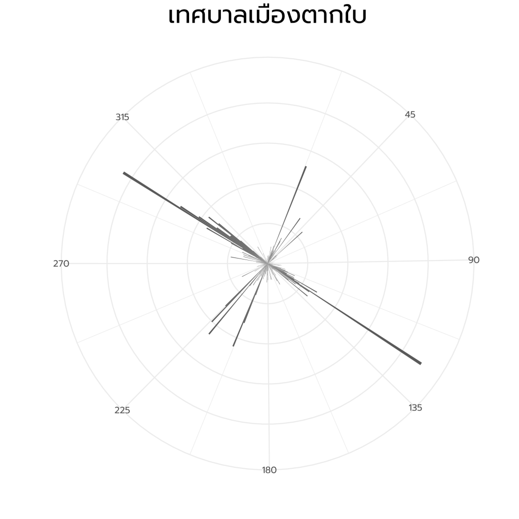
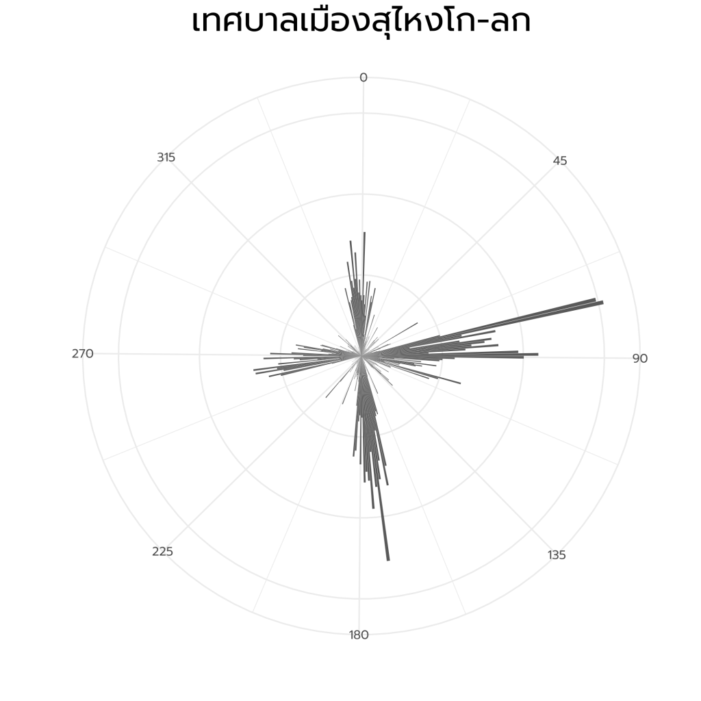
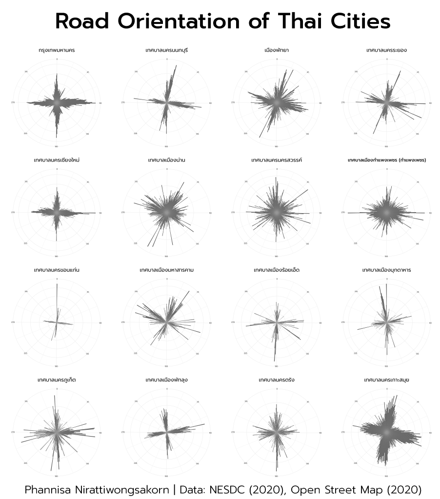
Road Orientation of 220 Thai Cities: Bangkok, Pattaya, Tessaban Nakhon, and Tessaban Mueang in polar histogram format, showing total road length by its azimuth angle (0 – 360 degrees).
Inspiration
I found this article ‘Comparing US City Street Orientations‘ very interesting. It visualizes city street network orientation of 100 cities around the world in polar histogram format. Street networks of major American cities like New York City, Chicago, Minneapolis, and Chicago are very gridded. On the other hand, Berlin, London, Moscow, and Rome have streets laid out in every direction.
Applications
Thus, I want to apply the idea with 220 Thai cities: Bangkok, Pattaya, Tessaban Nakhon, and Tessaban Mueang. The diagrams will help urban planners and transportation planners to have better understandings of city street network orientation.
Technical Methodology
- Clip road networks by Tessaban boundaries
- Explode roads (lines) into vertices.
- Calculate azimuth angle and length of each vertex. Using LINE_BEARING function in ‘Add Geometry Attributes’ (ArcGIS), or Degree and Azimuth expressions (QGIS)
- Export the attribute table as CSV and Visualize using R
Data Sources
Tessaban shapefile (Office of the National Economic and Social Development Council of Thailand, 2020), Open Street Map (2020)
Other Cities