Phannisa Nirattiwongsakorn
Thai: พรรณิสา นิรัตติวงศกรณ์. A licensed architect (B. Arch, Chulalongkorn University, 2007 – 2012, Fellow Architect No. 16124) and an urban planner (M.S., University of Wisconsin – Madison, 2015 – 2017), with a focus on architecture, sustainable urban planning, and spatial statistics. I am currently a National Programme Officer at UN-Habitat Bangkok Programme Office. Please see Linkedin.
Architecture
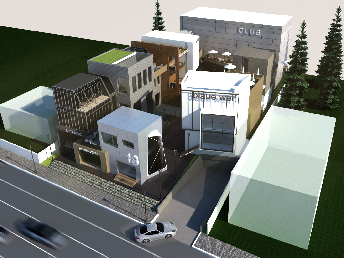
Having 3 years of experience as a design architect at Four Aces Consultants Co., Ltd. (Bangkok, Thailand), I have handled a wide range of building designs including houses, offices, hotels & resorts, shopping malls, and etc. My design concept is clean and functional with a little bit of gritty/wabi-sabi elements. My favorite styles are contemporary Thai, and Tuscany. In terms of technology, I use AutoCAD, SketchUP, Vray for SketchUp, and hand sketching.


Sustainable Urban Planning
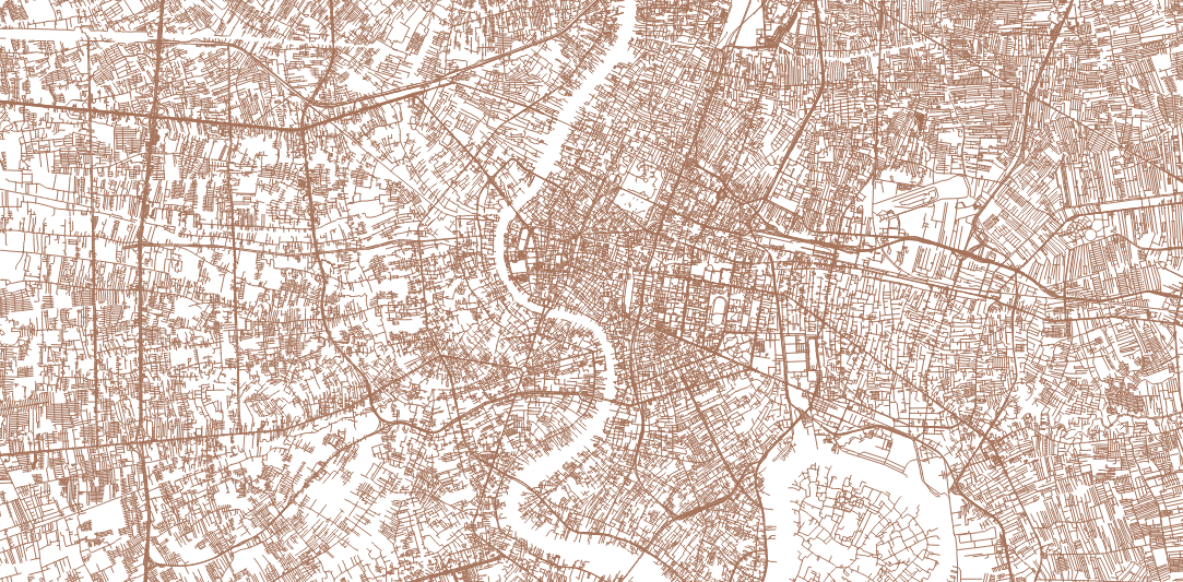
Earned a Master’s degree in urban and regional planning, with an environmental planning focus, from the University of Wisconsin – Madison (2015 – 2017). I worked as a plan and policy analyst at NESDC for 4 years (2017 – 2021), on urban and environmental policies. I supported the preparation and the draft Master Plan under the National Strategy on Smart Livable Cities (enacted in 2019). Its goals are to create, develop, and revitalize Thai cities to be liveable, inclusive, and technology-driven for national competitiveness, inequality reduction, and sustainable growth promotion. I have also supported the preparation of Thailand’s SDG Progress Report: 2016 – 2020, specifically on SDG 11: Make cities inclusive, safe, resilient and sustainable. The report includes spatial analyses on city-related issues such as the share of public space, accessibility to public transportation, and urban pollution. I use satellite imagery and open urban data to monitor the progress of sustainable urban development in Thailand.

Spatial Statistics
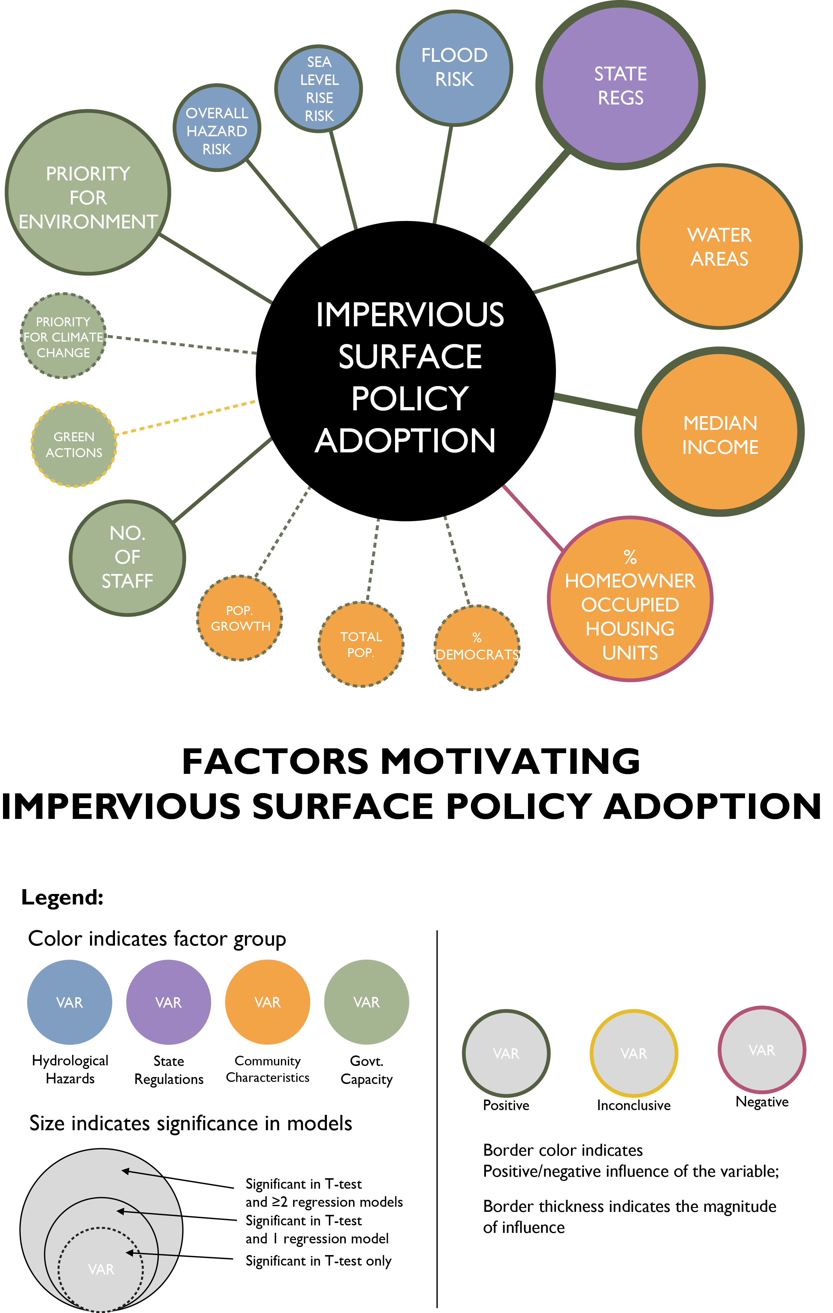
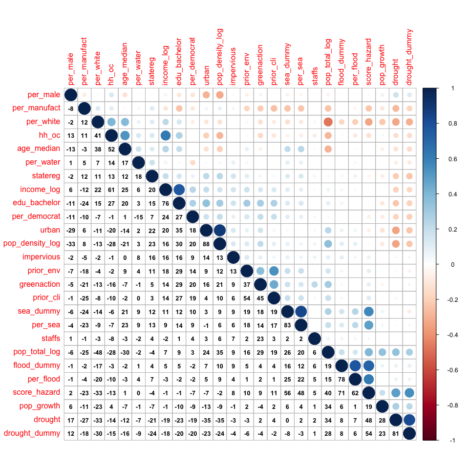
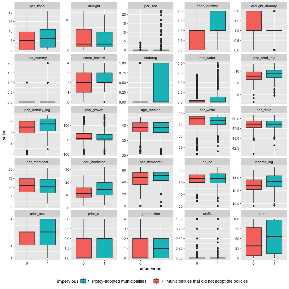
In addition to urban planning, I am interested in quantitative research methods and spatial statistics using Geographic Coordinate System (GIS) as a major tool. My thesis, Impervious Surface Policy Adoption Across US Municipalities and Its Relationship to Climate Change Factors, is the synergy of my mapping and statistics skills. It finds that local communities tend to regulate the percentage of hardscapes (in both private and public land lots) if there are higher median income, higher flood risk, and more stringent state regulations on environmental management. The result is applicable to state government to encourage communities to adopt environmental-related policies.


Community Building
Received 2016 – 2017 Jessica Bullen Community Service Award, from UW Madison’s Department of Urban and Regional Planning.
An award named in memory of Jessica L. Bullen, who is killed in a car-bicycle crash in July 2005, shortly after graduating from the Department and winning the AICP Outstanding Student Award. This award, given in her honor, recognizes community service by a graduating planning student. Community service is defined in the broadest possible terms, including service to the Department, the University, Madison area, or national/international service in the largest sense of the Wisconsin Idea.
Jessica Bullen Community Service Award
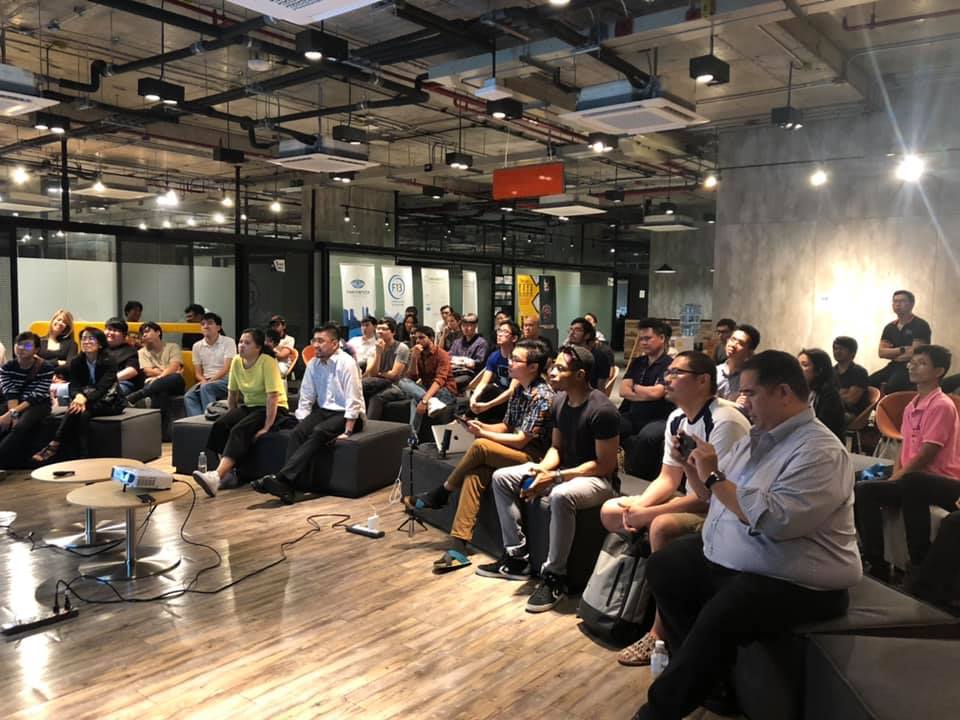
I believe that building communities is an undeniable part of creating better society, in both physical and non-physical senses. Since 2017, to create an appropriate environment for Data Science to thrive, I have been a co-founder and co-organizer of Data Science BKK.
No-nonsense, no-agenda meetup for data science and data engineering practitioners in Thailand. We welcome speakers and participants from all companies and industries. We believe in a place where we can truly share ideas and best practices without commercial interests–data people to data people. Meanwhile, Spatial Science BKK is a DSBKK’s spinoff on Geographic Information System (GIS) and other spatial-based data, majorly aimed to expand the horizon of ‘Data Science’.
Data Science BKK
To share knowledge, I have been teaching GIS and urban planning since 2019. I was a lecturer on GIS for Thailand ICT Camp 2019 and Data Journalism Workshop 2020.
Where the skills meet
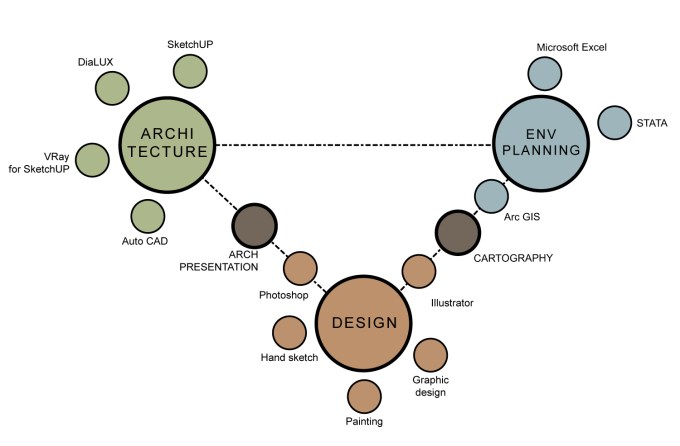
From 10 years of experiences in urban planning and architecture. My skills are the combination of architecture + environmental planning + design.
After 4 years at NESDC, I joined the UN-Habitat Bangkok Programme Office in 2021, where my skills are utilized. I started as a Local Project Officer for the ASEAN Sustainable Urbanization Strategy (ASUS) Phase I, supporting Hatyai City Municipality in developing its urban project proposal on digital safety and security. Currently, I am a National Programme Officer, supporting projects and coordination for UN-Habitat in Thailand. I have supported local governments, such as Udon Thani, Koh Samui, and Nakhon Si Thammarat, including Hatyai City Municipality, in developing urban projects and Voluntary Local Reviews (VLRs, the city’s SDG progress report). I also work with national governments such as NESDC, the Ministry of Social Development and Human Security (MSDHS), the Ministry of Interior, and the Ministry of Natural Resources and Environment (MONRE) on urban-related policies and SDG localization.
Selected Works
Udon Thani City Municipality’s VLR (2024)
Voluntary Local Review is a process through which local and regional governments can voluntarily assess and report on their progress towards achieving the United Nations’ Sustainable Development Goals (SDGs). These reviews allow municipalities to share their experiences, challenges, and successes in implementing the SDGs at a local level, contributing to a global understanding of sustainable development efforts. Currently, there are 257 local governments in 63 countries that have developed their VLRs. Udon Thani City Municipality is the second city in Thailand to develop a VLR report and the first city in the country to apply the Global Urban Monitoring Framework (UMF), UN-Habitat’s tool for urban monitoring, as a data collection framework. The report has been launched at the twelfth session of World Urban Forum in Cairo, Egypt, in November 2024, and uploaded on SDG Localization’s website here.

Travel Time to the Nearest Hospital in Thailand
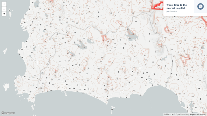
My project with Charin Polpanumas Travel Time to the Nearest Hospital in Thailand, a visualization of travel time by cars to the nearest healthcare facility from anywhere in Thailand on an interactive map platform, is the example of where all skills meet. The project engages skills in data management (data collection and manipulation), spatial statistics (shortest route analysis), visualization, and health-related policies of Thailand. It also engages in a policy workshop at NESDC (the Office of National Economic and Social Development Council of Thailand) to encourage data-based policy-making processes.
Reimagine Ranong: the Action-Based Policy Lab Initiative
My urban planning contributions are not limited to plan making and quantitative analysis, but action-based urban planning practices with local communities. I have led Reimagine Ranong, an experimental urban development project to explore new approaches of policy making process tthat are more connected to the real needs of citizens, between December 2018 – August 2019. Design Thinking was the major tool we used for the project. We started from conducting preliminary research on the contexts, challenges, capacities, and opportunities of Ranong through secondary research, formal discussions with the local agencies, as well as informal discussions with the citizens of Ranong from different backgrounds. Based on the insights we gained, we took these assumptions to discuss and revise with experts of urban planning, landscape architecture, local tourism development, business development, and banking to create the guiding principles for Ranong. Then we used such guiding principles to create two most possible future scenarios. The baseline scenario was the current trajectory of mass tourism, Ranong Mass Tourist City. The alternative scenario Ranong Wellness City made use of its natural resources such as RAMSAR mangrove forest and hot springs for sustainable and medical tourism. To test out our scenarios, we visualized both and presented to 95 local citizens and asked their opinions on a survey. After the surveys, we revised the preferred scenarios and developed city’s development guideline in a technical report.


ThaiME as the Catalyst of More Active Society

In July 2020, Charin Polpanumas and I has scraped, cleaned, and published the data for further analyses by anyone who is interested in the approximately 40,000 proposed government projects under the provision of Emergency Decree on Authorizing the Ministry of Finance to Borrow Money for Economic Recovery due to Corona Virus 2019 Pandemic B.E. 2563 (พระราชกำหนดให้อำนาจกระทรวงการคลังกู้เงินเพื่อแก้ไขปัญหา เยียวยา และฟื้นฟูเศรษฐกิจและสังคม ที่ได้รับผลกระทบจากการระบาดของโรคติดเชื้อไวรัสโคโรนา 2019 พ.ศ. 2563) with the loan ceiling of 400,000 million Baht (approx. 12,500 USD). We hope that, with data, people can engage in government budget process and become more active citizens which will create stronger communities.
Contact
Please feel free to contact me at:
Email: pnphannisa@hotmail.com