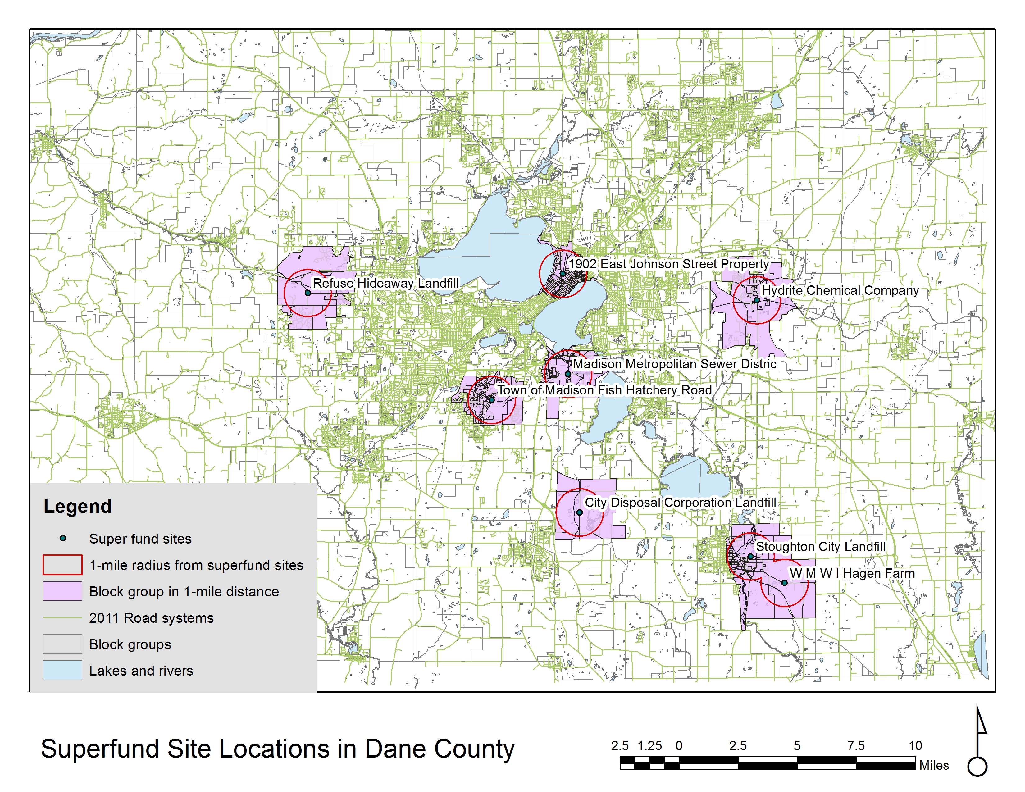
A spatial analysis performed by ArcGIS to assess environmental justice issues in Dane County, WI. The purpose of the analysis is to assess whether vulnerable population groups, i.e., children, seniors, and non-white tend to live within 1-mile radius of the superfund sites (lands that are contaminated by hazardous waste) compared to the whole Dane county as these areas are more affordable to these groups.
GIS Tools used:
- Buffer tool
- Select by Location