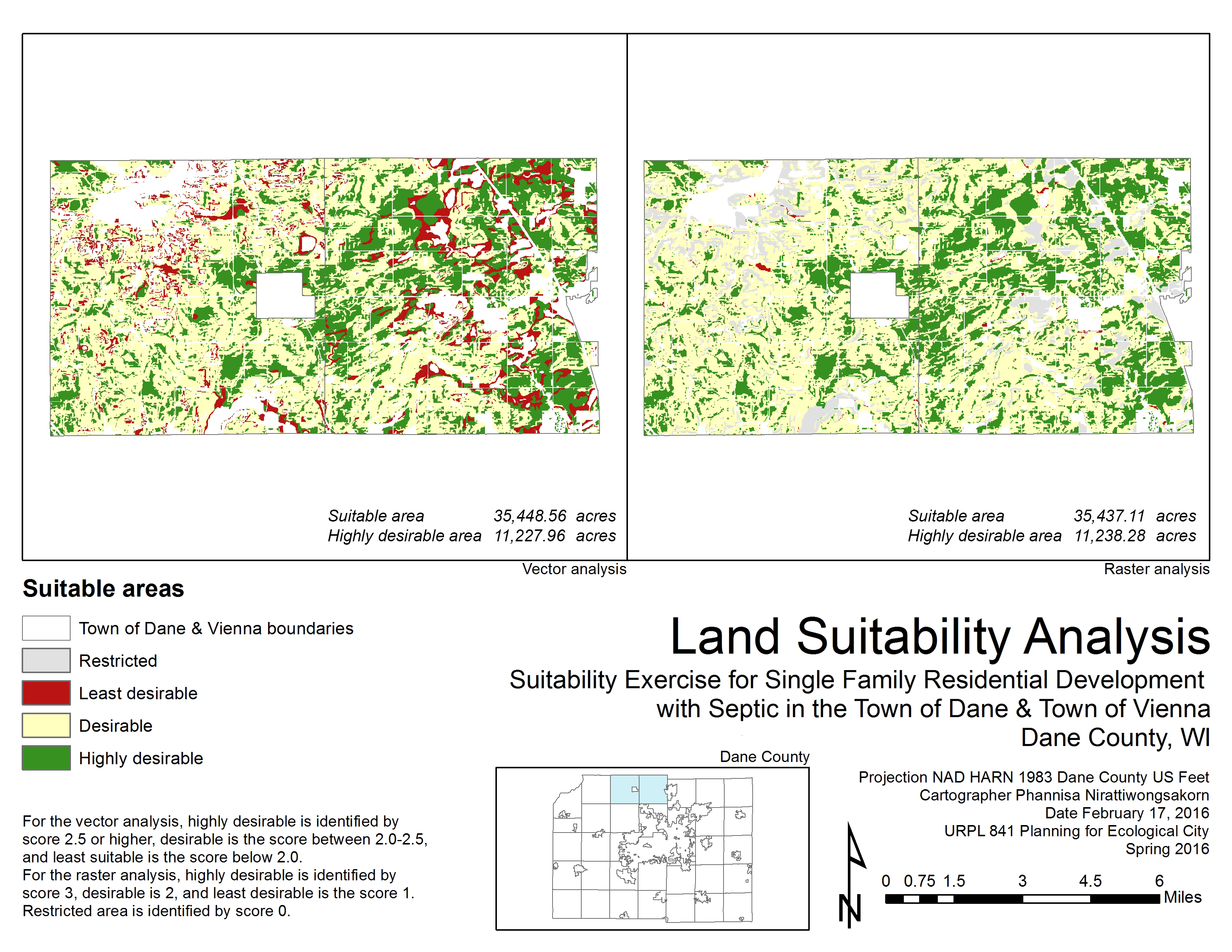
A spatial analysis performed by ArcGIS to find the best sites for a new residential development in Town of Dane and Town of Vienna, Dane County, WI with weighted criteria of:
- Slope – 0-3% slope is highly desirable, 3-6% is desirable, 6-10% is less desirable, >10% is restricted
- Flood risk – No flood risk is highly desirable, rare & very rare is desirable, occasional is less desirable, frequent is restricted
- Land use – vacant land is highly desirable, agricultural land is desirable, forest land is less desirable, other land use types are restricted
Different weights were given to the criteria by their priorities – slope 40%, flood risk 20%, and land use 20%.
The analyses are performed twice, by vector and raster layers, to compare the output numbers from the different types of calculations.