
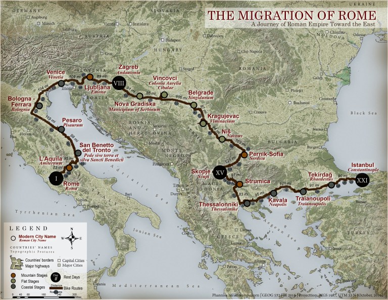
A new Tour de France route proposal from Rome to Istanbul, mimicking the migration route of the Roman Empire from Roma to Byzantium which later has become Constantinople and Istanbul respectively. The route is approximately 1700 miles in total with 21 stops and 3 stages – flat, mountain, and coastal. All stops are cities where were a part of Roman Empire. Bikers will feel like a part of the migration caravan, all history lies in the route.
The artwork is a part of Graphic Design for Cartography class, University of Wisconsin-Madison, Fall 2016.
Techniques:
- GIS analysis for hill shade and landcover
- Photoshop to combine all layers together
- Illustrator for labeling

