
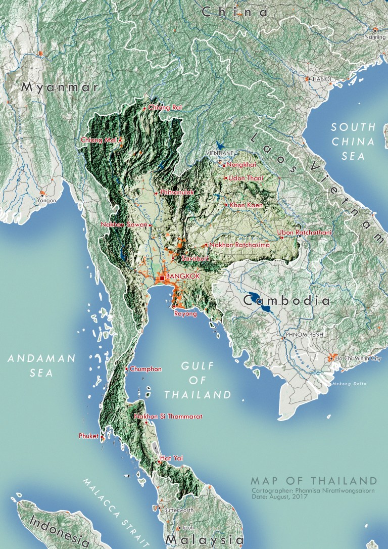
This project is to create a map of Thailand using QGIS and Adobe Photoshop, to see how much QGIS’ features are different from ArcGIS’.
Data
Digital elevation model (DEM, 15″) and administrative borders of Southeast Asia were downloaded from Viewfinder Panorama and Humanitarian Data Exchange respectively.
Terrain Processing
The DEM layer was processed in QGIS using terrain analysis. It has to be noted that Z factor must be reduced to 0.0007 (from 1.0000) as Southeast Asia’s topography is very flat compared to the other parts of the world, Z factor > 0.0007 will make the map looks exaggerate.
Extra layers for more information (and aesthetic)
After the hillshade layer was made, the other layers: land use, road networks, urban settings, and major rivers were overlayed together and exported as PNG format.


Post-processing
Adobe Photoshop is used to adjust the color scheme and labeling. Blue – green color scheme was used to portrayed natural features: rivers (blue), forest (dark green), farmland (yellow-green). In contrast, red tones were used to portrayed artificial features: orange (urban settings), red (cities’ names), and gray (roads).
QGIS vs ArcGIS
Compared to ArcGIS, QGIS is quite easy to understand. There might be some functions in ArcGIS that are unavailable in QGIS but there are a lot of plugins from the internet. In this project, all functions used to process the map are in QGIS already.


Right here is the perfect website for anyone who would like to understand this topic. You understand so much its almost tough to argue with you (not that I really will need to…HaHa). You definitely put a brand new spin on a topic which has been written about for decades. Great stuff, just wonderful!
Nice blog right here! Additionally your web site so much up very fast! What web host are you the usage of? Can I am getting your affiliate hyperlink for your host? I desire my web site loaded up as fast as yours lol
Hi Alex! I use normal WordPress.com host and theme, didn’t pay for anything. Hope it helps!
I’m no longer sure the place you are getting your info, but good topic. I needs to spend a while studying more or figuring out more. Thanks for wonderful info I was on the lookout for this info for my mission.
Thank you! I got the data from Viewfinder Panorama (UK), Humanitarian Data Exchange, and USGS. These are acceptable sources when I studied in the US. I didn’t use Thailand’s official data because some of them are not publicly opened for download.